The top UK temperature on Tuesday 17th was 18.0C near Northallerton in North Yorkshire, and today, the 18th, looks even warmer. Perhaps passing the 20C mark for the first time in 2026. Under the clear skies, temperatures have fallen away overnight but in the warm air from the south and the spring sunshine, they will be able to leap upwards in the middle of the week.
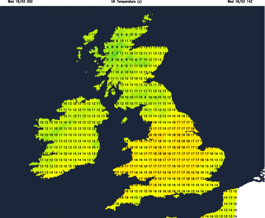
Areas that will move into the high teens will be west London, Bristol, the Midlands, into Yorkshire and northwest England, including Greater Manchester and Merseyside. Somewhere in the northwest of England or north/west Wales might see 20 or 21C, 70F on Wednesday. There will be a light easterly wind along the English Channel, for Kent and into the Thames, a southeasterly breeze onto the coast of East Anglia, just cooling and stirring the air a little.
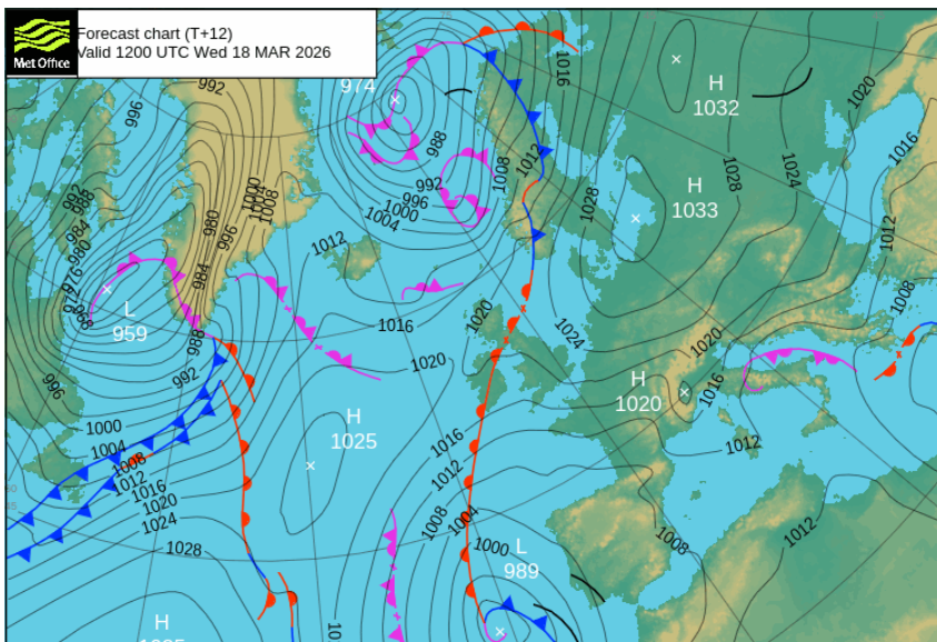
Nothing like the winds of Tuesday when the A1 in East Lothian was closed as a lorry overturned and traffic battled to stay on course in exposed areas. Across southeast Scotland, people struggled along the streets in the strong and gusty winds, although the weather had looked quite inviting out of the window. Today will not be as windy as pressure rises, the UK in a col with high pressure to the west and to the east.
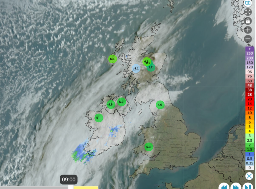
Netweather Radar showing frontal band of cloud and lowest ten temperatures at 9am.
The weak warm front is just a band of cloud over Britain, although there is rain over Ireland. This band of cloud is giving a grey but milder start in the north and west of the UK. There are sunny gaps over Scotland where it has been cold and clear overnight, but it is to the south of this frontal band where the spring warmth and sunshine will truly be felt today.
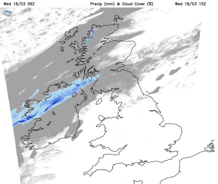
Without the strong sunshine and at the edge of the warm air, temperatures along the front will be around 12C for Edinburgh and Belfast. Grampian could see more sunshine and Aberdeen might reach 14 or 15C. There will be cooler, fresher air over the far northwest of Scotland with a few showers but the frontal rain will reach Northern Ireland during Wednesday afternoon. This will be a distinct band running NE/ SW so County Down could stay dry as it drifts slowly northwards.
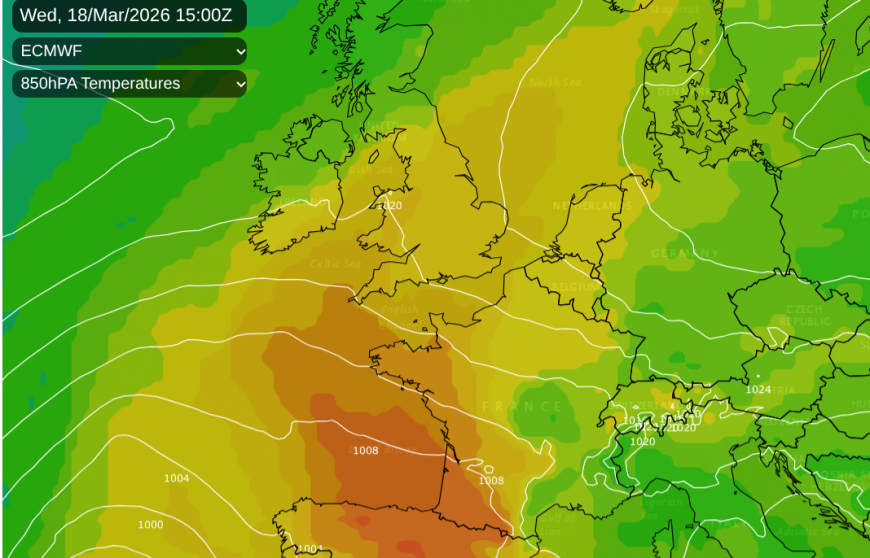
For England and much of Wales in the sunshine, there will be a large diurnal range. By day, temperatures will reach 15 to 19C thanks to the hours of sunshine and the warm airmass. By night, all of the day’s heat will just radiate away, and after the winter, there isn’t any warmth stored in the earth yet. Temperatures will fall away well down into single figures (the range) with a frost in places.
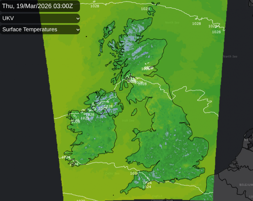
The frontal cloud will have edged northwards away from Northern Ireland over central Scotland but edging east with a narrow band of rain. By Thursday morning, that damp, grey weather could be over Fife, around the Forth and for Edinburgh, with sunshine to the north but cooler air. The band of cloud might extend into the far north of England too. The large area of warm air over England and Wales will have faded somewhat and rotated westwards. It will still be pleasant in any sunshine but not as warm as today.
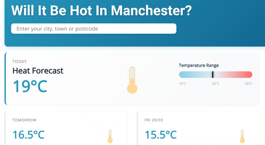
Tuesday 17th - Leeming 18.0C, Blackpool 17.1C, Rhyl 17.7C and Almondsbury, Gloucs. managed 10.4 hours of sunshine.
Loading recent activity...