It is not going to be as mild at the weekend, after the midweek heights of 18.7C. The nights will be colder with a frost in the north. By day temperatures will be around average on Saturday, 7 to 10C on Saturday and recovering on Sunday in some milder air, 10 to 14C.
On Saturday most of the UK will be in between rain bands. One band over southern Britain on Friday night will clear from eastern England on Saturday morning. This leaves fine and bright weather before showers for Northern Ireland with the next Atlantic front arriving for Saturday night. Sunday looks very mixed and windy.
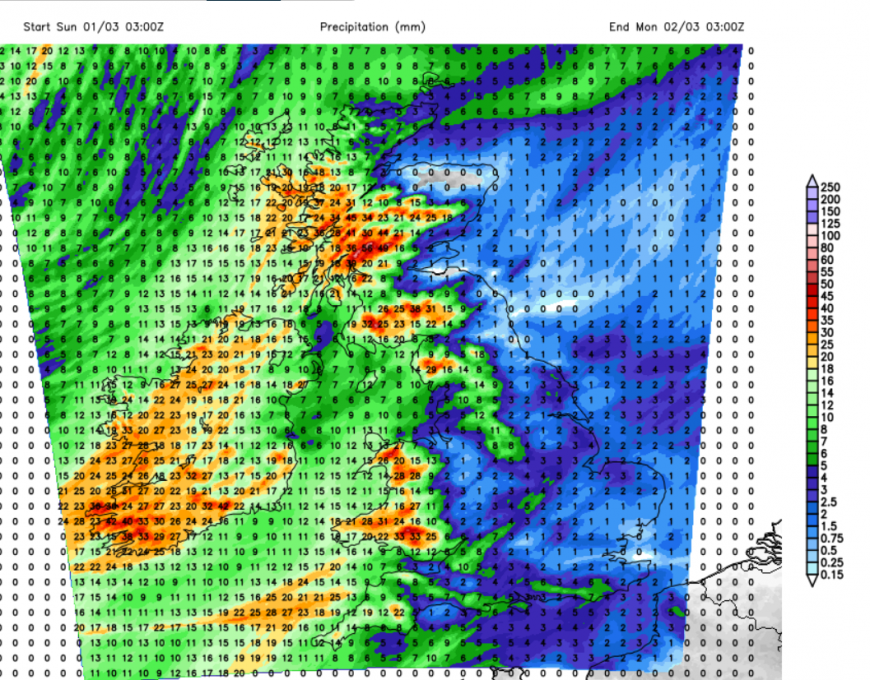
Rain totals through Sunday, wetter in the west, drier for the east
Friday night
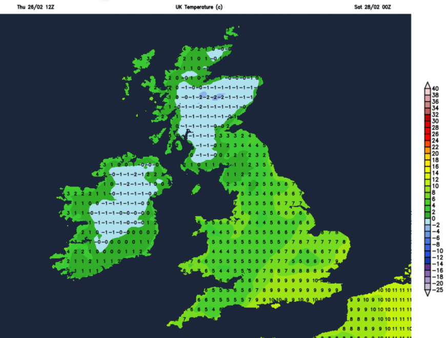
London and the Home Counties should start off dry and mild on Friday evening but there is a risk of showers later. The frontal rain band will stretch over parts of southern Britain but further north it will be clear and colder. There will be a widespread frost in the north where conditions will be calm as pressure rises, and the risk of ice.
Saturday
There is some uncertainty about how much rain will still be over central/eastern England from this band on Saturday morning. Southern Scotland and Cumbria, into the northern Pennines, could see a few showers, even wintry ones over the hills but these will be well scattered.
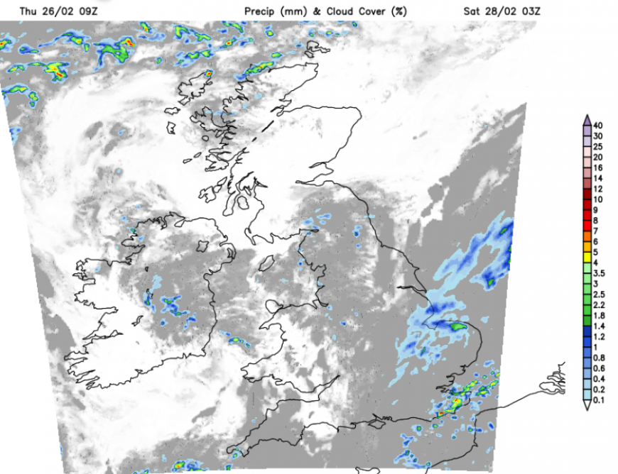
Pressure is rising and overall it will be a fine, bright or sunny day with only the odd shower. Most places will be dry with light winds. As the last of the frontal rain pulls away from East Anglia and Kent on Saturday morning there will be a brisk northerly wind and that will make it feel cooler. That wind will ease.
A southerly wind will pick up for Ireland and western Scotland as one frontal band arrives on Saturday afternoon. This will bring showery rain over Northern Ireland, to Wales by the evening and more of western Britain to end Saturday. Ahead of that it will turn chilly for Scotland and eastern England with some wintry showers for the tops of the high ground of northern England and southern Scotland.
London’s West End Ramadan Lights have returned for their fourth consecutive year. The celebration brings a dazzling display of light, colour, and community spirit between Piccadilly Circus and Leicester Square which continues this weekend. Friday evening might catch a shower later but it will be mild. Saturday and Sunday evenings look dry but Saturday will be cooler, Sunday windier.
Sunday
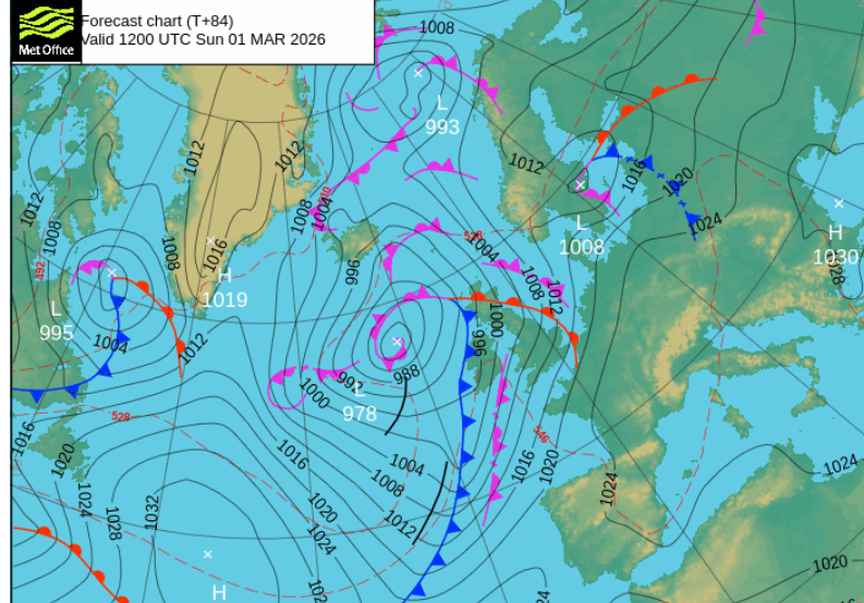
By Sunday morning there will be a brisk southerly wind bringing milder air. How this feels will be offset by the wind and outbreaks of rain. Rain from the warm front arrives for Ireland during Saturday night, heading across the UK on Sunday morning. The models vary in how the band holds together. The cold front looks more definite and slides over Northern IReland and western Scotland later on Sunday and potentially some lively downpours. In the warm sector there will be fresh S/SW winds, this mild air and potentially cloud breaks especially to the lee of high ground. So there could be sunny spells which might enable temperatures to rise to 15 or 16C. Exposed west coasts will be cloud and damp, eastern areas more likely to see brighter skies.
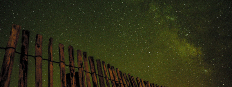
This weekend sees the Yorkshire Dark Skies Festival draw to a close. It has been a great opportunity to explore the beauty of the night sky with the Yorkshire Dales is the perfect place to celebrate dark skies and appreciate the wonders of the universe. There will be a Stargazing Photography Workshop under Malham Cove when the weather should be clear (but chilly) and on Sunday evening a Dark Skies Night Hike at Kettlewell and stargazing session at Ingleton.
Early next week weather fronts continue to push in from the Atlantic, for northwestern parts where it will stay windy. High pressure over central Europe will slow the progress eastwards and the Azores high will also extend its influence, maybe settling the weather down for Tuesday.
Loading recent activity...