The rest of the week won’t be as mild as on Wednesday. Kew Gardens in London reached 18.7C, with 18.5C in west Suffolk, which was also in the midweek sunshine. Highland Scotland and Northern Ireland peaked around 14C with more cloud. The Midlands were around 16C and north Wales up to 15.4C. Change is underway as an Atlantic weather system is bringing more cloud and rain in from the west.
For Thursday temperatures will be: Edinburgh 11C, Belfast, Manchester and Birmingham 12C, Cardiff 13C and London 14C, maybe 15C. By Saturday, temperatures in Scotland and Northern Ireland will be around 7C. 8 or 9C for central Britain and 10 to 11C in the south. Back closer to average with some chilly nights.
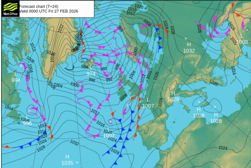
The very mild air flow from the south is being cut off by the westerly flow today. The lack of sunshine makes quite a difference too. By Friday, fresher air from the northwest will lower the temperatures further and there will be frost overnight. However, after this cooler dip on Saturday, milder air from the Atlantic will return in a southwesterly flow to end the weekend.
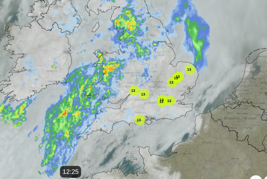
For the middle of the week, it was the northwestern quadrant of the UK that saw rain. In the brisk westerly southwesterly wind of Thursday, western Scotland and Cumbria have seen rain from occlusions moving by quite quickly. There have been bright spells to the lee of high ground, for Moray and Edinburgh. The main area of frontal rain will settle on Wales for the rest of Thursday. Heavier pulses will move along the band from the southwest, over Devon and Cornwall into central England and across to the Wash. The far southeast of England should escape this rain until Friday morning.
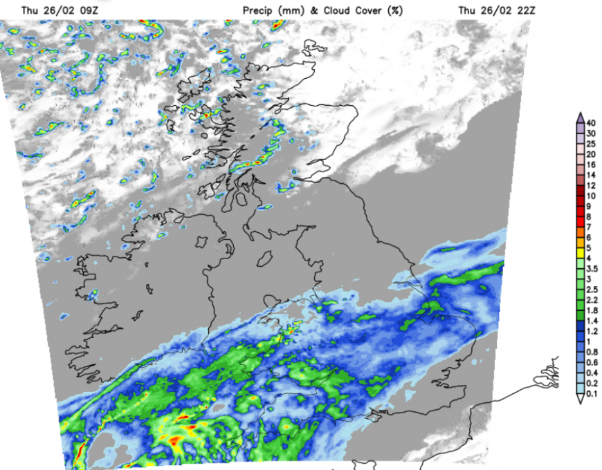
So wet weather this evening and overnight for mild southern Britain, particularly in the southwest with clearing skies in the north and a cooler feel to things.
Friday
The southern half of Britain will start the day with grey, damp skies and outbreaks of rain. It won’t feel as mild as it has recently. Further north, there will be bright or sunny spells with showers from the northwest. The air will feel fresher, even colder for the north of Scotland in a northwesterly wind with snow showers over the mountains.
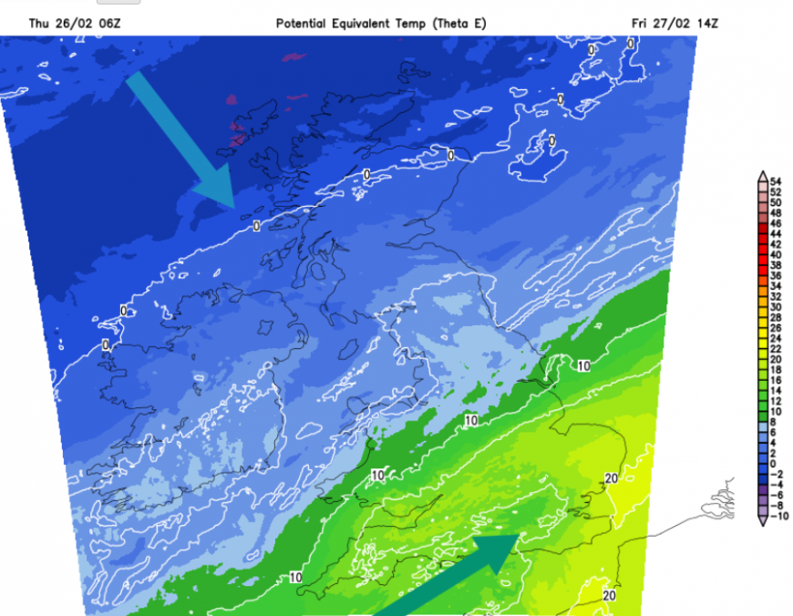
The far south and southeast of England will hold onto the mild air, fine weather and southwesterly flow but much of the UK will feel cooler as the flow from Iceland arrives. The frontal band will linger through Friday with rain stretching from SW England and Wales across the Midlands to the Humber.
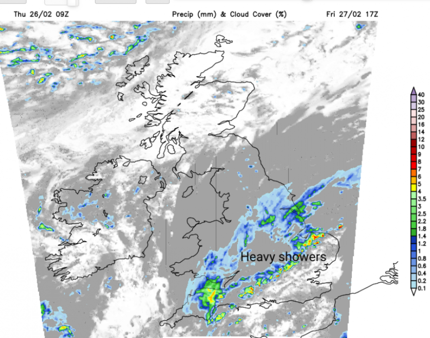
The UKV model shows a line of heavier convection developing by the evening. This could bring bouts of surface water and spray with poor viability for the Friday evening traffic. These showers will spread over London and the Home Counties through the evening so worth taking a brolly.
A much colder night for northern Scotland but staying mild on Friday night for SE England.
Loading recent activity...