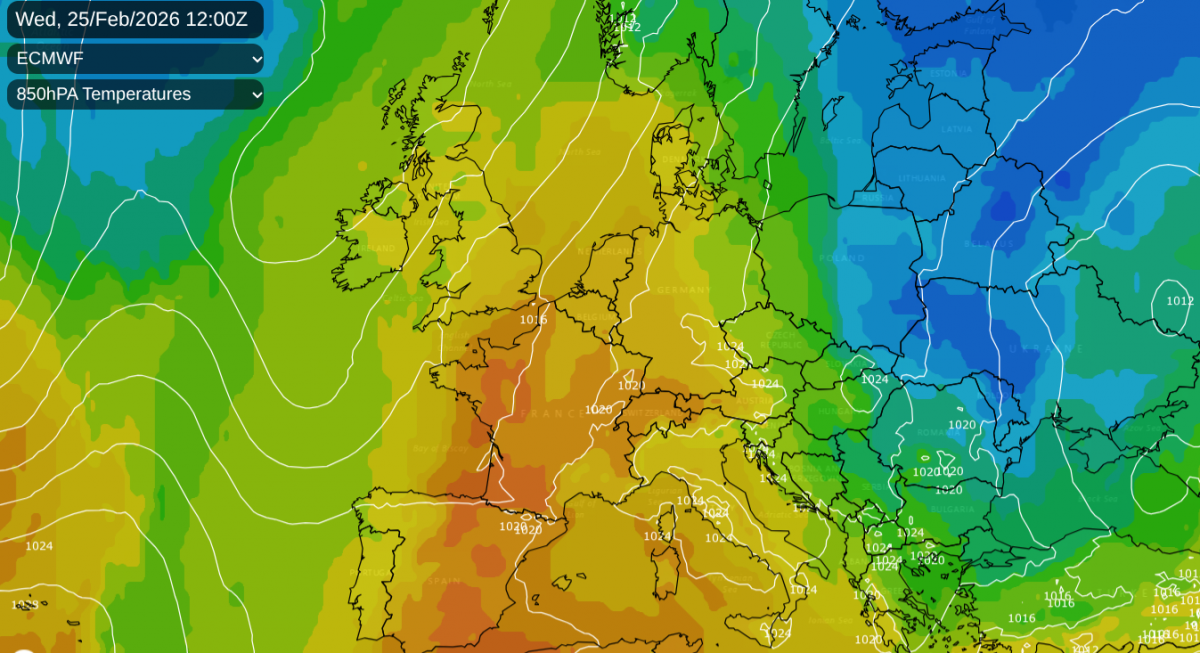
It has felt milder already this week, and by the middle of this week, temperatures in southern Britain could reach 17 or 18C. This mild, even warm air will surge up from mid Atlantic and the Bay of Biscay until fresher air interrupts from the northwest on Thursday night, and colder air arrives for Friday night with a frost.
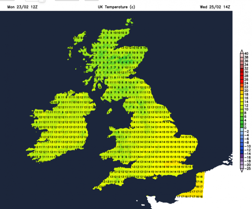
The blustery westerly wind on Monday did make it feel a bit cooler but the air does feel different from the winter that we have come through. There has been a shift back to the west/southwesterly flow off the Atlantic, which will continue to bring rain, especially to western Scotland. It has been eastern/NE Scotland seeing weeks of rainfall so the west coast is due a soggy week. Southern England has also seen a lot of rain this year but there will be dry weather this week and also bright or sunny times accompanying the very mild air.
The spring flowers are beginning to appear: crocus, daffodil buds and tulip leaves, and the birds seem busy.
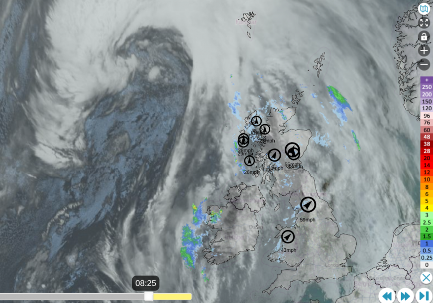
Netweather Radar (extra) showing frontal rain to W & N, cloud cover and top 10 winds 0825 Tues 24th
and clear (sunny) skies over France as mild air heads up through the UK

Temperatures on Monday ranged from 13C in the cloudy south of England to 7C for the sunny Northern Isles. The strong westerly winds have made driving conditions on exposed routes of central Britain a little difficult. An approaching warm front subdued the shower activity in the north but has brought a band of patchy rain over England and Wales, and a wet afternoon for Northern Ireland.
This rainband will edge northwards on Monday night. Behind this, we are in the warm sector and the cloud cover will pull apart.
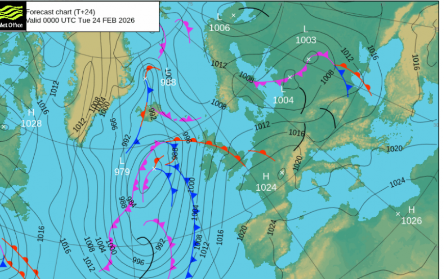
Tuesday
The southerly wind will become more blustery through the day. The warm front rain will soon clear from Shetland as the cold front turns to a waving frontal band with rain for NW Scotland. There will be quite a difference across the UK, with the cloudy Western Isles subjected to this wandering rainband and freshening southerly winds and SE Britain seeing fine conditions with sunny spells, lighter winds and temperatures of 12 to 15C.
Through Tuesday evening and night, the frontal band will creep eastwards, over the Northern Isles, into Northern Ireland and the west coast of Scotland. It will be a mild night everywhere with overnight temperatures closer to those you might expect by day at this time of year.
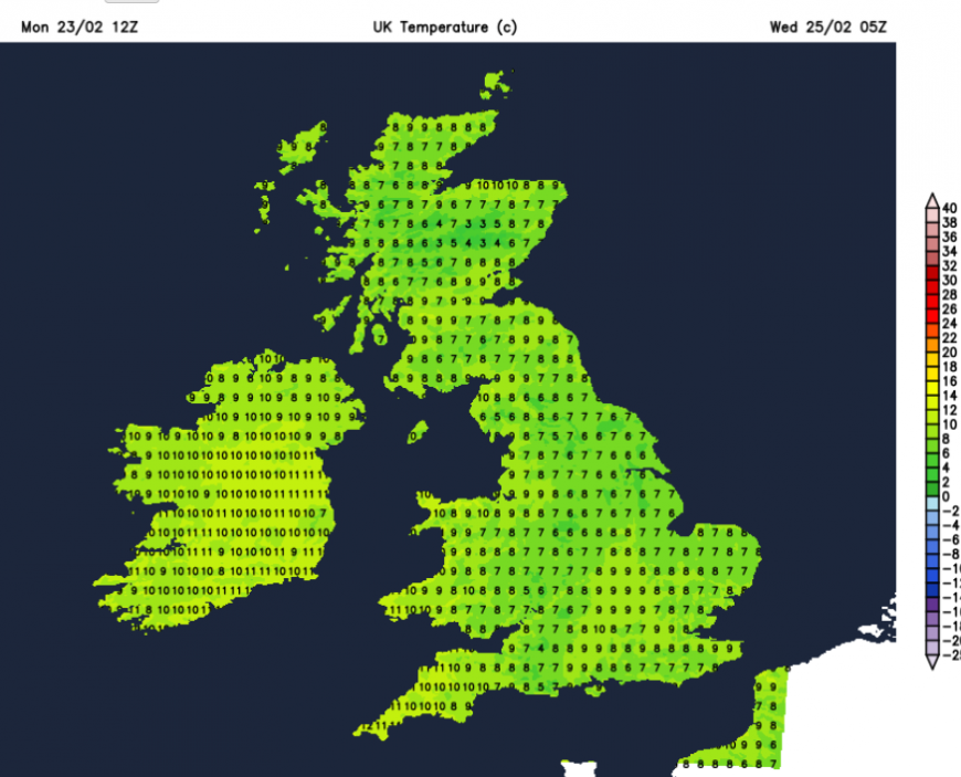
Wednesday
Much of England and eastern Wales should start on Wednesday with fine weather and sunshine. It will feel very mild and the temperatures will climb. In the light SSW breeze, Greater London into Essex could see 18C on Wednesday.
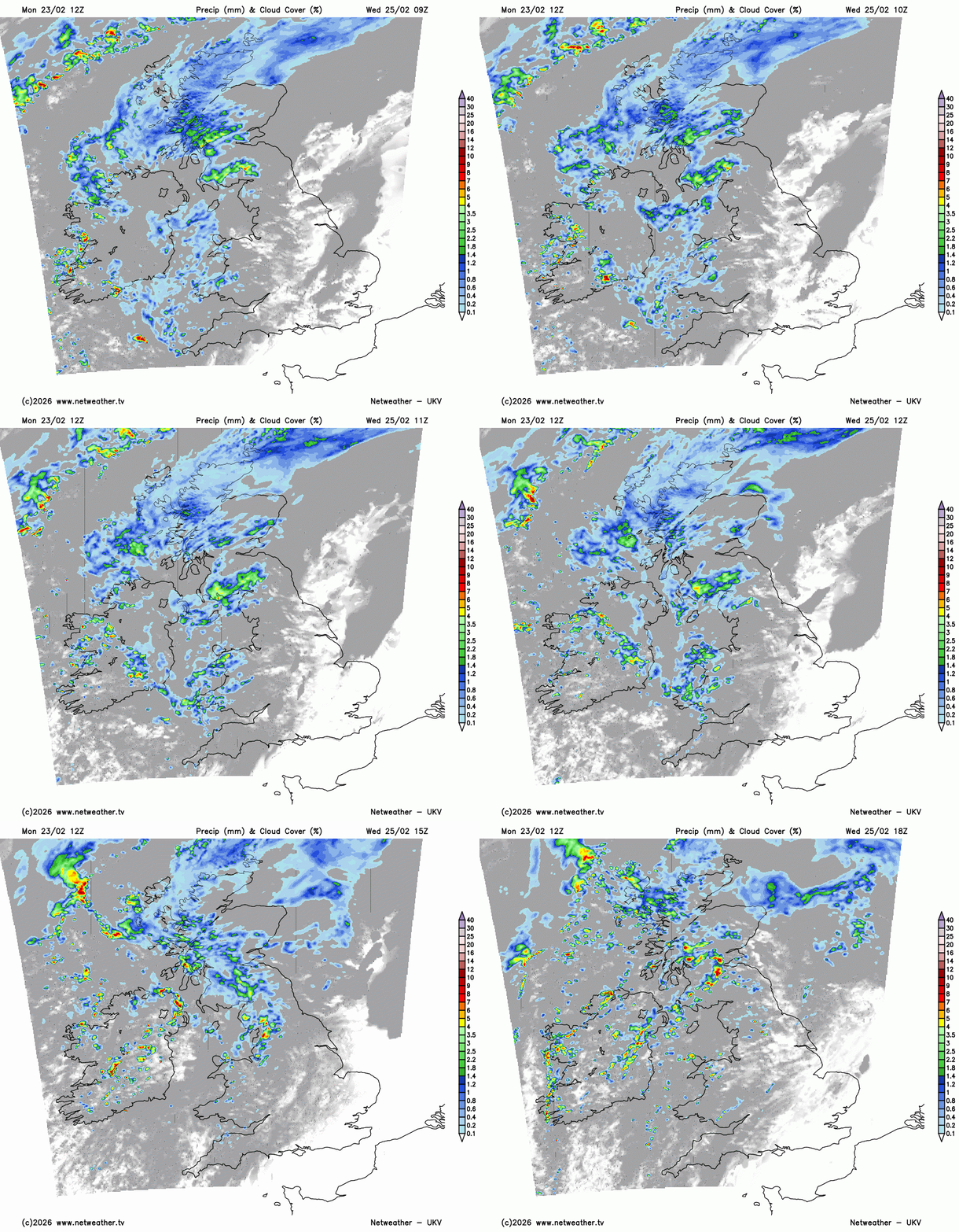
There will be some uncertainty further north and west around the waving frontal band. Eastern and northeastern Scotland could see some shelter in the flow from outbreaks of rain. SW Scotland, Northern Ireland, western and later north Wales, then Cumbria could all see showery outbreaks of rain from this frontal band on Wednesday. The rain and cloud cover will affect the temperatures but it will still be mild for all in the middle of the week.
Loading recent activity...