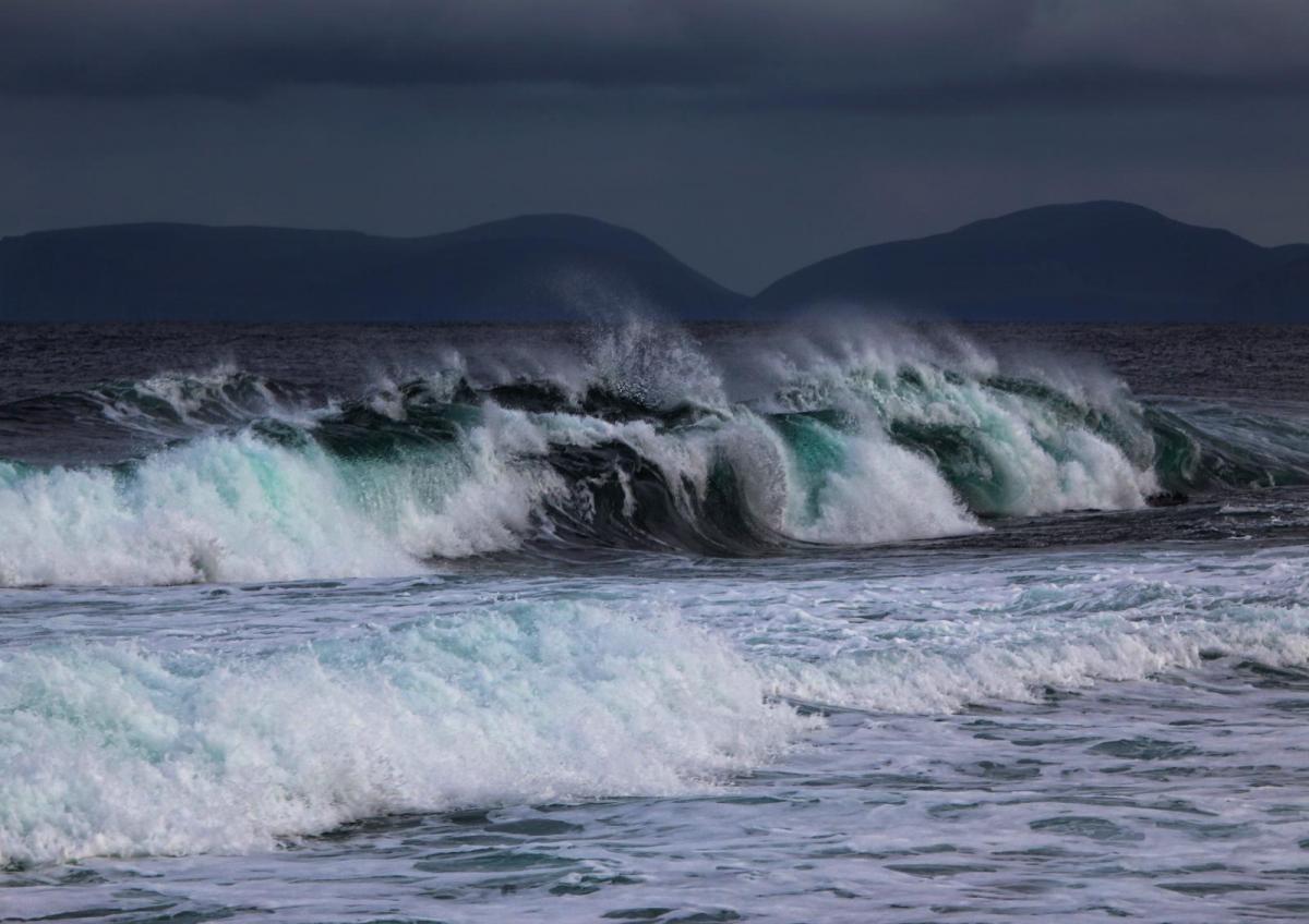
The UK Met Office has named Storm Chandra. Tuesday 27th looks wet and windy with snow over northern hills. There are concerns about flooding after a wet weekend for many parts with wild conditions in SW England as spring tides and large waves battered the coast in Teignmouth, Devon. NE Britain has seen dreich conditions since last week in an endless damp southeasterly flow off the North Sea. Further river and surface water flooding is forecast, even groundwater flooding for parts of SW England.
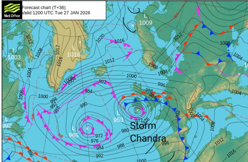
Next we have Storm Chandra, which follows Bram (early December 2025) on the storm name list. A deepening low pressure is heading for Ireland and being helped by the strong jetstream linked to the deep cold over North America. Chandra will bring even more rain, which will be the main concern for this week. This heavy rain will fall on already saturated ground, bringing the risk of flooding. There will also be strong winds with potential disruption, and hill snow for northern Britain.
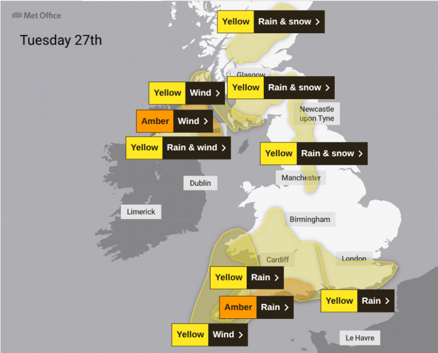
"Storm Chandra bringing heavy rain, flooding and disruption later Monday and overnight into Tuesday morning." MO
Over the past few days, we’ve had a low pressure churning away to the SW of the UK combined with the spring tides, resulting in chaotic, wild seas and damage to the coastlines. This low was Storm Ingrid. Named by the Portuguese Met Service, it had brought wild weather around the Bay of Biscay. It followed Storm Harry in the Mediterranean, which had brought devastating flooding to North Africa and stormy weather to Ibiza, Mallorca, Malta, Sicily and Sardinia. These are all in the southwestern naming group, which has brought Storm Claudia in November and Storm Goretti this month, far enough north to impact our weather. The UK, Ireland and the Netherlands are in the Western naming group, which is why our next letter is C (for Ch-an-dra). Chandra is a moon god.
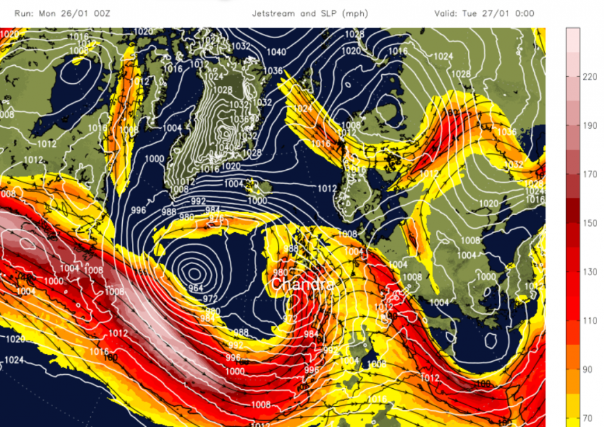
You may have seen news footage of the intense snow and icestorm on Sunday 25th, which continues over North America today. This surge of extremely dangerous cold resulted in power outages, traffic pileups, freezing rain with enough ice accretion to bring down tree branches under the excess weight. There was deep snow and closures today. This deep cold against the milder Atlantic air creates a huge temperature contrast which has powered up the jetstream. The low that will become Storm Chandra will be in an area of development overnight. The low moves northwards and away from the jet influence. So Monday night and Tuesday will be wet and windy but Wednesday does look better.
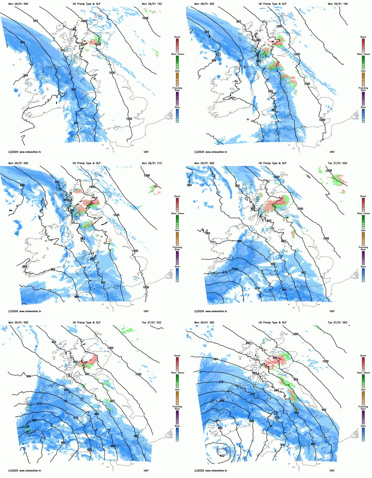
There is an occluded band of rain ahead of the Chandra low, which will bring a wet Monday for Northern Ireland. This edges over western Britain this evening with wintry weather over the hills as Storm Chandra arrives from the southwest. Along the occluded band, there will be strong SE winds through the Irish Sea and for western and northern coasts of Scotland.
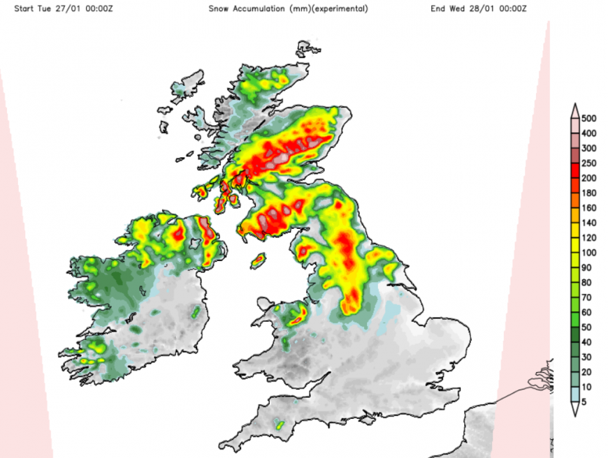
What about snow?
We are not going to see the American snow. We just have this fired up jetstream from the dramatic temperature gradient on the other side of the Atlantic. There will be snow over high ground as the late Monday occlusion reaches northern Britain and as the main fronts from Chandra head north. Two to ten cms is mentioned over the hills with up to 20cm of blowing snow above 500m. At low levels, don’t expect much. It might be that there will be icy rain, sleet for a time but heavy rain will feature from this low. The far northeast of the UK will see colder air from Scandinavia waving in on Tuesday, helping the frontal precipitation turn to snow over the Scottish mountains.
Winds
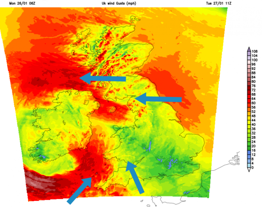
Through the night, the winds will increase for SW Britain, starting as a southeasterly but with easterly gales developing through the Irish Sea. So a wild start for Northern Ireland and the Isle of Man on Tuesday with the S/SW winds beginning to crank up over Cornwall and the Isles of Scilly.
"Storm Chandra will bring very strong winds, leading to the potential for damage and disruption on Tuesday." MO warning
Remember how the low was going to drift away from the developmental area under the jetstream and head northwards? This could bring gales to the south coast of Ireland, but also keep the worst of the winds away from much of England. Through the morning, there will be a fresh to strong E/SE wind across northern Britain and catching eastern England. This will continue for Northern Ireland with gales for exposed areas. Around the low to the southwest, the main core of gales and high gusts could stay over the sea, over the Western Approaches but Met Eireann will be watching their southern counties.
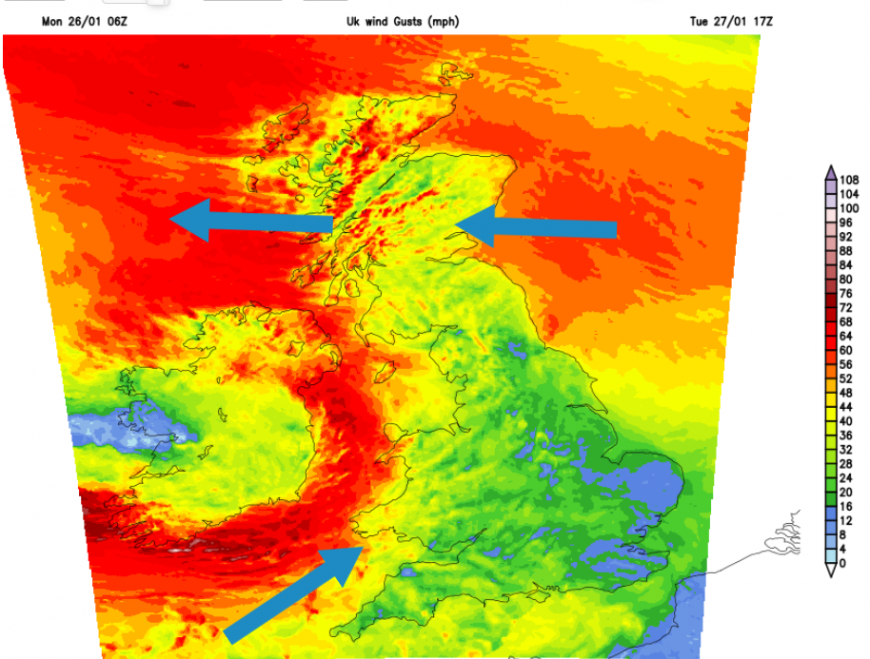
Through Tuesday late afternoon and evening, there will be gales for western Wales, around the Irish Sea and still a very windy day for Northern Ireland. Western Scotland should expect lee gusts and ferry disruption and delays, including for the Northern Isles.
NorthLink Ferries “Early Disruption Warning to Customers - Present weather forecasts indicate the possibility of disruption to our services from Sunday 25th January through to Saturday 31st January.” Calmac on the west coast have more cancellations (due to the weather)
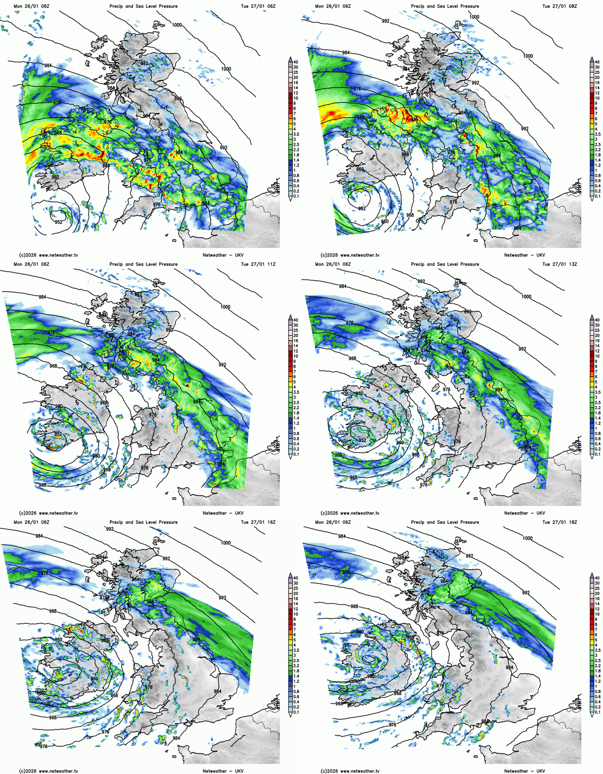
Rain band moving northwards on Tuesday (UKV) with a host of heavy showers around the low centre
Through Tuesday night, it will remain windy in the north but quieter for the southern half of Britain. By Wednesday, there will be some fair weather before heavy showers spill from Cornwall up into Northern Ireland, with more grey, wet weather for Grampian thanks to a northeastern occlusion.
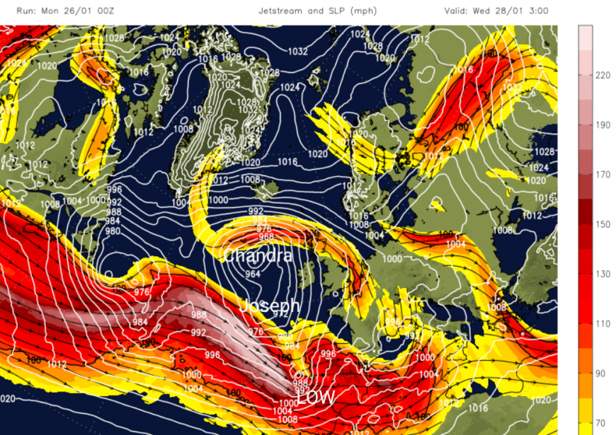
The strong jet will be further south. The GFS model shows another new small low deepening as it arrives over northern Portugal and NW Spain by Tuesday night. Iberia has seen wet and windy weather in the past week with a red rain warning in Galicia on Monday and stormy conditions along the west coast of Portugal, linking back to a large mature low further north which IPMA named Joseph on Sunday. It looks like other parts of Europe will also see wet and windy weather, if not stormy conditions, linked to the deep cold over North America.
More discussion and chat to come in the Netweather community forum
Loading recent activity...