Storm Bram is arriving to the west of Ireland and is already battering the west of the UK and Ireland, with gusts reaching 50-60mph across the far SW of England and west Wales. Bram has already brought a lot of rain in the mild and moist flow overnight ahead of it across SW England and Wales, with 50-60mm falling in the last 24 hours over the SW Moors and mountains of Wales, locally more.

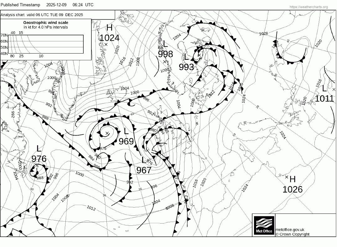
Storm Bram is showing typical Shapiro-Keyser cyclone characteristics - with a warm core, cold frontal fracture and warm frontal seclusion - as shown on the Met Office fax chart for 6am this morning
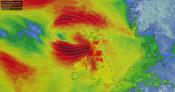
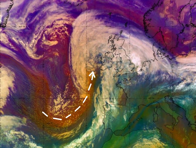
Also note on airmass imagery a dry air intrusion rushing into the centre of the low, with high cyclonic vorticity - which, combined with the low being in the left exit region of the jet stream where air diverges aloft and converges at the surface, will help rapidly deepen the low through the day as it heads NNE.
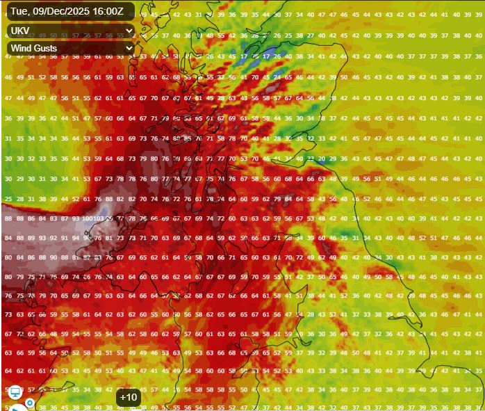
The Met Office’s high resolution UKV showing violent gusts of up to 100mph along the coast of Donegal in far NW of Ireland late afternoon, then 80-90mph gusts for NW Scotland this evening.
There are Amber Warnings for wind in force for NW Scotland along with the northern and western parts of Northern Ireland. The Republic of Ireland is all under ‘Status Orange’ wind warnings.
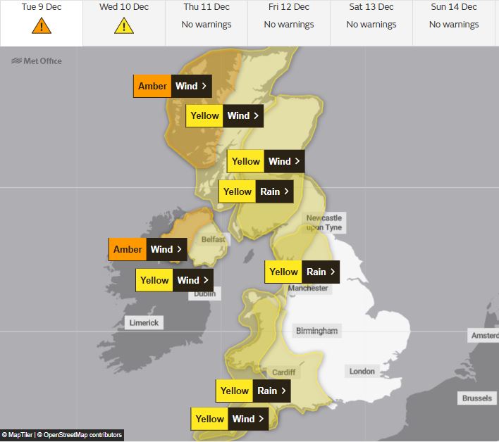
For NW Scotland, the Met Office ‘Further Detail’ states:
A short spell of very strong southwesterly winds are expected to develop as Storm Bram passes close to northwest Scotland on Tuesday evening and night. Gusts of 70-80 mph are expected for a few hours with a chance that a few places may experience gusts of up to 90 mph. Heavy rain will accompany these strong winds and may exacerbate impacts.
For Northern Ireland, the Met Office ‘Further Detail’ states:
Winds are expected to increase further through the afternoon and early evening as Storm Bram tracks to the north of Northern Ireland.
Southerly winds, becoming southwesterly during this period, within the amber warning area may increase to gust 60-70 mph with a chance of 80 mph or more around coasts and over hills for 2-3 hours, before dropping again. However, winds will continue to be very strong for some time after the amber warning expires, with the yellow warning continuing until 2200.
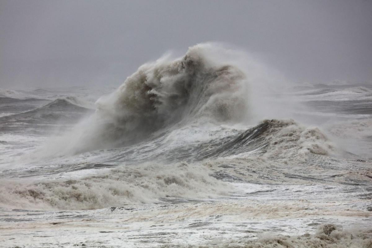
There are yellow warnings for wind and rain across the north and west of the UK too. These areas will bear the brunt of Storm Bram today and into tomorrow, with damaging winds likely across N. Ireland, western Scotland and west Wales. Also with all the rain that has fallen and continues to fall across the west - there is a risk of flooded roads leading to travel disruption. Large waves across western coasts will also lead to coastal flooding.
So the worst of the strong winds will develop across the northwest this afternoon and evening, but gales likely elsewhere in the west, especially around coasts and hills, windy elsewhere too. But with the wind from the south, it will be very mild, as morning rain clears north and sunny spells develop between showers, temperatures this afternoon will widely reach 13-15C, perhaps 16C across eastern England. Exceptionally mild for early December. It looks to stay grey and rather wet across northern Scotland today though.
Severe gales and rain becoming confined to the far north overnight, otherwise a windy night with clear spells and a few blustery showers in the west lingering into the morning. Wednesday looking a mostly fine day with sunny spells, mild too, though still rather breezy.
Mostly fine on Thursday, but turning cloudier from the west, with rain arriving in the west by evening. Rain spreading east overnight before clearing the east early afternoon to drier and brighter weather from the west. Still rather mild.
Loading recent activity...