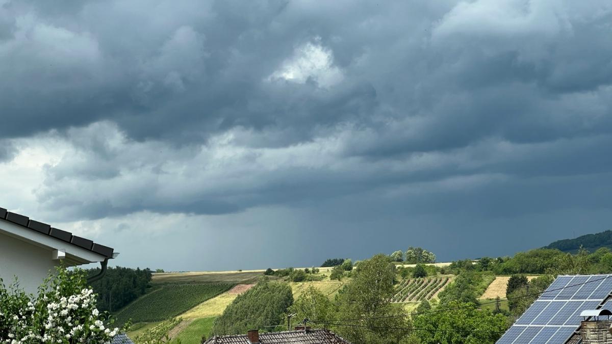
The weather will take a downhill turn from today, with changeable and often windy conditions setting in for the rest of the week, as a strong jet stream coming out of eastern Canada and running east across the North Atlantic takes aim at western Europe.
The change will be marked by a cold front with a band of rain sweeping east across all parts this morning, driven by a quite deep low for the time of year moving past the northwest of Scotland this morning, 967 hPa on fax for 6am. Quite brisk and gusty southwesterly winds this morning across many areas, with gales in the far northwest, though overnight there were some quite high gusts for early June, with a gust of 70mph at Capel Curig in north Wales.
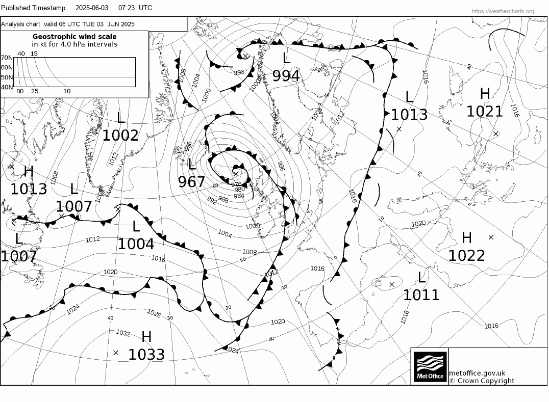
The low to the northwest will slowly drift northeast and fill over the next few days. Further south, a conveyor of lows and waves forming along a baroclinic zone across the North Atlantic, separating cool air to the north and warmer air to the south and paralleled by a strong jet stream running west to east, will bring bringing further spells of rain with showers in between for the rest of the week.
Jet stream will have a heavy influence in bringing unsettled conditions over the UK over the coming days.
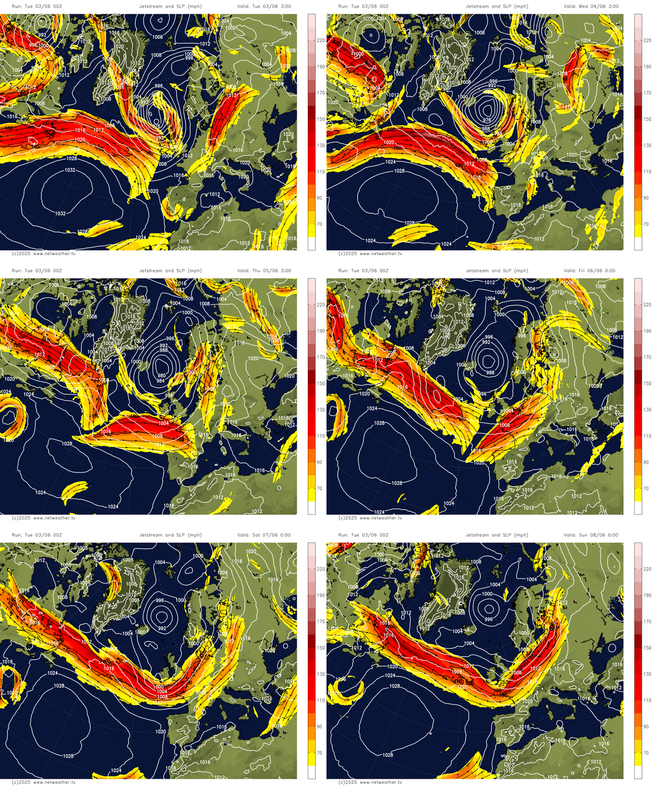
The cold front and its band of rain clearing east this morning will weaken as it reaches the southeast, due to the upper trough driving it weakening. Sunny spells and showers will follow for the rest of Tuesday and through Wednesday, showers mostly in the north and west. However, upstream, a frontal wave off Nova Scotia this morning will run east along the baroclinic zone strung out over the North Atlantic over the next few days - before running east across England and Wales on Thursday morning - bringing outbreaks of rain then turning showery in its wake. Another wave looks to follow but pass to the south over northern France.
Wave depression running east bringing rain across England and Wales on Thursday
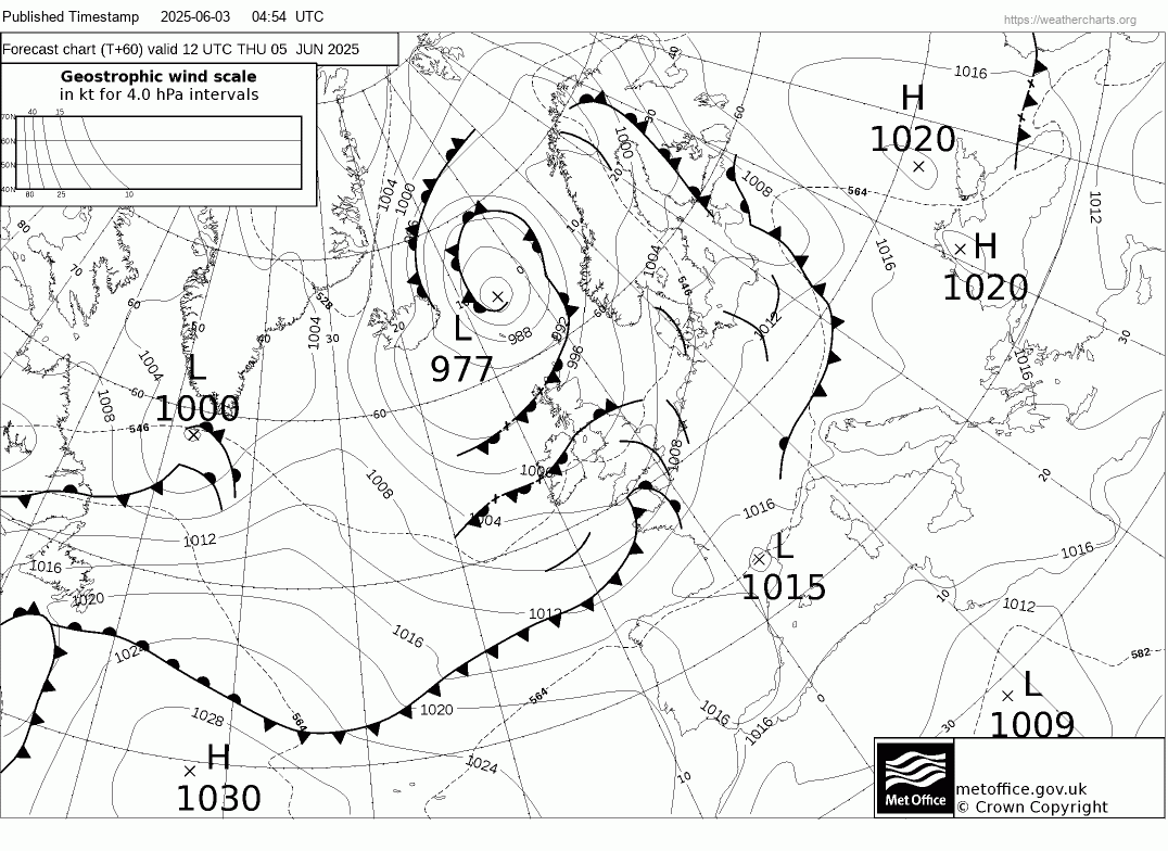
Unsettled with spells of rain or showers for most over the coming days
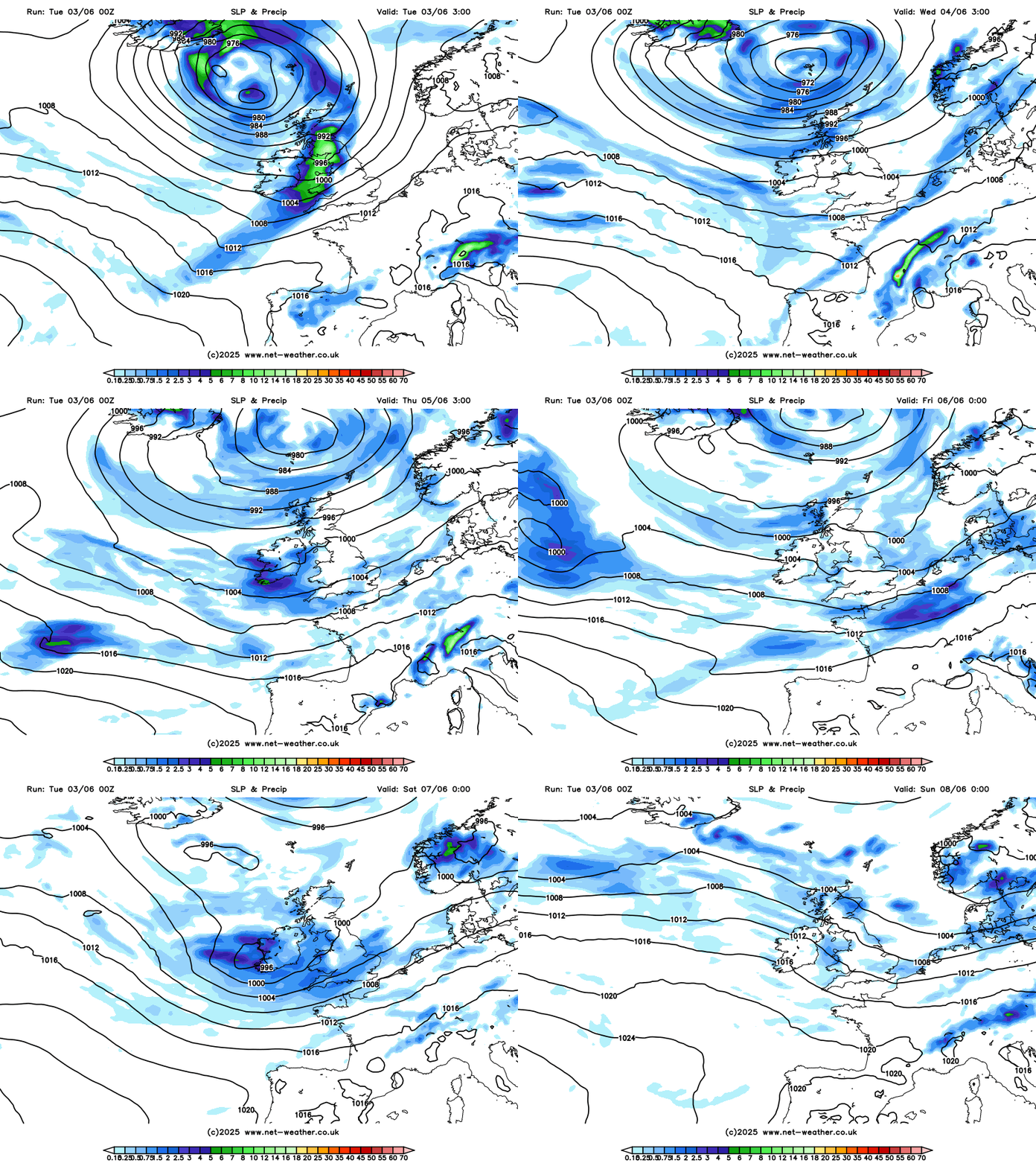
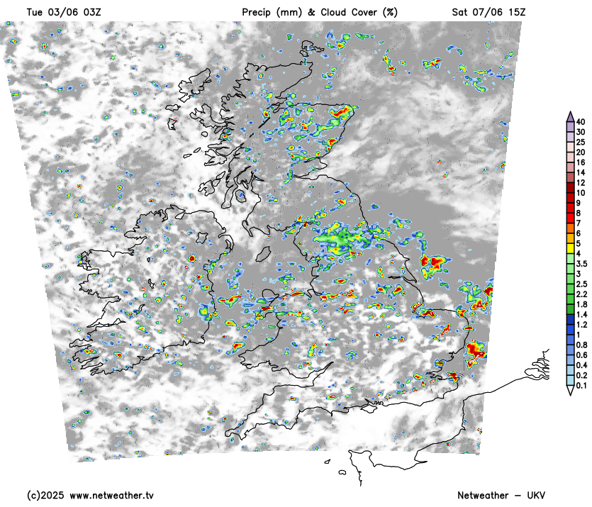
Sunshine and showers on Friday, then a low moving out of northern Canada and over the Davis Strait then looks to track southeast over the North Atlantic then east across southern UK on Saturday. Given its quite northerly origin from the edge of the arctic circle, this low will have quite cold air aloft associated with it, which will cause steep lapse rates and so the low will be quite convective in nature. So heavy showers and thunderstorms are likely across England and Wales, but also heavy showers breaking out across Scotland in the unstable northwesterly flow following the low clearing east further south.
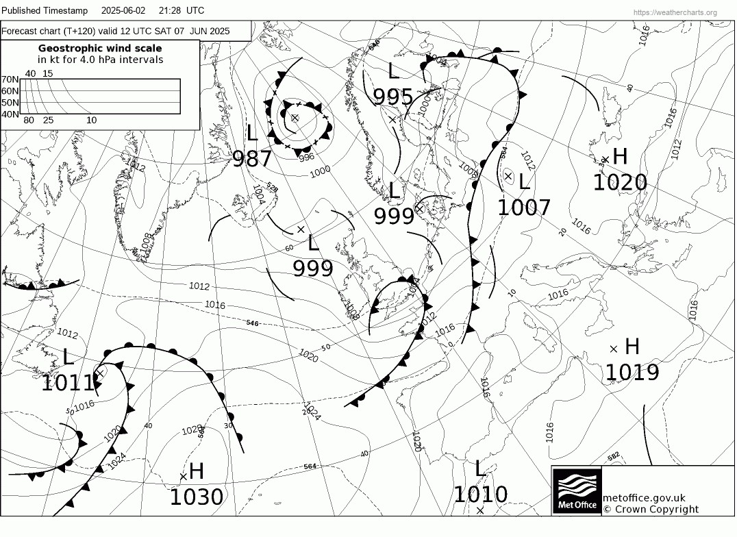
Heavy, thundery showers possible on Saturday
Cool and showery on Sunday in a brisk westerly flow, then another low forming over the Davis Strait southwest of Greenland looks to move southeast and deepen before swinging east or northeast close to Scotland or between Scotland and Iceland on Monday - bringing more rain and showers, though uncertainty how far north or south.
There are disagreements thereafter, as is often the case this far out, between models on the upper flow evolution over the North Atlantic and Europe. The European ECMWF and the Canadian GEM model bring a shortwave upper trough southeast across the North Atlantic from northeast Canada, which will help amplify a long wave trough south over the Atlantic, phasing with upper low west of Iberia. This backs the flow to southerly and brings a very warm but unstable plume north across the UK later next week, with a risk of thunderstorms. However, GFS keeps the upper flow more zonal and doesn’t amplify the upper trough over the Atlantic next week, instead, it moves the trough east across the UK and NE Atlantic, keeping a cooler and more unsettled westerly flow, with further spells of rain or showers.
Potential for a (brief) plume of very warm air later next week hinted at by ECMWF ensembles
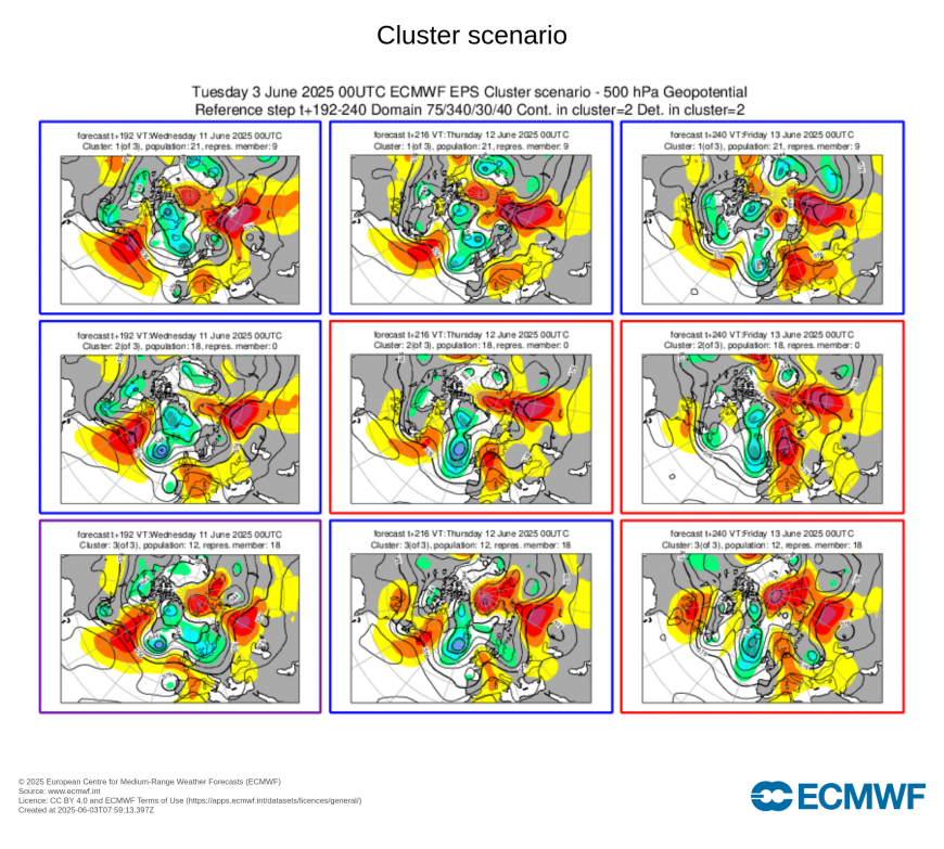
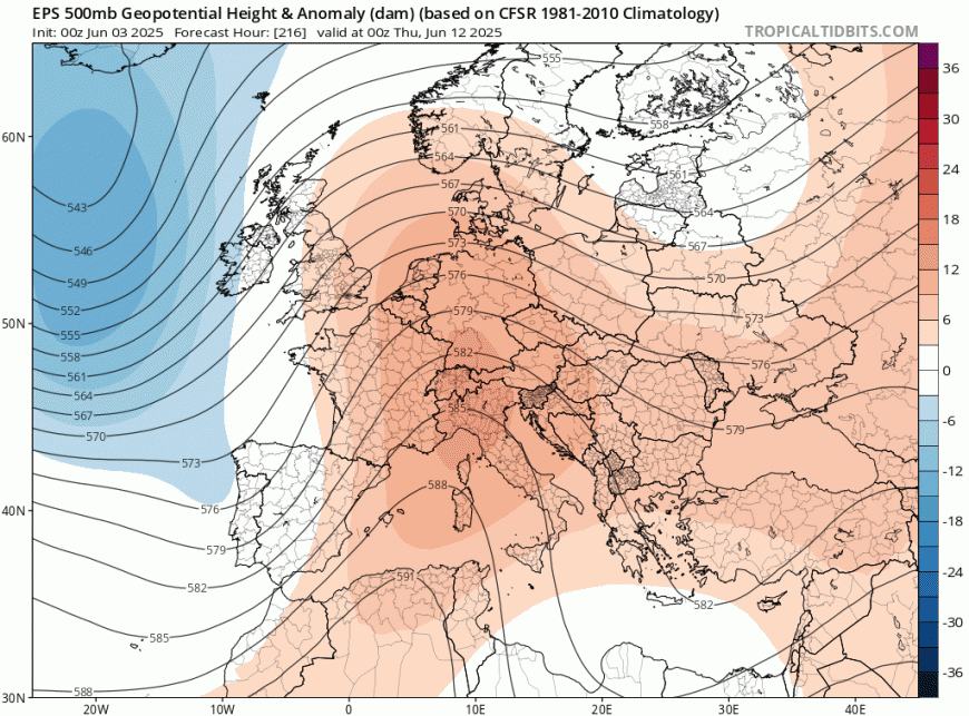
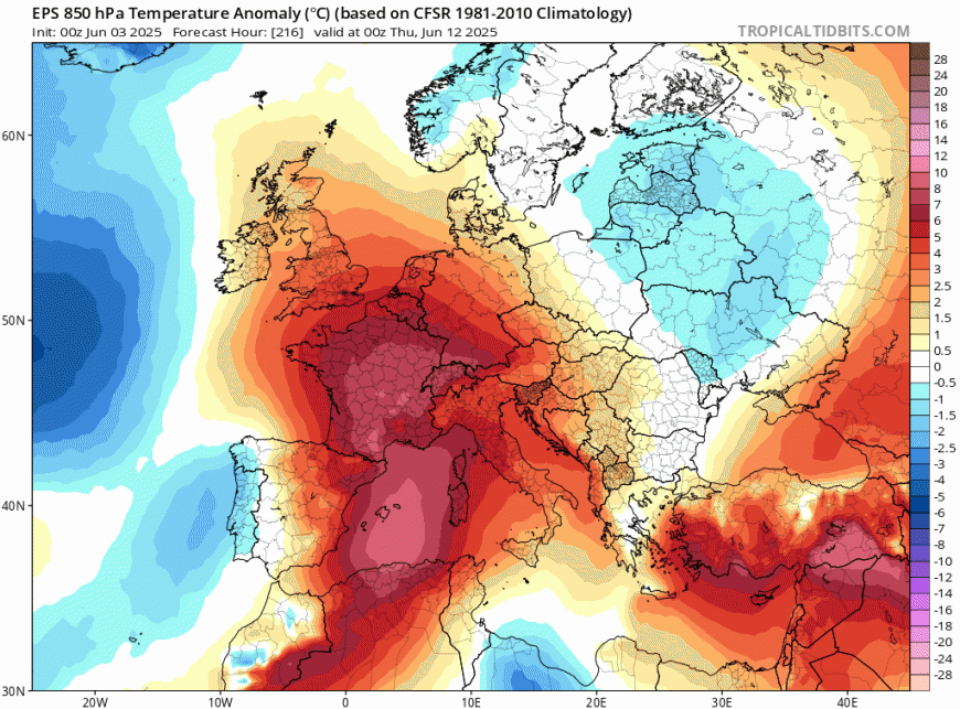
A look at the ECMWF 500 hPa height ensemble mean and clusters, above, does back the idea of an amplifying trough to the west and a plume of very warm air being pumped north towards the UK later next week, though the plume could be brief. The GFS ensemble mean is flatter with 500 hPa flow, so does not have as much warmth, but does hint more than its operation of it warming up next week.
Loading recent activity...