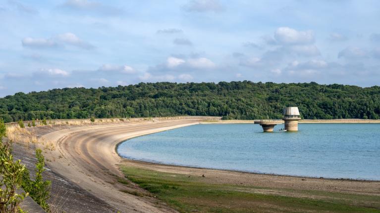
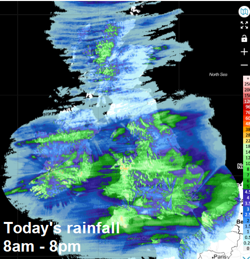
It’s been a cloudy, windy and wet day across much of England and Wales, thanks to a shallow wave depression tracking east off the Atlantic. The rain should largely clear east this evening, however, a trailing front will bring a band of heavy showers with possible thunderstorms across the Midlands and East Anglia overnight. Elsewhere clear spells, with isolated showers in the far north and west. Chillier in the north, with a risk of a patchy ground frost forming in sheltered inland areas where skies clear – a mild night in the south.
Wednesday is looking like a day of sunny spells and scattered showers, locally heavy with perhaps the odd rumble of thunder in the east. Showers tending to fade in the west, as a brief ridge of high pressure builds in. It should be less windy than today though, so feeling warmer.
It’s all change again Wednesday night, as the next low pressure system moves northeast from the Atlantic towards Scotland, spreading cloud and rain across many areas overnight before clearing east Thursday morning, though the far south may stay mostly dry bar the odd patchy outbreak of drizzle. Turning drier and brighter from the west across the south Thursday afternoon, sunny spells with a some scattered showers in the north, before windier conditions, thicker cloud and rain moves in across Ireland and Scotland in the evening before clearing overnight.
More unsettled in the north than the south from Thursday and through to early next week
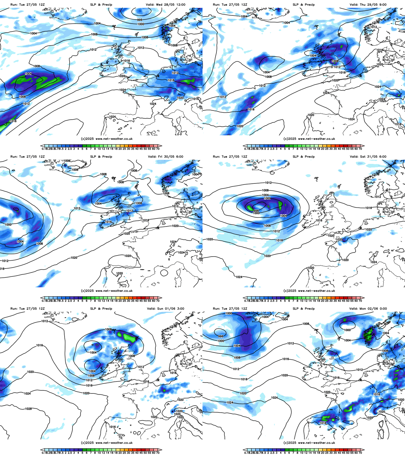
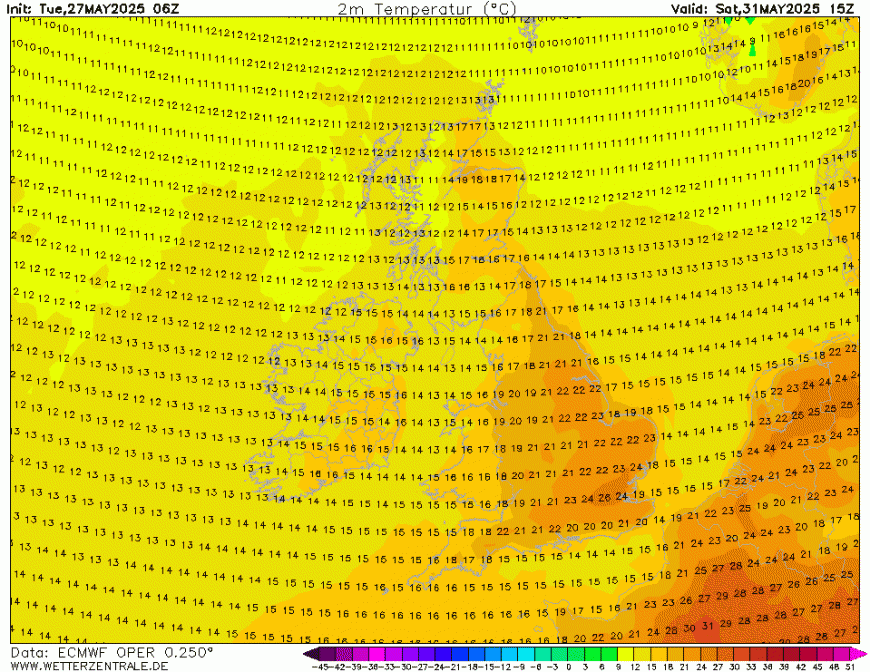
Friday looking bright and breezy, with some scattered showers in the north and west. Quite warm towards the southeast, perhaps reaching 25C in London in any sunshine.
Some uncertainty how quickly the next Atlantic frontal system arrives in the north on Saturday, which could introduce heavy showers or longer spells of rain to Scotland and perhaps parts of the northwest of England and Wales. Drier and sunnier across SE England and East Anglia – where it could turn rather warm and humid – again perhaps reaching the mid-20s Celsius, maybe 26-27C in London.
Some very warm conditions on the SE of England on Saturday?
A cold front likely sweeping southeast through all parts Saturday night / early Sunday, weak with little or no rain on as it reaches southern and eastern England but introducing cooler and fresher conditions for all on Sunday. An area of low pressure moving northeast across Scotland may bring further showers or longer spells of rain in the north and west along with windy conditions on Sunday. Southern and eastern England could stay dry and sunny.
Next week may see unsettled conditions return across all parts, as un upper trough pushes SE into NW Europe.
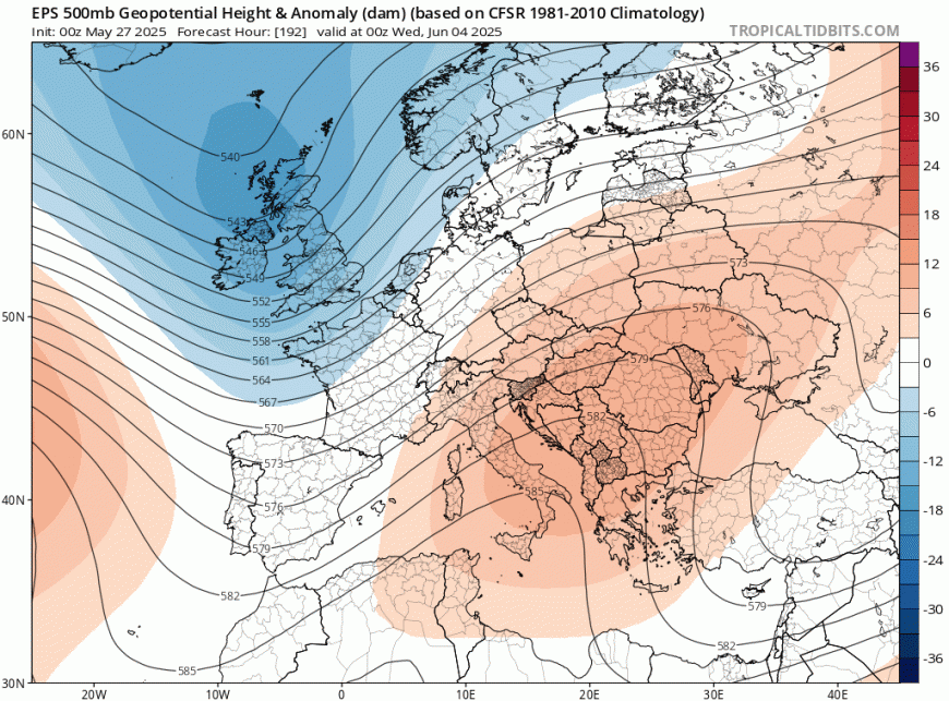
Some uncertainty by early next week, though ECWMF ensemble mean and clusters indicate an upper trough dropping southeast towards Northwest Europe, which would bring increasingly unsettled and windier conditions from the west Tuesday onwards, after perhaps a dry day on Monday under a brief ridge of high pressure. The unsettled conditions lasting for rest of the week too, with heavy showers, storms or longer spells of rain, but it could be warm in any sunshine.
Loading recent activity...