More spring sunshine this week for England and Wales but it will be more unsettled further north. Eastern Scotland could do well, sheltered from the brisk winds off the Atlantic. Aberdeenshire saw a temperature of 14.4C at Fyvie Castle on Sunday. Other spots, including Kew Gardens, saw lovely spring sunshine and reached between 12 and 13C as March got underway.
For the start of the working week temperatures will be around 9 to 12C but they could rise into the mid, even high, teens in the sunshine. Northern parts of the UK will be in mild air as the risk of frost continues for southern England over the next two nights.
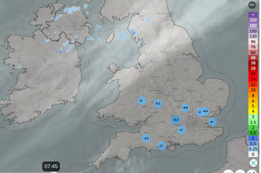
Where the air stagnates in the south and southeast, air quality will decline. DEFRA’s air pollution forecast mentions ‘Isolated pockets of moderate air pollution are possible in parts of southern England tomorrow and also eastern England on Wednesday and Thursday.’
High pressure is keeping the weather over the southern half of the UK quiet and settled and this high extends over much of mainland Europe on Monday. There is a weak fading weather front across northern Britain and Northern Ireland with more cloud and patchy rain or coastal drizzle. To the north, low pressures are still moving by for Iceland and bringing fresh W/SW winds to the north of Scotland, even strong winds to the Islands. To the lee of high ground, the Moray coast could see the highest temperatures again today.
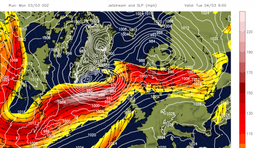
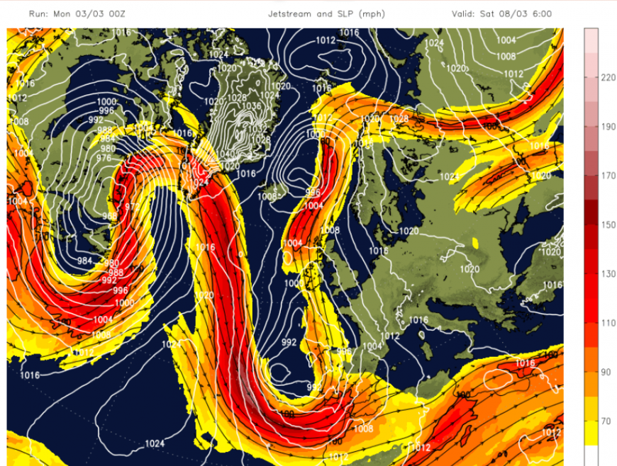
Later this week, the jetstream buckles, which ends the hold of the high pressure over the UK but could help steer a warm southerly surface flow our way for the end of this week. Spain and Portugal have been seeing unsettled weather with heavy downpours and squally winds. There have already been impacts from flooding including along the Costas. As this rainy picture continues this week, further incidents look likely for Spain.
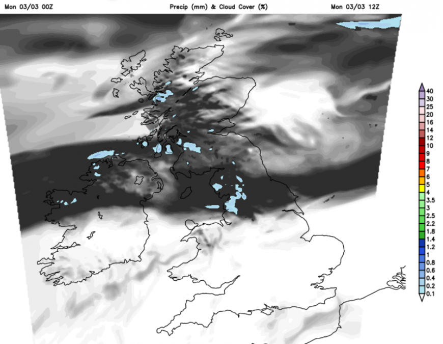
We have three segments across the UK; after a cold start southern Britain will be fine and sunny with hardly any breeze, the frontal band will keep more cloud across a central swathe of Britain and Northern Ireland with patchy rain for the Lake District, for Scotland eastern areas will see more sunshine with more cloud for the west coast and a cool breeze here.
Tonight the frontal band will drift northwards and it will stay mild. The far northwest will be blustery but southern Britain will be calm and chilly, dry and clear under the high.
Southern inland areas will see a widespread frost and there will be fog, even freezing fog in places. The difference north to south will be vivid on Tuesday as the winds strengthen, perhaps even to gale force for the Scottish Islands with very rough seas for ferry journeys. Rain will arrive for the NW Highlands with frontal cloud extending over much of the northern half of the UK. Further south it will be a fine day with sunshine. London will be around 12 or 13C. It will be chilly again for southern Britain overnight but rain will extend over more of northern and western Scotland.
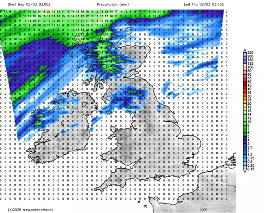
Northern Ireland could remain on the edge of the frontal band midweek with thicker cloud and damp weather just confined to the north coast. Eastern Scotland should see sunshine and mild conditions to the lee of high ground in the blustery flow. Thicker cloud could trouble Cumbria, perhaps the west coast of Wales, but overall there should be plenty of fine weather for England and Wales on Wednesday. Temperatures could tip towards 15C.
As the jetstream buckles, frontal rain might affect more areas, notably western Britain, even down to Devon and Cornwall later this week. We’ll have to see how well the high pressure holds on after Thursday.
Loading recent activity...