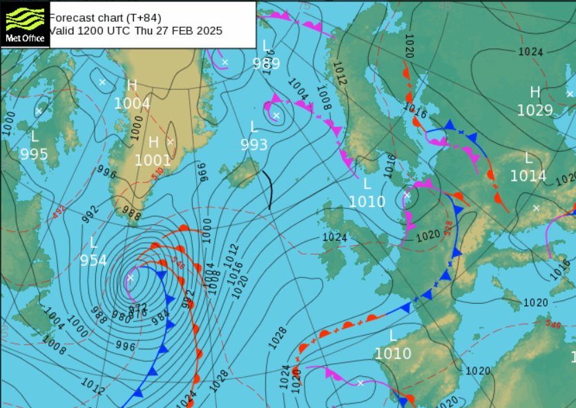
For the end of February and the beginning of March, our UK weather will stay under the westerly influence of the Atlantic. It won’t be as mild as it has been over the past few days as we lose the blustery flow from the south or southwest. Hull reached 17C on Friday and at times, out of the wind, it felt like spring wasn’t too far away this weekend. High pressure should form over England and Wales later this week, bringing welcome dry weather. However, as the winds fall light here it will be colder by night, with frost and fog.
There will be more rain today, and on Wednesday, after a wet weekend for parts of the UK but the overall trend this week is for drier weather. Southern Wales had an Amber warning on Sunday after persistent rain for regions exposed to that S/SW flow.
“The heaviest rainfall has now cleared this area. We will continue to monitor the situation”
Natural Resources Wales on Monday morning as the number of flood warnings diminishes but river levels remain high.
The jetstream weakens this week and then begins to buckle, throwing low pressures further north towards Greenland and Iceland. High pressure manages to keep a lot of dry weather over the UK into the weekend. The far north/northwest will be exposed to wet and windy weather.
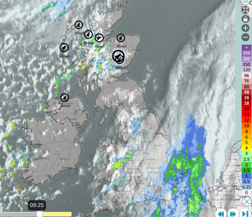 Netweather Radar with Visible cloud and top ten gusts at 09:25
Monday
The last of the weekend frontal rain will clear from SE Britain by lunchtime and the following showers will be mixed with a lot of fine, bright even sunny weather across the UK. Temperatures will still be in double figures, 10 to 14C. The strong to gale force SW winds will continue for NW Scotland with showers and cancellations to ferry services. A line of heavier showers will appear over Ireland this afternoon and move over County Down, then head to western Britain. These showers will be scattered but heavy and affect Wales, Cumbria and central Scotland by this evening.
Tuesday
There will be a lot of fine weather with bright or sunny skies and a more westerly breeze. Showers will continue to move by for northern and western Scotland and Northern Ireland in the morning but scattered for more of Britain by the afternoon. A frontal system further south will bring heavy rain to France on Tuesday and there is some uncertainty about a linked band of rain which could move over northern France and even reach across the English Channel. This might bring rain and cloud to southern England and particularly the far southeast during the day but the models vary.
It turns chilly and clear during Tuesday evening and overnight as the winds ease down. Bands of showers will arrive after midnight from the southwest
Wednesday
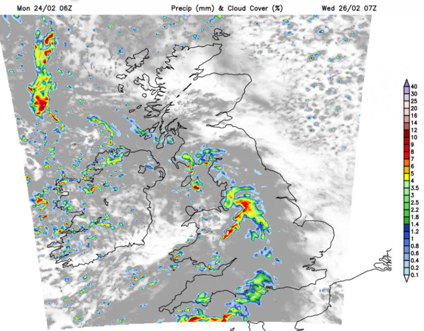
Northern Scotland should start the day sunny and cold with a frost. Heavy showers and longer spells of rain then move across the rest of the UK. It will feel colder with more cloud and wet weather. Again another band of heavy rain will move across France. This might wave up into southern England on Wednesday but it looks like the main focus is for France and then the Low Countries. The UK will have some hefty showers though for midweek and a blustery colder NW wind will pick up for Northern Ireland, the Irish Sea and north Devon during the afternoon.
Wednesday night becomes drier and cold although there is uncertainty about how much cloud will remain. If the skies clear, the temperatures will fall and there will be more frost.
Thursday and Friday look quieter with the risk of fog in places, and some frost but a lot of dry settled weather with light winds. A new weather front may arrive from the northwest during Friday night with freshening southerly winds before that.
Loading recent activity...