At the start of the weekend, temperatures fell to -18.9 in the Highlands, with deep snow. By Monday morning, a complete change at +11C in a strong SW wind and the snow across Scotland is disappearing fast.
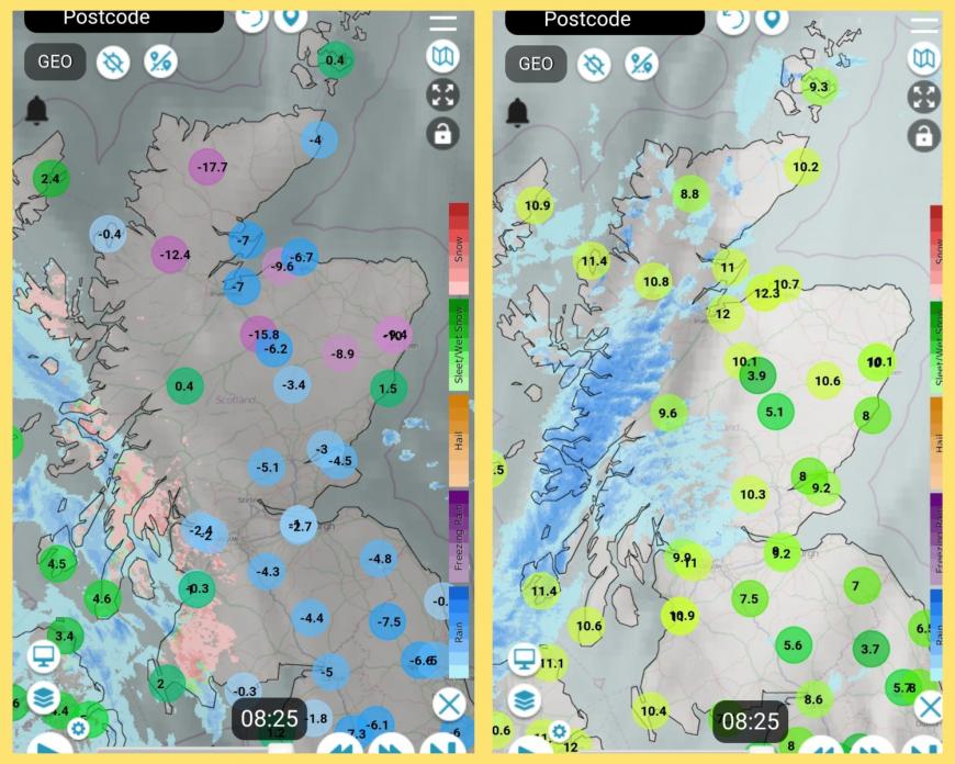
There is frontal rain over Northern Ireland and Scotland with blustery winds bringing in mild air. England and Wales are still under the influence of the cold High pressure with more settled but murky conditions. The high pressure remains nearby for southern Britain as weather fronts drift down from the north and weaken. It becomes a settled, mostly dry week. Blustery in the far northwest but light winds continue in the southeast. Temperatures are recovering after the wintry spell with some very mild days for northern Britain and Northern Ireland which will continue the snow melt.
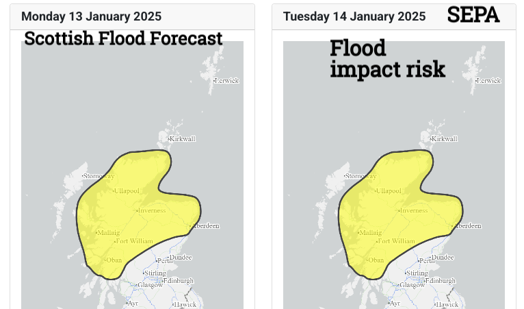
“Flooding from rivers and surface water is likely on Monday and Tuesday across the north of the country. This is due to snow melt and outbreaks of rain. In some areas, river flooding is likely to persist into Wednesday as rivers continue to respond to the melt. “ SEPA
Through this week there will be a lot of dry weather. The Western Isles and NW Highlands will be clipped by passing weather fronts often with windy conditions this week and today, Monday will be the wettest day, but only affecting the NW half of the UK, as two weather fronts topple in from the Atlantic.
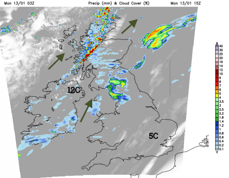
The warm front fades over northern England and the Irish Sea but the cloud persists as will wet conditions into the evening for Cumbria, Lancashire, the Pennines and Anglesey. The cold front brings lively outbreaks over the Great Glen this afternoon but the band fades over Northern Ireland and by evening as it reaches southern Scotland. Accompanied by blustery SW winds and the mild air. The quiet, steady and colder weather continues over southern Britain for the rest of Monday as the cloud cover thins and breaks.
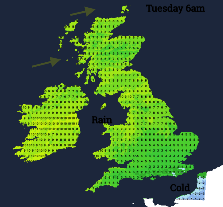
As temperatures dip near to zero in southern England there will be a patchy frost and a small risk of fog. The weak weather front will keep cloud and damp weather over western Wales for Tuesday morning but much of the UK will be fair and bright with light winds. Western Britain will see more cloud through the day and eastern areas will be more likely to catch some sunny spells. Northern Ireland looks dry and fair but still windy for NW Scotland with thickening cloud and a damp end to the day. Temperatures across the UK will be 7 to 11C, so feeling mild.
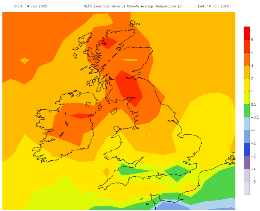 Much milder than average for Northern Ireland, northern England and Scotland midweek. Quite a change.
The middle of the week looks quiet with a risk of fog for England and Wales, even still a touch of frost for a few spots in southern or southwest England staying close to the cold air over mainland Europe. The stirring winds in the far north will continue at times reaching gale force for the Western Isles as rain wavers by. Overall the trend is for a quieter, less cold week ahead with mild conditions in the far north and west. A dramatic change away from the cold and wintry start to January. There will be fog to watch out for.
Loading recent activity...