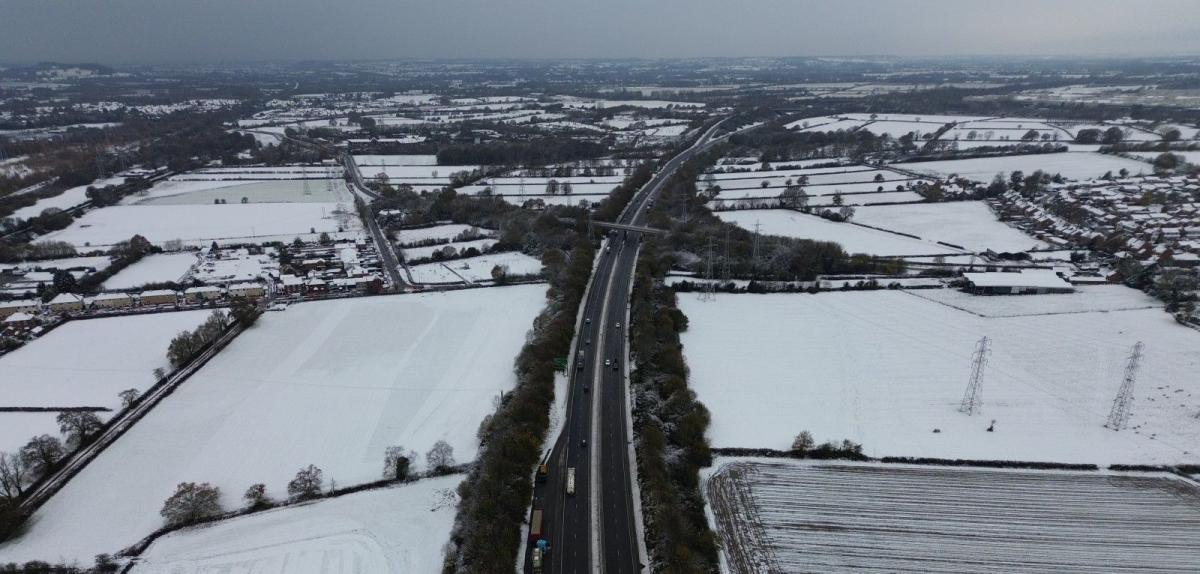
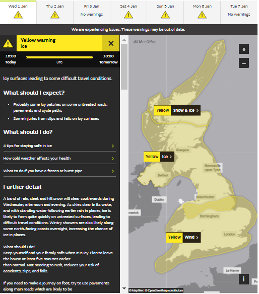
Happy New Year from all the Netweather team. January is certainly in like a lion on New Year’s Day, with a yellow wind warning for wind across much of England and Wales bar northern England. There is also a yellow warning for snow and ice in force for northern Scotland and warning for ice covering Scotland, N. England and N. Ireland. So a lot going on and worth bearing in mind these warnings covering most of the UK that may cause disruption for those travelling today.
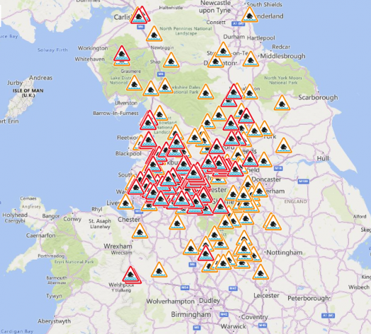
Persistent and heavy rain overnight across N England triggered an amber warning to be issued for parts of NW England - which expired at 9am this morning. However, although the rain cleared this morning, there will continue to be a risk of flooding, with 121 flood warnings in force as I type, most of these in northern England.
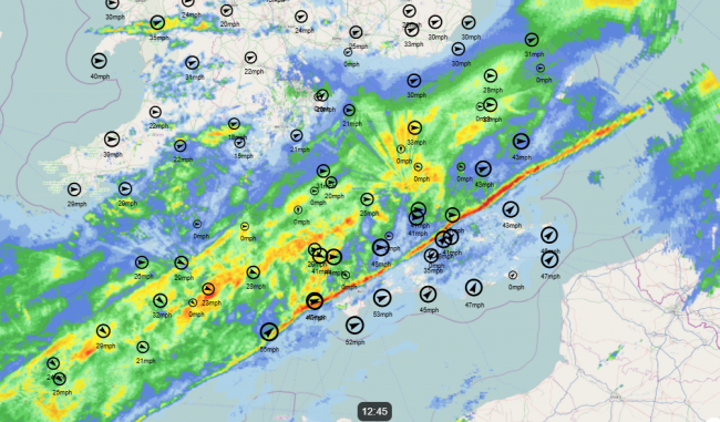
At lunchtime, there is a cold front, marked clearly by a squall line on the Netweather radar, clearing southeast across central southern and SE England this afternoon, with a spell of rain following on behind. Some very strong squally winds ahead of the front, with southwesterly gusts of 50-60mph along the south coast, 40-50mph inland locally. The rain and strong winds could cause some tricky driving conditions and may bring down a few branches onto roads. A yellow wind warning is in force until 3pm today. Still mild across the far SE of England before the cold front clears through, with temperatures in double figures.
Turning drier, brighter and cooler following the rain clearing southeast across Wales, Midlands and northern England, clearer skies eventually reaching southern England early evening as the rain clears away. Temperatures following the clearance of the rain falling down into single figures.
Further north across Scotland, it’s an increasingly wintry picture, as an occluded front brings an area of rain and sleet turning to snow inland, with winds switching from westerly to northerly bringing colder arctic air from the north as the front moves south. Some accumulations are possible as the sleet and snow moves south, particularly, but not exclusively, over high ground. Brighter but colder conditions across northern Scotland following through the afternoon, though sleet, hail and snow showers continuing across northern Scotland towards coasts. Temperatures reaching 1-3C at best across Scotland this afternoon.
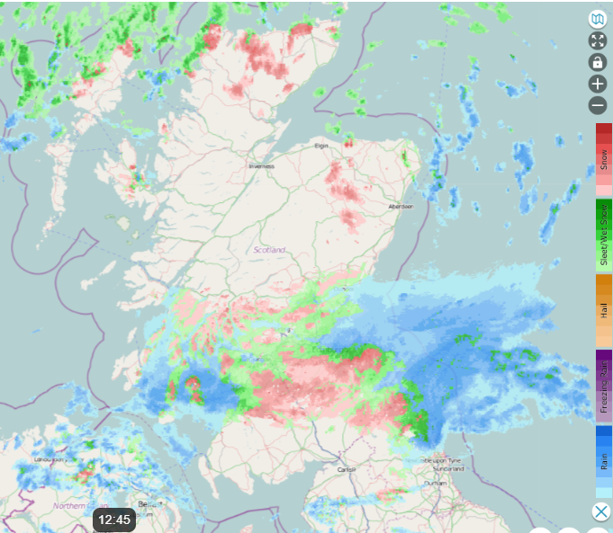
Sleet and snow moving south from Scotland into northern England this afternoon and evening generally petering out, while rain clears the far south, to leave a generally dry night. Though some sleet and snow showers will affect northern coasts With skies clearing and winds turning northerly it will be a cold night with a widespread frost developing. Warnings for ice across in force for much of Scotland and N. Ireland, as temperatures fall below freezing tonight under clearing skies create a risk of ice on untreated roads where rain or snow has fallen.
Thursday and Friday are looking mostly dry, sunny but cold. Winds northerly on Thursday, which will continue to feed wintry showers across coasts of Scotland and along North Sea coasts of England. Perhaps a spell of more frequent sleet and snow showers moving down across northern Scotland later in the day, bringing further accumulations here. Friday winds turn northwesterly, with wintry showers confined to the northern and western Scotland, north coast of N. Ireland but also some off the Irish Sea across NW England. Widespread frost overnight.
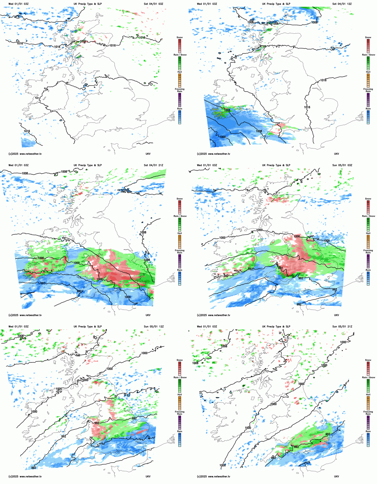
Saturday is looking mostly dry and bright with light winds but on the cold side, some wintry showers continuing in the far northwest. However, an area of low pressure moving northeast from the Azores looks to bring outbreaks of rain in from the SW later on Saturday preceded by a spell of snow across England and Wales which will continue into Sunday. Any snow quickly turning back to rain across southern England, but may stay as snow and linger through Sunday and perhaps into early next week across Wales, the Midlands and northern England. So potential for some large accumulations of snow over higher ground of Wales and northern England as the low moving in across southern UK is slow to clear east.
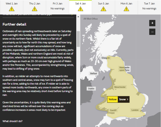
 Broad Met Office warning for snow for Saturday, Sunday and Monday in force across England and Wales, but likely to be revised next few days, as it becomes clearer where is most likely to see disruptive snowfall.
However, there is uncertainty how far north the low will get, if the low is shallower, it and the snow may end up further south. But for now, southern England most likely turning milder for a time, with outbreaks of rain later on Saturday through into early next week, sleet and snow further north over England and Wales, before the low clears east early next week and cold air returns for all next week.
Loading recent activity...