The weather is set to turn milder, wetter and windier from the north-west as we head towards the New Year, with high pressure receding south-eastwards and a strengthening west to south-westerly flow. It is forecast to turn particularly wet in western Scotland, where there will be considerable orographic enhancement of the rain over high ground. This will also bring the recent foggy weather over England and Wales to an end.
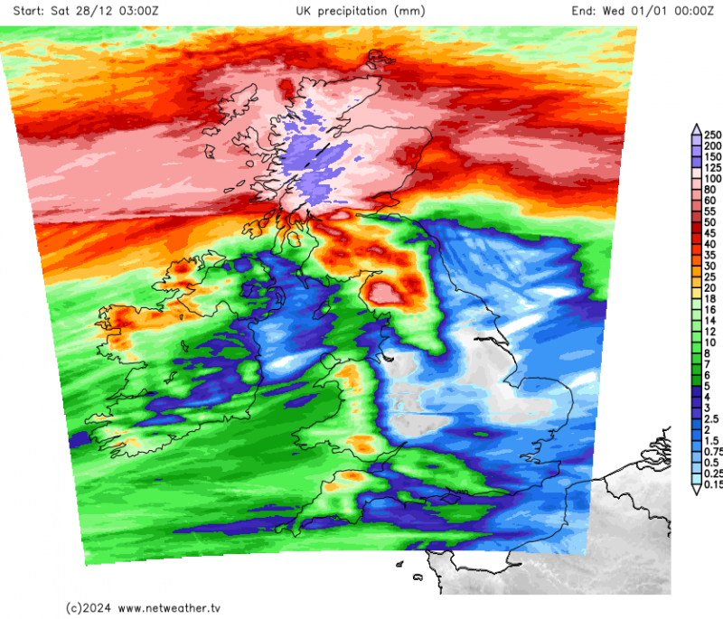 Rainfall totals between now and the New Year
However, this mild spell is expected to be relatively short-lived, with a significant change to colder conditions likely in the first few days of January as Arctic air moves south across the country, following some potentially very windy weather as low pressures move through.
In Gordon Manley's long-running Central England Temperature series from 1659, 2022 and 2023 were the two warmest years on record, but 2024 is not set to be another record breaker. Although the first five months of the year were exceptionally warm, temperatures from June to November inclusive were generally close to the long-term average. December is set to be a very mild month, but nothing like as warm as December 2015. However, 2024 does look set to come in as the 4th or 5th warmest year on record for Central England, behind 2022, 2023, 2014, and possibly 2006. We will find out how the UK-wide temperature fares from the Met Office at the end of the year, but it will probably be a similar story for the UK as a whole as for Central England.
Even during the run of relatively cool months from June to November, substantially below-average temperatures were rare, though we did have two notably cold blasts in September and one in the third week of November which brought some notable early snowfalls for some parts of the country.
2024 has also been a wet year for much of the country, and rather cloudier than most recent years. The summer was relatively dry in most of England and Wales, but not particularly sunny, and rather cool for recent years, though slightly above older averages such as the 20th century average or 1961-1990, reflecting the recent warming trend.
On the other hand, it is looking set to be the warmest year on record globally. Although El Niño dissipated quite early in the year and there have been hints of a weak La Niña coming in, which normally leads to a small drop in the mean global temperature, 2024 has continued near record warm globally, falling just short of the record highs set in 2023. Because early 2024 was much warmer globally than early 2023, this is sufficient to raise the mean for 2024 above that for 2023.
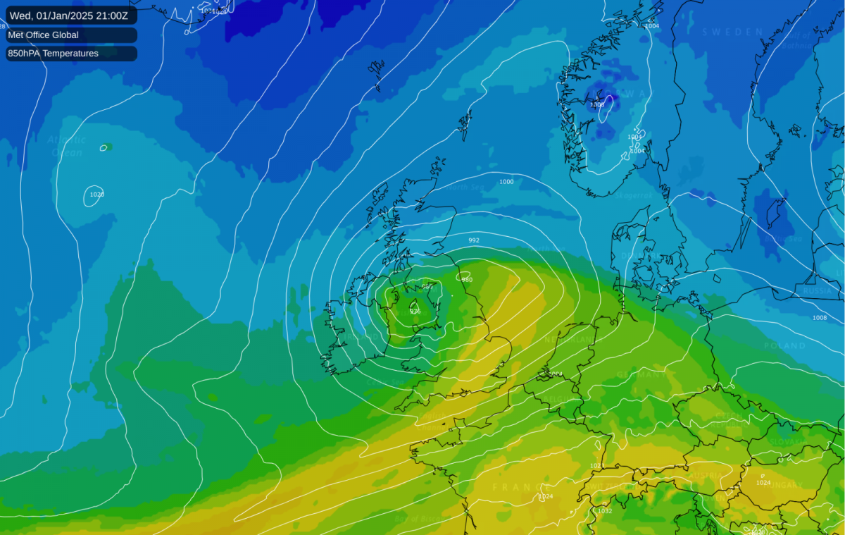
The weather as we head into New Year 2025 is well worth keeping an eye on. Firstly, there is potential for some damaging winds in Scotland on New Year's Eve, as a deep depression moves through and introduces a sharp pressure gradient between the low and between high pressure centres to the north-west and south-east. Then on the 1st and 2nd January 2025, damaging winds look set to strike further south, although there is considerable uncertainty over how far south. A second deep low is forecast to cross the country, most likely bringing damaging winds through north Wales, the northern half of England and into southern Scotland, though they could end up further south, as there is still a lot of uncertainty over the track of the depression.
After this, it is looking likely that we will see a spell of mainly northerly winds, with much colder air pushing in from the north behind this second depression on 1/2 January, associated with the high pressure developing to the north-west of Britain. It is currently uncertain whether there will be much snow associated with these northerlies, because high pressure will be close to the west of Britain which means that it could well end up dry for the majority of us, with wintry showers largely confined to north-facing coasts. However, there is potential for some troughs in the flow to bring some snow quite widely, depending on how long the northerly sustains for and how far away the high pressure is to the west. Either way, it looks probable that there will be plenty of cold and sunny weather with widespread overnight frosts.
The longer range outlook sees high pressure probably staying close to the British Isles for a large part of January, although there are signs that during the back end of January we may move into a mild and wet regime with westerly and south-westerly winds. Before that, dry weather looks to be the likely outcome, probably with temperatures generally recovering to near normal after a cold start to the month. There is potential for further wintry outbreaks should the high be positioned to the north and/or west of Britain at times, allowing in cold northerly or north-easterly blasts, but with high pressure set to be close by, there probably won't be much snow after the first week of January. However, the first week of January does have potential to bring snow for some, especially the north-east of Britain.
Loading recent activity...