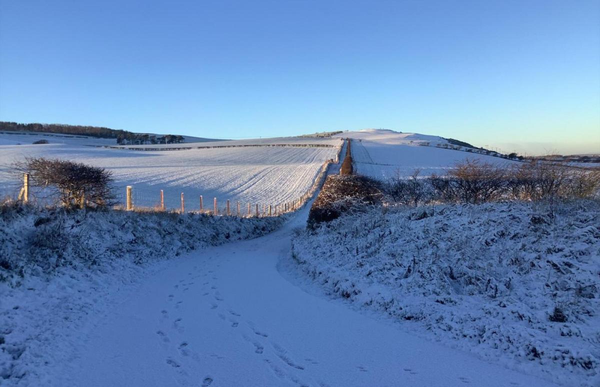
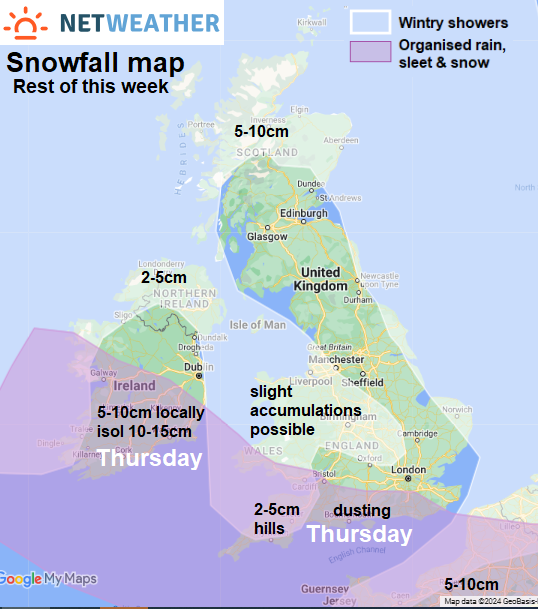
It is staying cold for the rest of this week, with the risk of further snow in places along with widespread frost overnight – which may bring a risk of ice. The snow risk will be mainly from snow showers forming over the relatively warmer seas and blowing in on the northerly wind across the far north of Scotland and down along coastal areas of eastern and western Britain. Perhaps getting inland at times from western coasts too. But weather fronts associated with an area of low pressure passing to the south of Ireland and into France on Thursday will bring a more organised area of snow inland across southern Ireland, south Wales and SW England, with rain or sleet on coasts.
Snowfall map: areas where snow is most likely to fall rest of this week, with accumulations in places
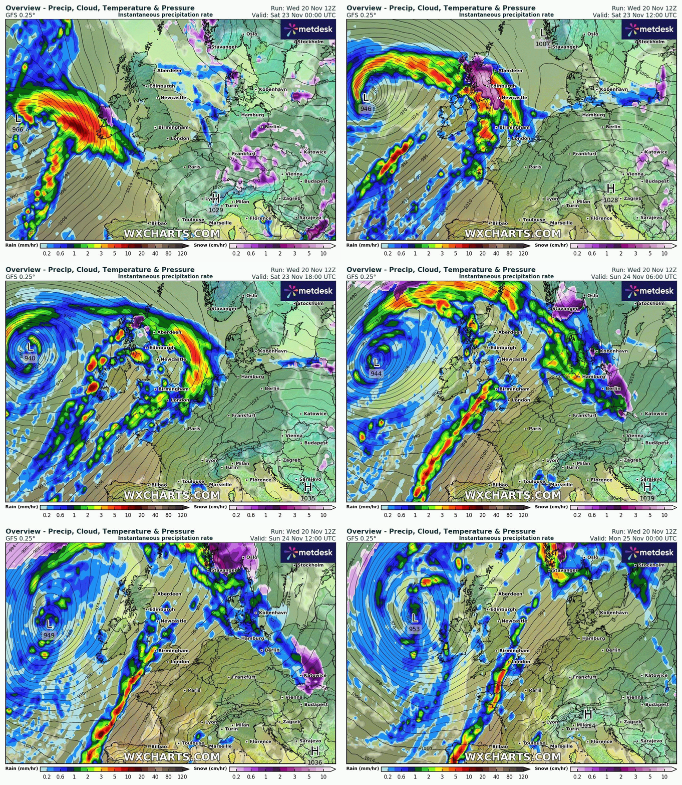
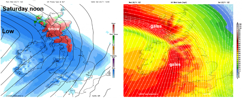
Then a big change over the weekend, as we lose the cold arctic feed and, instead, gain a much milder south to south-westerly flow while a rapidly deepening Atlantic depression swings in close to the northwest bringing wet and windy conditions with strong winds and gales. Met Office warnings of heavy rain are in force for parts of SW England and Wales for Saturday, while a warning for rain and snow is in force for Scotland and northern England.
Big change to milder, wet and windy this weekend
Heavy snow showers this morning brought a winter wonderland across parts of Wales and the English Borders, causing some disruption too. But it’s been drier and sunnier this afternoon, while frequent snow showers have been affecting the far north and west coast of Scotland for much of the day, adding to accumulations here. Snow showers have also affected the east coast of England, particularly Norfolk and eastern Suffolk this afternoon, bringing a covering in places. Elsewhere skies have been mostly clear and its been dry and sunny, but a raw northerly wind everywhere making it feel close to or below freezing, despite temperatures of +3 to +5C.
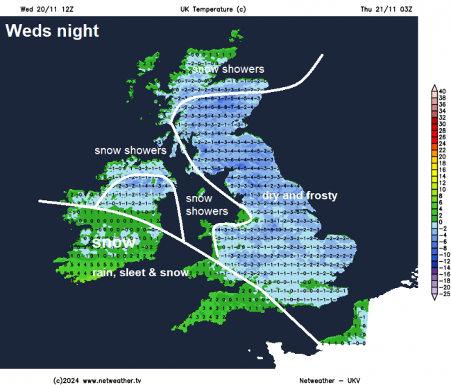
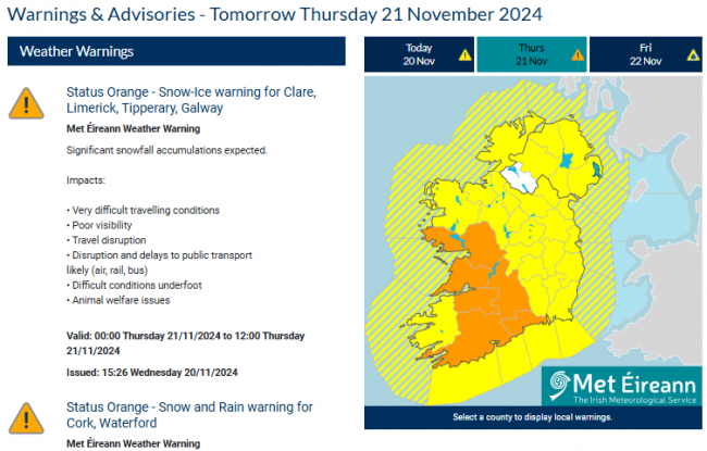
More snow showers piling in across the north and far west of Scotland tonight, here we could see 5-10cm accumulating overnight. Elsewhere, skies mostly clear, which mean temperatures will plummet below freezing, leading to a widespread frost and also a risk of ice on untreated wet surfaces. Temperatures falling to -3 to -5C over northern, central and eastern Britain, -1C in the south. Temperatures perhaps holding up across the far SW of England and SW Wales, as a deepening area of low pressure moving towards Brittany to the south bringing cloud and outbreaks of rain, which will turn to sleet and snow inland as it bumps into the cold air. Risk of significant snow developing across parts of southern Ireland tonight, with a Met Eireann orange warning in force, while snow will develop and accumulate over the southwest Moors by dawn.
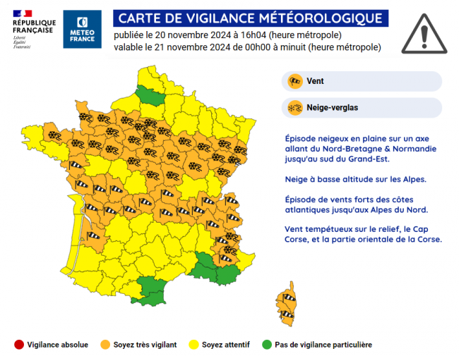
A deepening low will continue to track southeast across northern France on Thursday, bringing a swathe of heavy snow from Brittany and Normandy east across to the Alsace region in NE France. Meteo-France have issued an orange warning for snow and ice in this swathe, while an orange warning for wind is in force to the south for gusts of 50-70mph.
On the northern side of the low, rain, sleet and inland snow will also continue to spread east across south Wales, SW England and perhaps along southern most counties of England through the morning before clearing south into the afternoon. The southwest Moors could see 2-5cm of snow from this. Elsewhere, further snow showers will affect northern and western Scotland, N. Ireland, Irish Sea coasts of NW England and Wales, perhaps moving increasingly inland during the evening. Elsewhere, it’s looking sunny and dry. Cold everywhere, temperatures reaching 3-5C across the board, but winds will be lighter than today, so not such a wind chill as today.
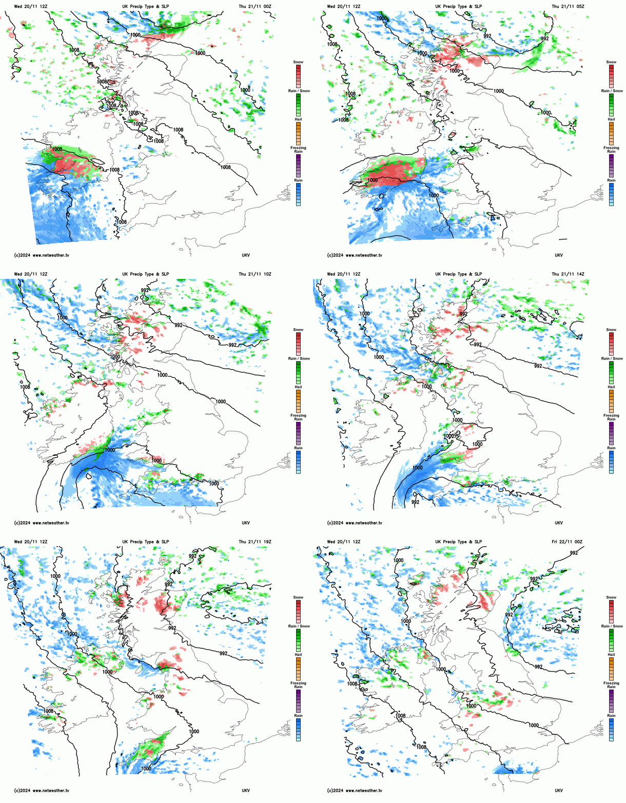
After another widespread frost Thursday night, Friday will be mostly dry and sunny but cold in the northwesterly breeze, but there will be some wintry showers again, affecting north and northwest Scotland, the east coast of England and Irish Sea coasts of England and Wales, some of these showers penetrating quite a way inland into the Midlands too. Temperatures reaching 4-6C generally, perhaps 7-9C in the far southwest.
A significant change as we go through Saturday, with a deepening area of low pressure steaming in from the Atlantic towards the northwest of Britain. This deep low could be the second named-storm of the season, Storm Bert, as it looks to bring some disruption to northern and western parts of Britain over the weekend with gales developing along with heavy rain, which could turn to heavy snow for a time across northern areas, before milder air sweeps in. As well as the wet and windy conditions, it will become very mild, temperatures may reach 15-16C across southern England on Sunday. Compared to 4-5C at best a few days before!
Loading recent activity...