In some recent years, this time of year has seen the first snow of the season in some parts of the country, 2024 won't be one of those years, though.
In October 2008, following a northerly blast on the 27th, sleet and snow fell widely on the 28th and parts of central southern and south-eastern England had both falling and lying snow that evening, accompanied by thunder in some places as well. Although the snow thawed in the sun during subsequent days as daytime temperatures rose well above freezing, some of the heavier hit areas still had some lying snow left by the 30th or 31st. Meanwhile, an exceptional hailstorm hit Ottery St Mary in east Devon on the night of 29/30 October. Despite 2008 not being a particularly snowy year overall, for many areas, it was notable for an unusually short gap between the latest and earliest snowfalls of seasons 2007/08 and 2008/09, as snow also fell and accumulated quite widely on 6/7 April 2008. The Met Office reported that snow was reported lying in October at 0900 in the England SE and Central S district for the first time since 29 October 1922.
Another notable late October snow event hit on 26/27 October 2012. Although the Arctic was exceptionally warm that year, a scoop of very cold air from Greenland entered the northerly airflow and eastern counties from the east Midlands northwards saw sleet and snow showers to low levels, with some temporary accumulations of snow close to sea level. The snowiest weather generally hit close to midnight. Less cold air moved in towards dawn, picking up air from the Svalbard/Russian Arctic region which was seeing anomalously high temperatures for the time of year, which caused snow showers to turn to rain and sleet at low levels.
27 October 2018 was another notable example. Wintry showers affected mainly north-eastern counties early in the day, with for example some quite heavy snow showers around Durham, although on this occasion the snow only generally settled on relatively high ground, typically above 150-200m or so. Later in the day showers spread into south-west England and brought the first lying snow of the season to parts of Dartmoor, while some low-lying parts of the south-west saw sleet showers.
This relatively recent spate of late October snowfalls has been quite remarkable considering that since the exceptionally cold and snowy end to November 2010, Novembers have tended to be largely snow free. Probably the most widespread November snowfalls from 2011 onwards have been those of 30 November 2017 and 26-28 November 2021, but these both hit towards the end of the month and saw rather less widespread snow cover than we saw from various snow events in the Novembers of the 1990s and 2000s.
There is no snowy weather in the forecast this time round, although the medium range weather forecast models do suggest that we may briefly catch a northerly flow next Friday/Saturday. The chances are that the main northerly outbreak will go out into the North Sea and into central Europe, potentially bringing some relatively early snow to these regions, with Britain staying dry, but it has potential to result in one or two widespread overnight frosts next weekend, and there is a slight chance of some wintry showers for a time, chiefly for north-east Scotland.
High pressure has increasingly dominated the weather in recent days and has produced variable amounts of cloud, with many areas of the UK seeing plenty of sunshine on some days, and anticyclonic gloom on others, with persistent low cloud. Most of us will see some sunshine this weekend due to the wind picking up and some clear polar maritime air coming in for Sunday. A band of rain will push south-eastwards through today and tonight, affecting western Scotland and Northern Ireland during today. However, it will fizzle out as it moves south-eastwards, and much of central, southern and eastern England will probably see no rain at all from this system. Sunday will be a sunny day for most but cloud will increase in Northern Ireland and western Scotland.
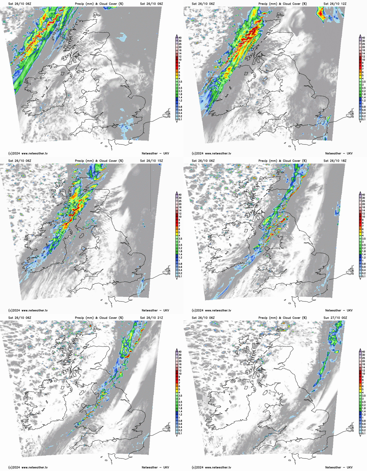
High pressure will continue to dominate the weather for much of next week. The weather is likely to be predominantly mild and cloudy, with some moist tropical maritime air coming in from the North Atlantic early in the week. Monday will see widespread light rain and drizzle, but after Monday the weather is forecast to be predominantly dry. Areas to the east of high ground, particularly in eastern Scotland and north-east England, will probably see the most sunshine next week. As noted earlier, brighter, colder weather with some overnight frost may temporarily establish next weekend due to a brief northerly outbreak.
Loading recent activity...