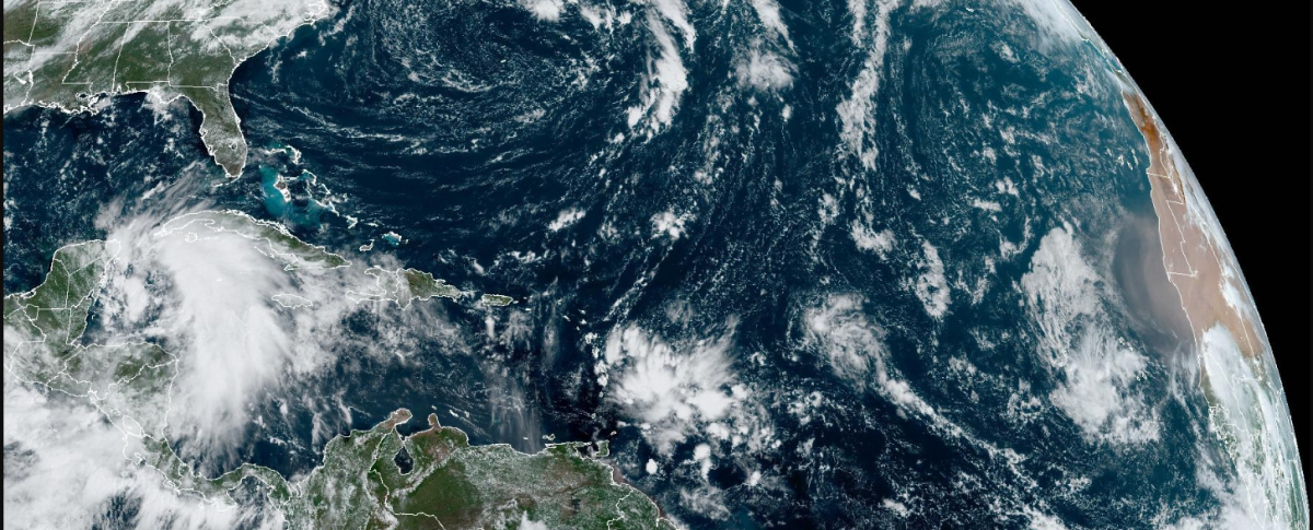
Both sides of continental America are watching tropical cyclones; what was Hurricane John, now a Tropical Storm but still bringing ‘exceptional rains’ to western Mexico and Tropical Storm Helene which is forecast to reach the Big Bend in Florida as a Major Hurricane on Thursday. After a close brush with the Yucatan peninsula of Mexico early Wednesday, the Florida Panhandle and the Florida west Gulf Coast are most at risk, including lesser impacts for Disney World, Orlando.
NHC "Tropical Storm Helene is expected to produce total rain accumulations of 4 to 8" over western Cuba, the Cayman Islands and the northeast Yucatan Peninsula, with isolated totals around 12". This rainfall brings a risk of considerable flooding."
Tropical Storm Helene
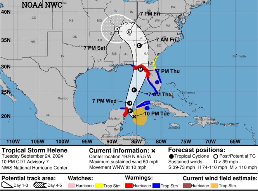
In the USA, southeastern states will be watching the developments of Helene. It has reached Tropical Storm status over the northwestern Caribbean Sea and NHC forecast it to “move across the eastern Gulf of Mexico Wednesday and Thursday, potentially reaching the Gulf coast of Florida late Thursday.”
Rain accumulations of 4 to 8” over western Cuba. Similar for the Cayman Islands and southeastern U.S. with up to 12” possible. The Yucatan Peninsula will also see intense rainfall and the risk of flooding.
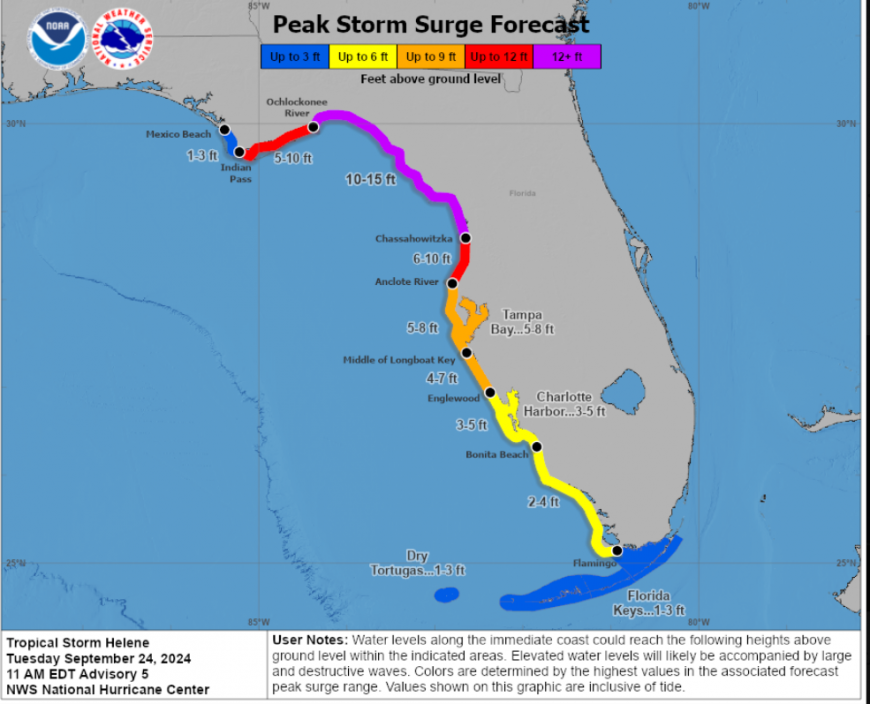
A dangerous storm surge, swell and rip currents will develop as the winds strengthen. Hurricane conditions could reach the US by Wednesday night and early Thursday. Tropical storm conditions are expected in the warning areas in the Cayman Islands, Cuba, and Mexico on Tuesday.
Conditions are ripe for strengthening with decreasing shear, very high oceanic heat content values and an environment of upper-level divergence. NHC “There is still a risk that the system could reach the coast as a major hurricane.”
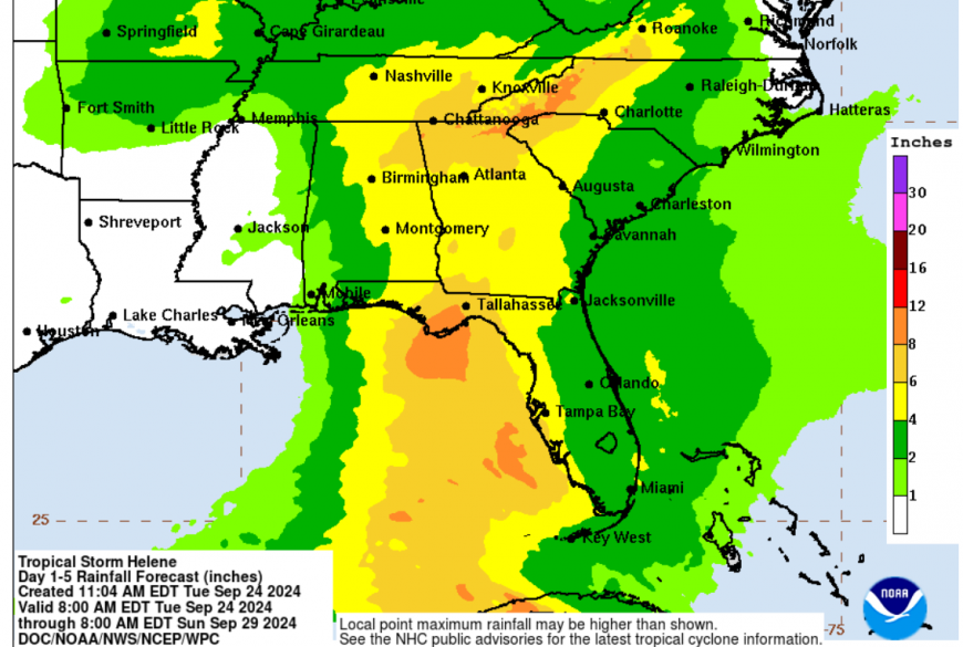
The Florida governor's office has issued a state of emergency for numerous counties noting that this system will be large and powerful before landfall and that the water table and river levels are already high due to recent Hurricane Debby. Due to its size, wind and rainfall impacts will extend well inland and “impacts could damage the operational capability of critical infrastructure including major interstates, roadways, bridges, airports, schools, hospitals, and power grid”
For Disney World, it is sunny, warm and humid with a Tropical Storm watch in place. The weather will deteriorate on Wednesday night with Tropical Storm conditions possible on Thursday and an unsettled end to the week.
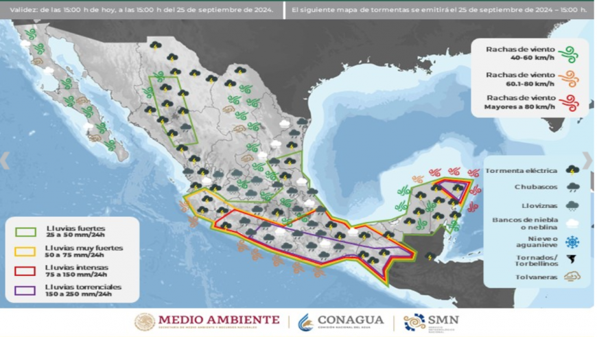
Tropical Storm John
John has been rapidly weakening since it moved inland on Monday night. It still has a well-defined centre and continues to produce heavy rains for southern Mexico. There are thunderstorms with the risk of tornadoes, strong gusts and high waves along the coast.
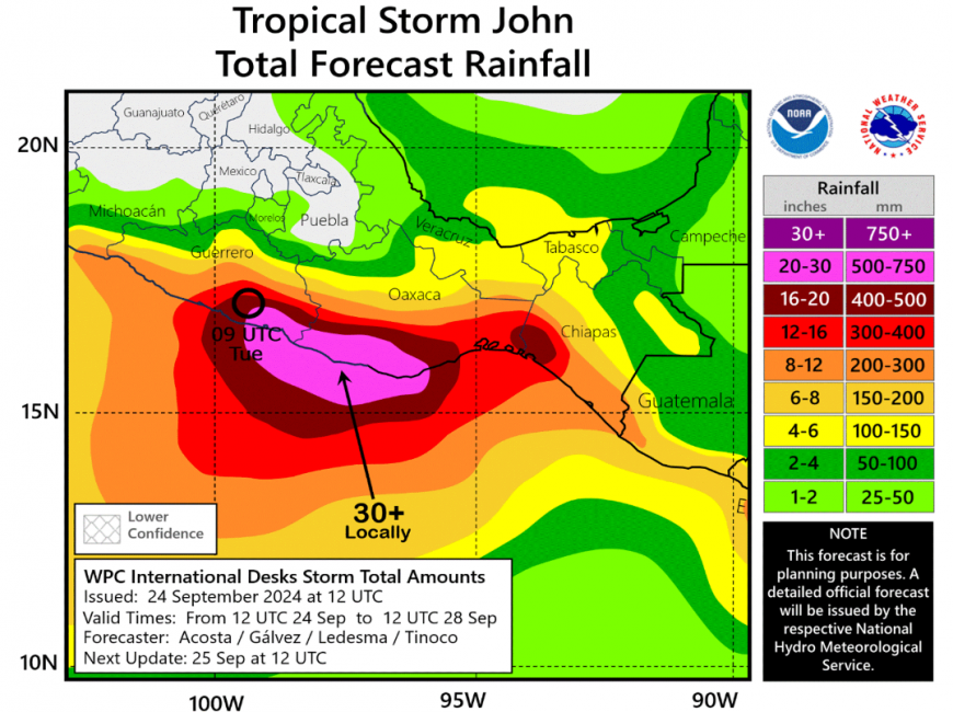
The NHC Forecast shows John lingering near the coast of S/SW Mexico until the end of the week with further heavy rain. This brings the risk of flash flooding and mudslides. Here in the UK, we struggled with over 100mm of rain, so 4”. In Mexico, the forecast from John includes 15 to 30” of rain in this tropical system.
Further discussion on Helene and Florida
Loading recent activity...