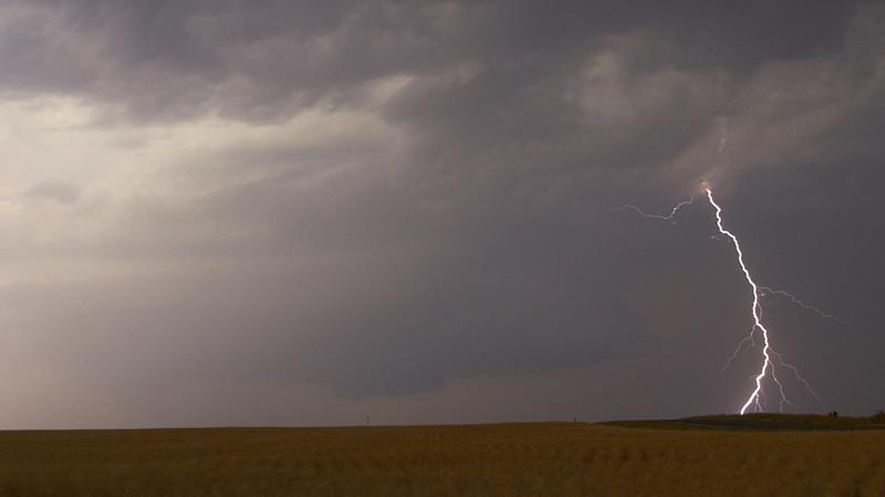
Yesterday saw the hottest day of the year so far, with Heathrow and Kew Gardens in west London both reaching 32C. Heatwave conditions continue across southern Britain today. However, the heat has been somewhat tempered across SE England compared to yesterday, with the heat shifted a little further west across southern half of England, thanks to a brisk easterly breeze. Highest temperatures generally to the west of London, the highest looks to have been 31.1C at Brize Norton in Oxfordshire.
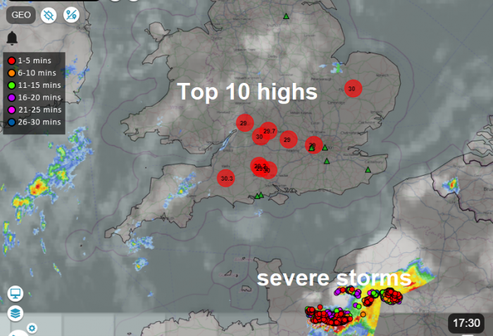
As well as the very warm or hot conditions across S England, humidity levels are on the rise too from the south today. This increase in moisture in the very warm airmass over southern UK, combined with gradual cooling aloft from the west, as an upper trough over the North Atlantic starts to edge further east, will bring an increasing risk of thunderstorms as we head into Thursday.
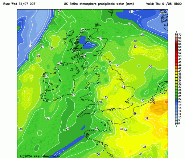
Humid air characterised by high PWAT (Precipitable Water) over northern France is now advancing north over England and Wales:
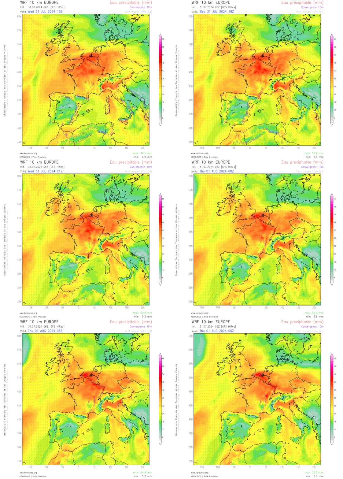
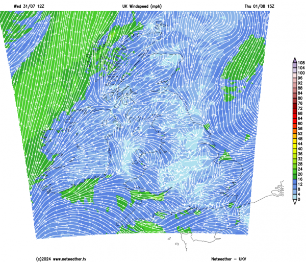
High pressure has been in charge to start the week and is just about in charge today but is beginning to retreat east over the North Sea. This will allow pressure to fall slightly at the surface into Thursday, which will favour breeze convergence to develop on Thursday, which will likely be the trigger for thunderstorms to develop over parts of England tomorrow.
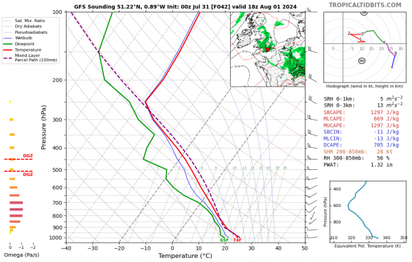
The fuel for the thunderstorms is very warm and humid air spreading north out of France. The air is very warm to quite a depth in the lower atmosphere over northern France, with 850 hPa temperatures (about 1500m up) 20C or higher.
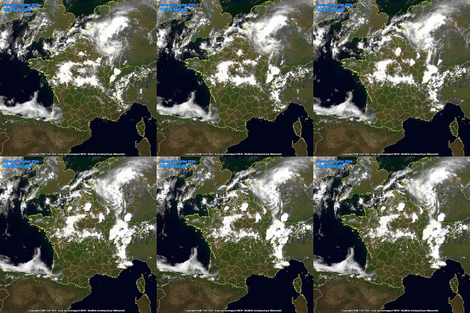
This causing very steep lapse rates between this height and 500 hPa (about 5800m up), where temperatures are around –11C. These steep lapse rates above the warm and moist air below is creating large amounts of potential convective energy (CAPE). However, like yesterday, this energy is largely capped by the warm and dry air aloft, apart from where local breeze convergence is forcing warm moist air to rise – leading to some localised intense thunderstorms to develop this afternoon to the northwest and east of Paris.
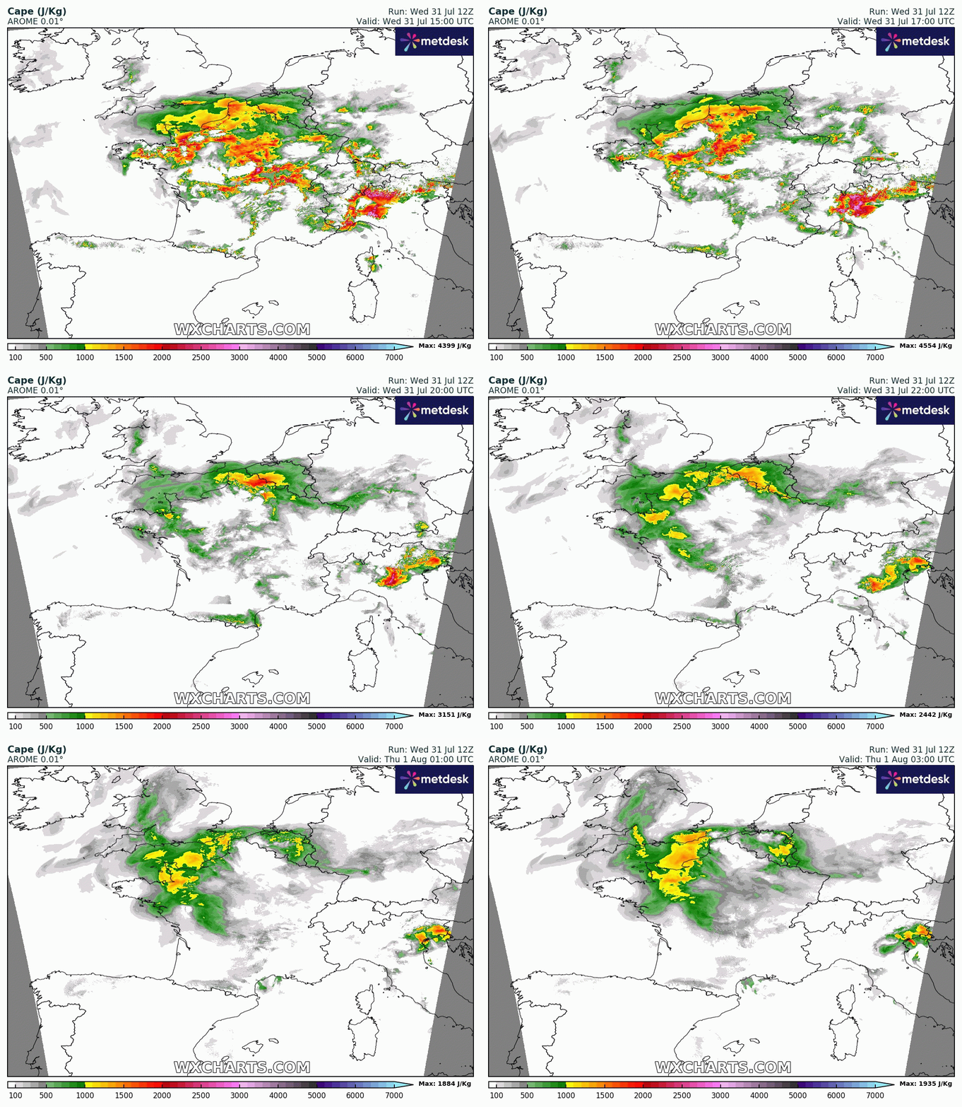
SE England is on the very northern edge of this hot, humid but conditionally very unstable airmass over northern France. Conditional on there being a trigger for thunderstorms to develop and tap into this large area of instability. So far, storms have failed to develop any further north than the eastern English Channel. There’s been a few sharp showers over Kent, but the capping has prevented clouds attaining sufficient depth so far for storms. But there remains a risk this evening and overnight for isolated thunderstorms to form where subtle areas of forcing in the mid-levels trigger lift in the unstable airmass.
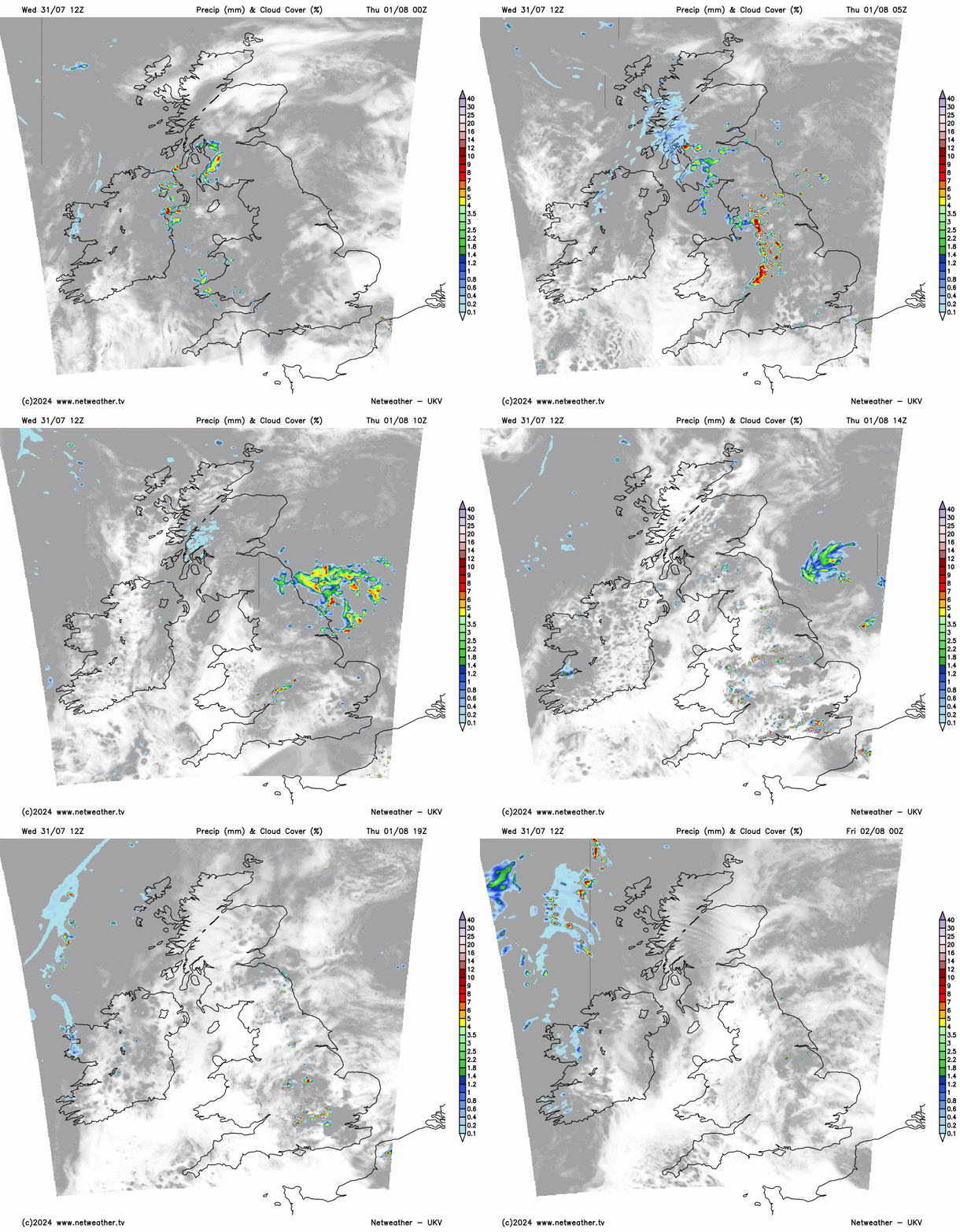
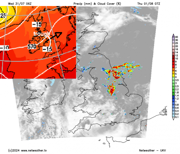
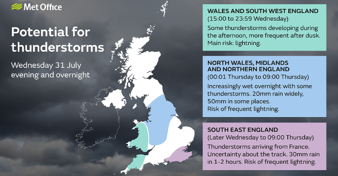
However, a far more greater risk of thunderstorms looks to evolve across parts of England and Wales on Thursday. There is two rounds possible for storms during the day. In the morning a risk of heavy showers and elevated thunderstorms moving east across central, northern and eastern England. Then a greater risk for severe surface-based thunderstorms to develop in the afternoon across central, southern and eastern England in response to maximum diurnal heating and breeze convergence inland.
Loading recent activity...