The UK has recently had a brief hot spell, but nothing particularly out of the ordinary by historical standards. Yesterday saw a maximum of 31.9C at St James' Park in central London, and many sites in the eastern half of England reached 28C or higher.
However, this was nothing compared with what happened exactly two years ago. On 19 July 2022, the UK hit 40C for the first time with a new record of 40.3C at Coningsby, Lincolnshire. The hottest weather extended unusually far north and a number of sites in the Midlands and northern England broke their previous record temperature by 4C or more.
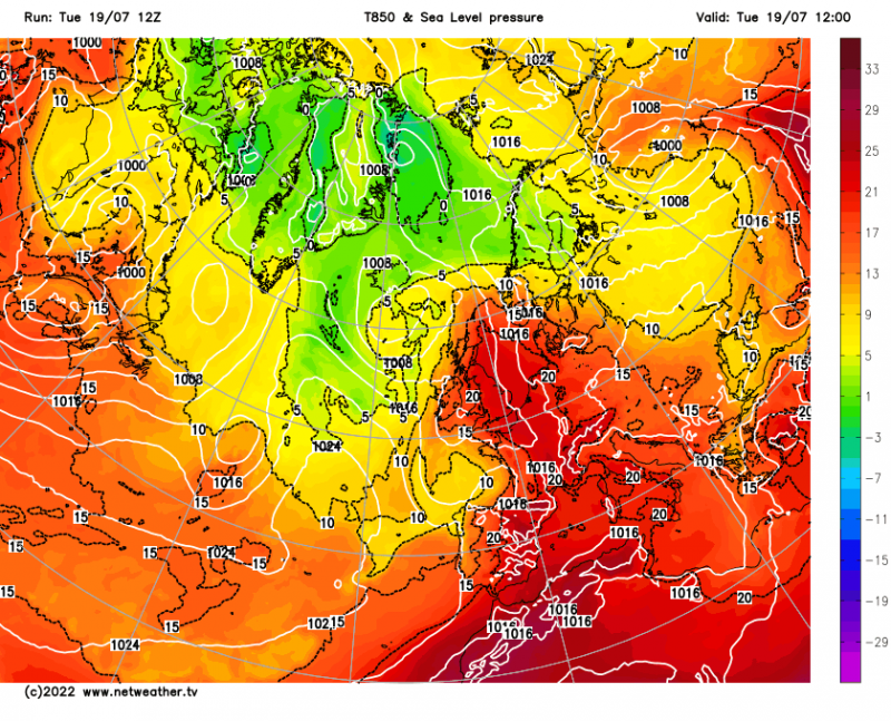
There were various reasons why the recent hot weather didn't compare with what happened two years ago. During the last few days, the air masses were only coming in from southern and central Europe, e.g. south-eastern France and northern Italy, so we did not pick up any intense heat from north Africa. Many areas of north-western Europe have had a wet summer so far, with some particularly heavy and frequent rain at times around the Alps, meaning that soils are not as dry as they were in July 2022. And in the July 2022 heatwave, a persistent cut-off low to the west of Spain and Portugal ensured that there was a persistent draw of hot air from north Africa into Spain and France, which then moved northwards to Britain when high pressure moved away to the east.
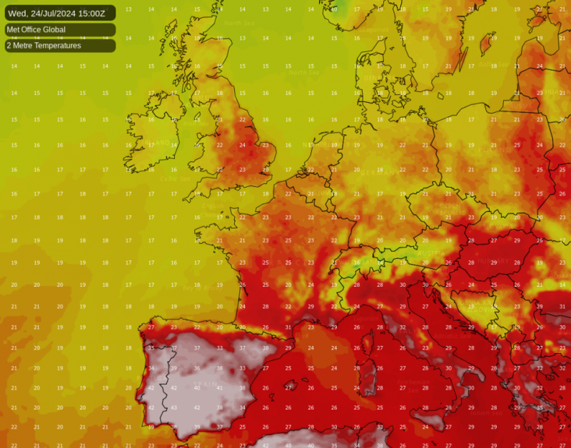
Instead, the extreme European heat has continued to be confined mainly to south-eastern Europe, where Greece and Croatia have been especially affected with temperatures widely into the low to mid-40s Celsius. Italy is also being strongly affected over the weekend, where the heat is expected to peak on Sunday. Spain and Portugal look set to be especially affected during the coming week, where temperatures have potential to peak at 45C or higher in the south, and look set to widely exceed 40C.
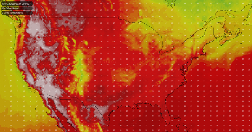
Further afield, the western USA continues to be affected by a persistent "heat dome" which is also spreading into south-western Canada at times. This looks set to shift eastwards from midweek next week, resulting in some relief for these western regions, but at the same time a plume of heat will head eastwards into south-eastern Canada and north-eastern North America.
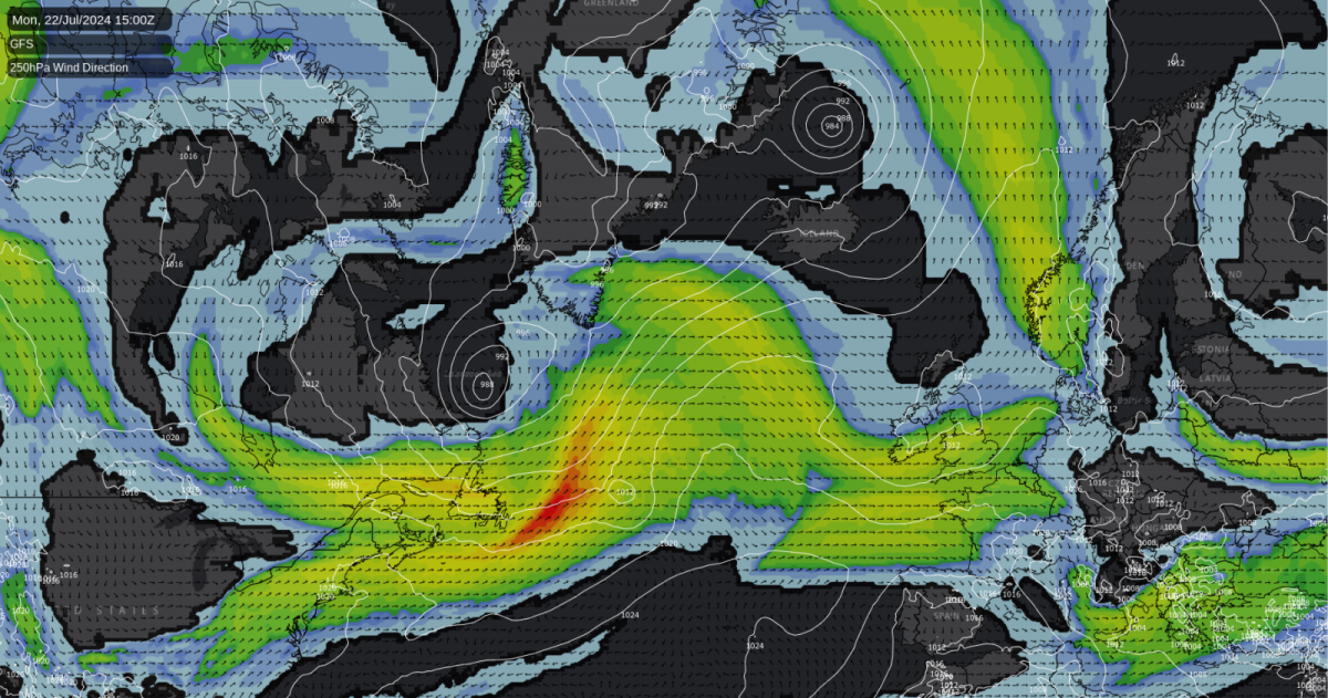
After the current brief hot spell, Britain's weather is set to return to being dominated by westerly winds, but it does not look likely to mark a return to the sort of weather that we had during the first half of July. The jet stream will generally be further north than we saw earlier in the summer, typically heading straight over the British Isles, rather than to the south. This means that we can expect a more normal mix of weather types, with some unsettled spells with westerly winds and low pressure systems tracking over northern Scotland or to the north of Scotland, but also some ridges of high pressure breaking off from the main Azores High and heading eastwards across the British Isles, especially affecting the south.
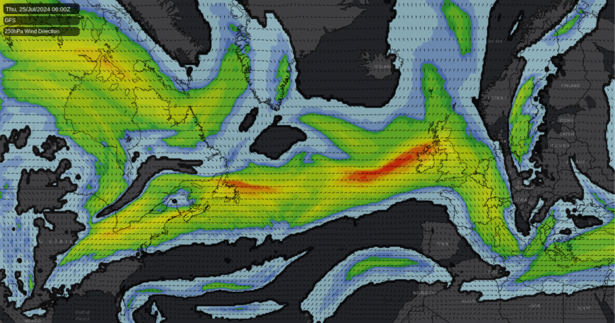
Temperatures and sunshine amounts look set to be near normal for most of the country for the rest of July, unlike during the first half of July, which was unusually cool and cloudy, especially for recent years. Rainfall also looks set to be below normal for most during the remainder of July, despite quite a changeable weather regime. The relative lack of thundery activity during the summer so far looks set to continue to be a theme during the rest of July.
There are indications that there may be another fine spell centred around 30 July, with a more substantial ridge of high pressure and perhaps a short-lived anticyclone moving eastwards across Britain and affecting most of the country. However, like the one that is breaking down today, it looks likely to be short-lived, with longer-range model guidance suggesting that we may see a return to generally unsettled weather dominated by low pressure for a time in early August.
The first half of July was exceptionally cloudy for most of the UK, as well as wet for many regions, especially the south and east. It was about 2C cooler than the old 1961-1990 average, meaning that it was exceptionally cool by recent standards. It looks likely that a more normal second half of July will not be sufficient to offset the first half, so July as a whole looks somewhat likely to come out cooler, wetter and cloudier than average, especially by recent standards, but not as exceptionally so as may have looked likely earlier in the month.
Loading recent activity...