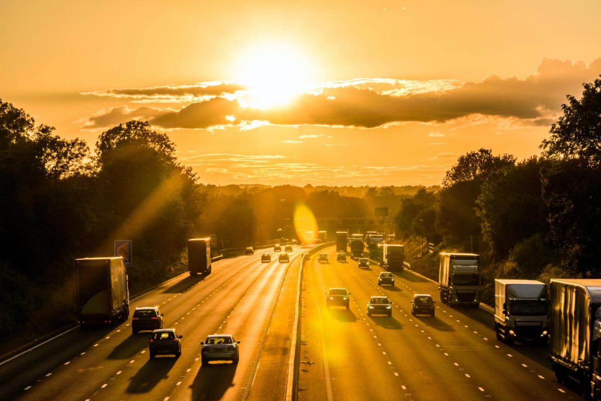
We have a burst of heat coming up for the end of this week. It will be good to have a break from the July rain but as temperatures climb into the high 20sC in southeastern Britain there will be a variety of reactions. If your summer holidays have begun then any sunny, warm weather will be very welcome. For those still at work on Friday the travel could be grim and sweaty. It will also be very warm for anyone heading off at the end of school term; by car, train or ferry, even into the evening.
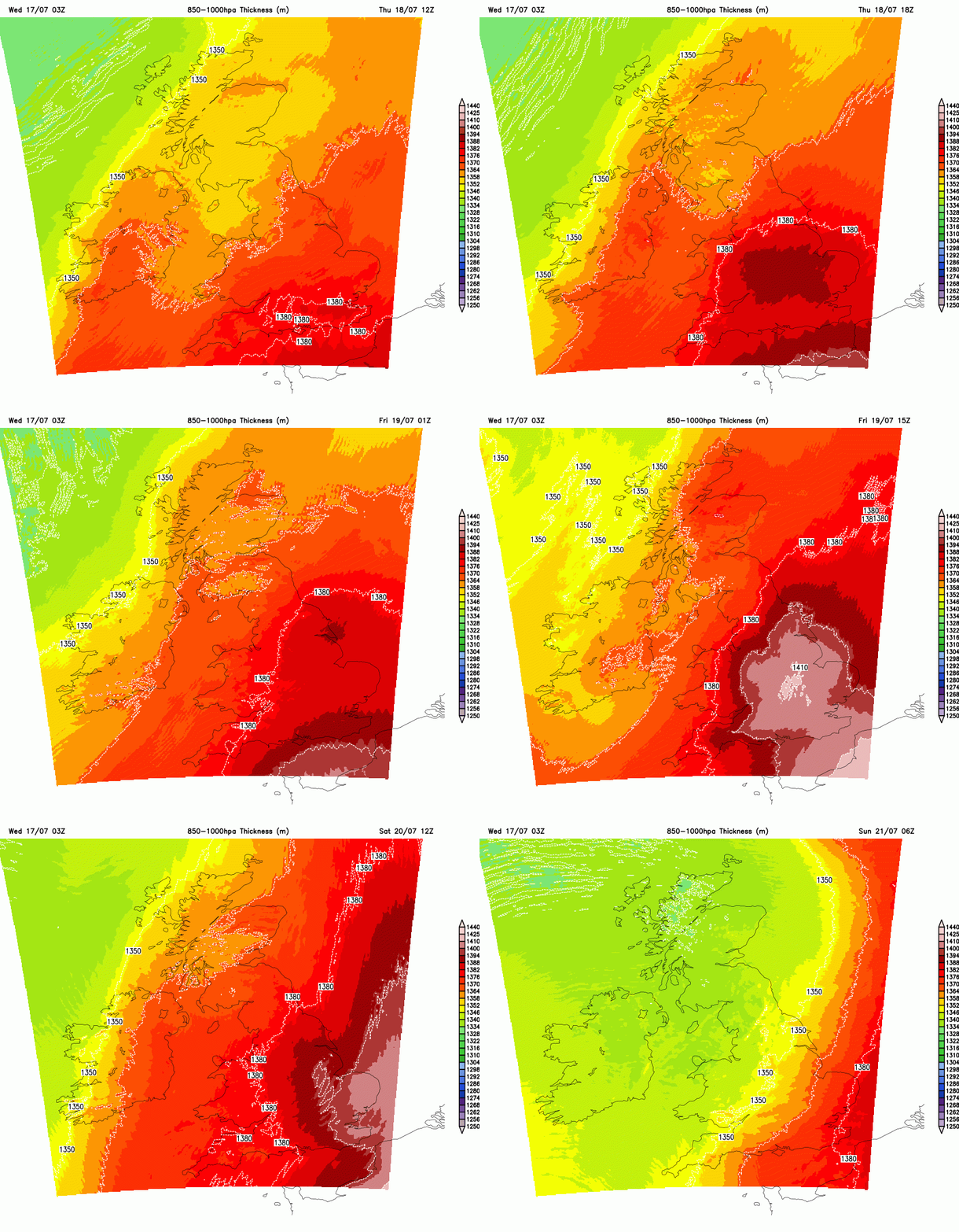
The peak of this heat pulse will be on Friday. The hottest part of the day is usually mid to late afternoon as the incoming solar radiation heats the ground, buildings and, in a run of warm days, adds to the existing heat in our cities. It will still be warm in the evening for England and inland Wales and if you are planning an early getaway, the warmth overnight could interrupt sleep patterns.
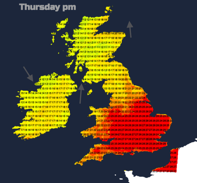
If you are happy in the warmer weather Thursday looks very warm for much of southern Britain with temperatures of 23 to 28C. It will be dry, and sunny with hardly any breeze. Eastern Scotland, northern England and north Wales will have more cloud, the odd shower with bright spells and temperatures of 17 to 22C.
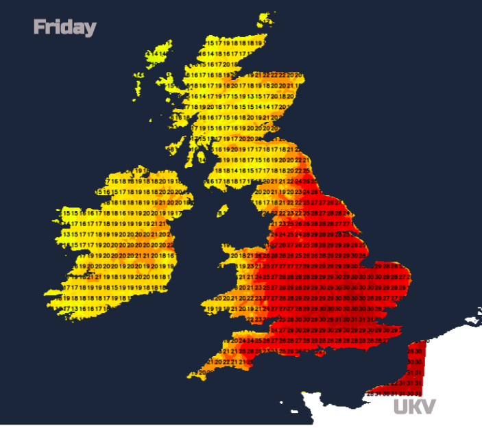
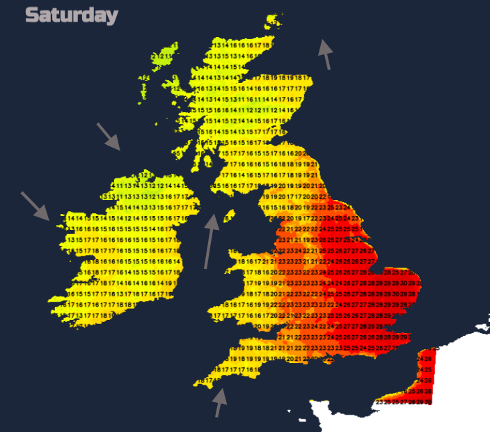
Friday will be hotter as heat from France surges northwards. It will be warm across the UK, 18 to 22 for N.Ireland and Scotland well into their summer holidays. Across England and Wales 20 to 26C with inland England into the high 20sC with Greater London possibly passing 30C. Friday evening looks fine and warm.
The weekend
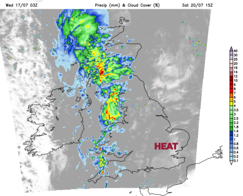
Changes are afoot on Saturday from the west but again it will be very warm for central/eastern and southeastern England. An Atlantic frontal system will bring cloud and rain in from the west. Northern Ireland, west coast Scotland and Pembrokeshire will have a wet Saturday morning with the possibility of heavy downpours reaching Cornwall and Devon before lunchtime. The band of rain will reach more of western Britain during the day with pulses of heavy rain to watch out for. There is some uncertainty about the timing of this wet weather as it reaches NW England, more of Wales but looks to pivot over mainland Scotland during Saturday afternoon. Grampian could stay dry til the evening when very heavy rain moves through. Northern Ireland will become drier and have a lovely evening with sunshine but will feel fresher in a northwesterly breeze.
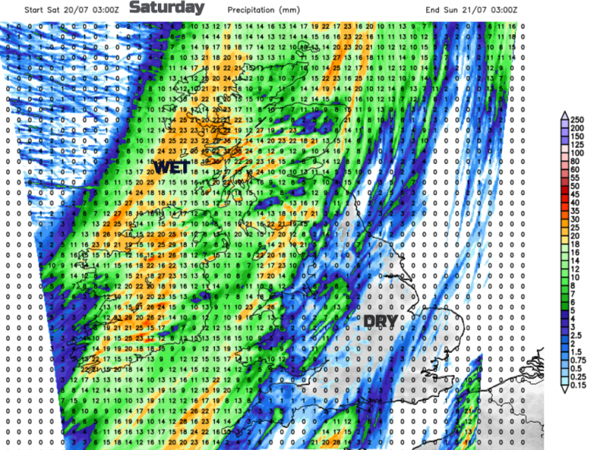
If you have outdoor plans on Saturday in Britain or are travelling do keep checking back with the forecast for the timing of this incoming rainband and on the day look at the radar. As this frontal band interacts with the very warm air over Britain there will be the risk of embedded thundery downpours but also isolated thunderstorms developing in-situ ahead of the main band. A weather app with its hourly symbols won’t be able to share this uncertainty.
Night time warmth
By night it will feel warm and close. It will be warm overnight for a good part of central/eastern and southern England on Thursday night. Friday night will be warm for much of central, southern and eastern England. Saturday evening looks warm in eastern Britain with another warm night for SE Britain as the heat fades away over the southern North Sea. A 'tropical night' is defined where the minimum daily temperature does not fall below 20°C. This looks possible, but perhaps not likely, later this week for London and the Home Counties.
Sunday
The last of the frontal cloud will be over SE England early on Sunday with just the odd shower. Kent and around the Thames estuary could still feel very warm but there will be a fresher feel for most of the UK in a NW breeze. It will be fine and sunny and will feel warm in the sunshine. Not like Friday but London could reach 25C, Edinburgh 19C, Cardiff 21C but more cloud for Northern Ireland with Belfast at 18C. The July sunshine will be strong with high UV and still moderate to high pollen levels.
Summary
Friday looks dry and sunny for most, with the peak of the heat possibly up to 30 or 31C. Saturday sees a band of rain from the west with the risk of heavy downpours but more heat and fine weather for much of Britain ahead of that. Sunday looks fine again, feeling fresher but still with strong sunshine.
There is a yellow Heat Health Alert for later this week. It isn’t for the general public but is an early warning for health and social care workers that upcoming high temperatures could impact sections of the population in England.
The alerts cover East Midlands, East England, London and the South East from Thursday 18 July. They will be in place until Saturday 20 July. Expected hot weather may have minor impacts on the health and social care sector.
Heat can be an extra layer of stress on the body. Warm, sunny weather can induce a feeling of well-being and happiness but for others, such as the elderly and those with existing medical conditions, extra care and adaption is needed. For all, remember shades, water bottle and suncream for your travels, even a fan if you are braving the London underground.
Loading recent activity...