There is a rollercoaster of weather conditions on the way, with snow, strong winds, heavy rain, and even some spring warmth in the forecast. Storm Kathleen will be responsible for some of those and will arrive this weekend.
Met Eireann has named Storm Kathleen for this weekend. Very strong winds are due to move up across Ireland and ultimately through into western and northern parts of the UK from late Friday. That's not the only weather type to keep an eye on during the coming days, though. In fact, you can take your pick from heavy rain, snow, strong winds, and even temperatures climbing into the twenties Celcius for some.
As you'd probably expect, there are some weather warnings in place to cover at least some of the expected conditions. They start during the early hours Friday with a warning for snow across central and northern Scotland, along with heavy rain in southern Scotland. That's all thanks to a weather front moving northeast during the latter part of Thursday and overnight; it'll bring rain across England and Wales first, then as it heads into Scotland, the rain will turn quite readily to snow the further north it gets, particularly but not exclusively over the higher ground. It should then clear away on Friday morning, leaving some showers behind it.
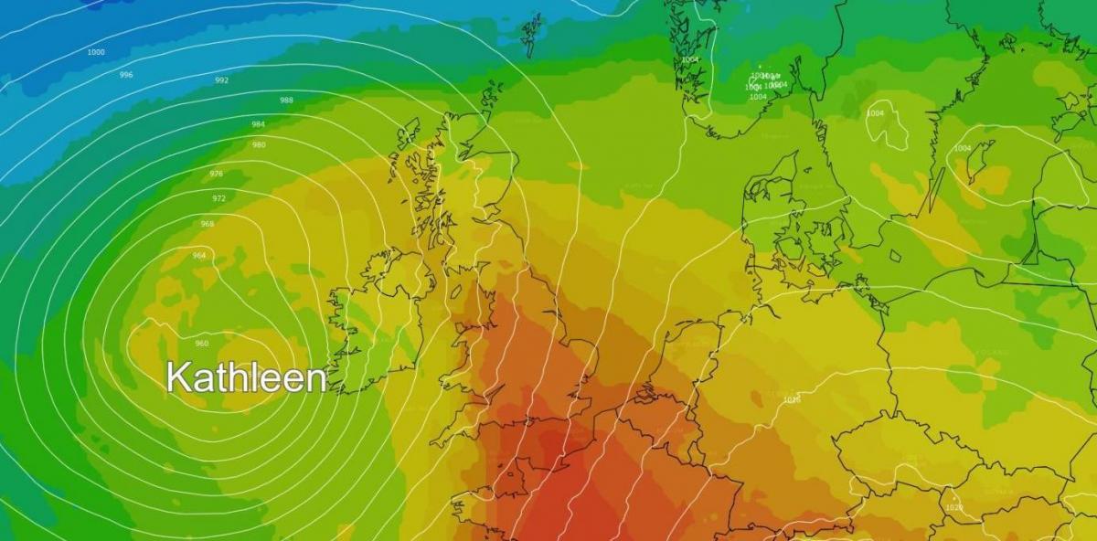
Then, into the weekend, the wind warnings come into play, up the western side of Britain and across Ireland (North and South), with an amber warning in force for western and southern parts of the Republic of Ireland. The winds will actually already be blustery across a good part of the UK and Ireland on Friday. But, it'll be overnight and into Saturday when they really pick up, bringing gusts potentially in excess of 80mph into exposed parts of western Ireland initially, before spreading gales or severe gales east and north.
The winds will stay strong in the west and especially the north of the UK through much of the remainder of the weekend as well, slowly becoming more limited to the far north, but perhaps taking until later on Monday to final clear away from Northern Scotland.
Another talking point over the weekend is also likely to be the warmth, particularly as it's going to be joined by such blustery winds. Temperatures on Saturday may well reach 20-21c or so, making it the first time this year that 20c could be breached. Eastern England will be in with a shot of seeing these sorts of temperatures, though. Further west, the mid-high teens will be the max. As shown on the loop below, though, the warmer air doesn't hang around long before being replaced by a cooler feed of Atlantic-sourced air from the west.
Aside from the wind and warmth, there will be some rainfall around this weekend, but for a change it's not liable to be the main story, as it'll be a case of scattered, blustery showers - most frequent in the north and west, least frequent in the southeast where many may well get away with a dry weekend. Where you do catch the showers, though, some will be heavy.