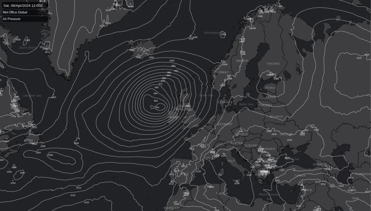
Following a soggy March, more rain and gales are on the way. Increasingly mild temperatures will offer some contrast, with highs potentially reaching 20c in southern and eastern regions this weekend. Severe gales are also on the cards this weekend with a deep low nearby.
You probably don't need telling it's been wet lately, and the stats for March back that up, with another wetter than average month for the vast majority of the UK. That same unsettled pattern isn't going away fast either, with low pressure well in control again this week, culminating this weekend with the potential for heavy rain and gales as a deep low comes our way.
Even today (Wednesday), low pressure is right over the country. Rain and showers will move northeast through the day with another band of wet weather following behind later. There'll be a brief lull in with some sunny spells coming through in southern and central England this pm, and western Scotland should see a lot of drier weather, so it's not all doom and gloom, but it's yet another day where the wetter parts well outweigh the drier ones.
Thursday will be quieter in the main, with a day of sunnier breaks and a scattering of sharp showers, but with the next low not far off, we'll need to watch towards the southwest as fronts approach. Those fronts will be in play on Friday, moving northeast and bringing showers or longer spells of rain. The weekend should see the persistent rain begin to clear through, followed by sunny spells and blustery, sometimes heavy showers. The video below shows the rain accumulating from today through to the end of the weekend - wet (yet again) sums it up.
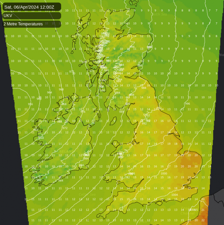
Temperature-wise, it's already reasonably mild across the southern half of the country this week, but Scotland is on the colder side, with some more snow likely up over the higher ground in the north during the coming days. But, with low pressure out to the west as we end the week and head into the weekend, that milder air is going to become widespread and, in fact, milder still. So much so that 20c isn't out of the question during the sunnier spells in southern and eastern regions this weekend.
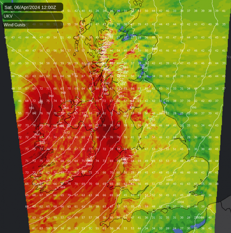
Of course, with a deep low nearby, it's not all Spring warmth, sunshine and flowers - the wind gust map at the same time paints a contrasting picture, with severe gales likely in the west and north.
So, there is plenty to keep an eye on during the coming days. Low pressure will still be the main driver of our weather into next week as well. Perhaps from the middle part of the week, there could be more in the way of drier, brighter interludes as higher pressure makes an odd (brief) appearance, but the direction of travel is likely to remain the same.