The next few days will bring rain, hefty showers and gusty winds with a cool feel in the air. Heading into the long weekend, things improve a bit but it's not completely dry.
It's another week with low pressure over the UK bringing bands of heavy rain, blustery winds, brief brighter skies then hefty showers. There is a lot of damp air wrapped around the low and where skies stay cloudy it will feel cool by day, especially in the breeze. Where any sheltered sunny breaks do appear, it will feel pleasant. By night, in that cooler air, there could be a touch of frost as the winds fall light. Easter Sunday should be milder but nothing to get too excited about.
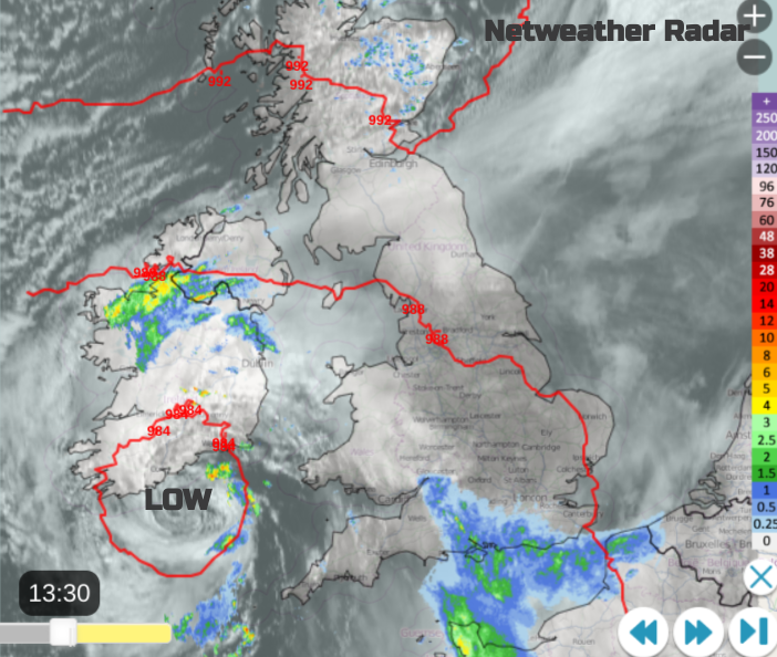
One frontal band gathers itself later today and overnight with more rain for southern England, from London to Liverpool and across to Northern Ireland. Northern Scotland will be cold in a brisk easterly wind but the cloud increases as the frontal rain edges northwards. Heavy showers will appear from the southwest as an occlusion heads in.
 Wednesday
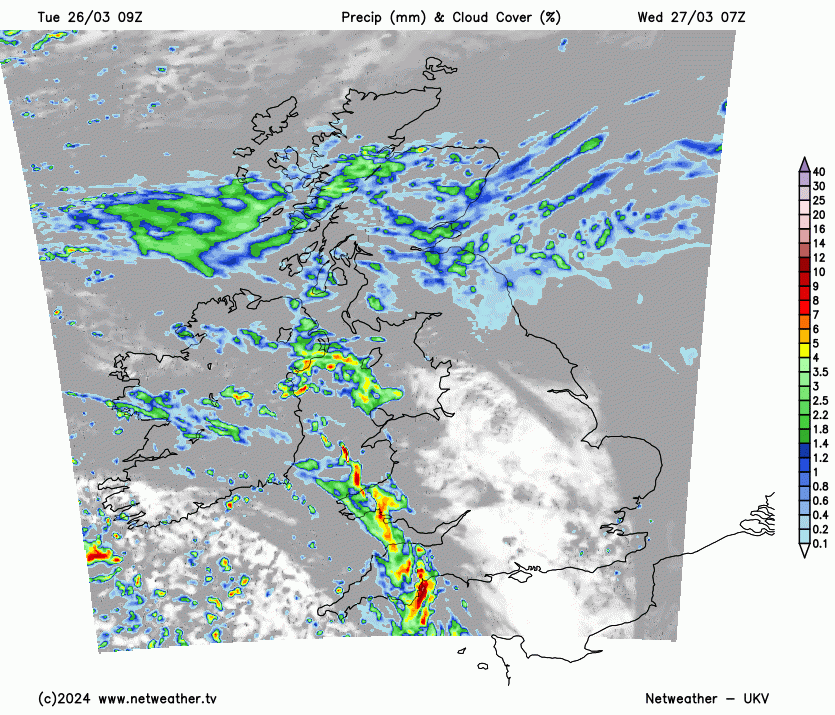
There will be some lively weather around for the start of Wednesday in SW Britain. The band of heavy rain with squally winds followed by sharp showers and sunny spells. The lively band will move across the West Country and Wales, heading northeastwards through the morning with tricky driving conditions. It also looks wet for County Antrim and Down. Ahead of this, it will be bright even sunny. Scotland keeps the east/northeasterly flow with the frontal rain from Tuesday. Over the hills and mountains, there will be snow on a cold feeling day here. Things change through the day as the weather rotates north or northeastwards. Brightening up for southern Scotland, as a scattering of showers appears for England and Wales. By the end of the day, most of the UK will be in brighter conditions but with a good scattering of showers, fewer for eastern Britain but some heavy even thundery downpours with hail possible, more likely in the southwest by teatime. In the evening there could be wintry ones over the high ground of Wales and NW England, then for central southern Scotland in the small hours of Thursday.
Thursday
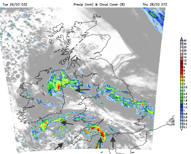
There has been a lot of rain for England this winter and another pulse of heavy rain is forecast to push up from France on Wednesday night. The current forecast brings the rain northwards, clipping SE Wales with perhaps some wintriness over Exmoor. There is the risk of strong gusty winds swirling around this rain as another band moves into Cornwall from the southwest ready for Thursday morning. That brings another lively start to Devon, as the rain from France reaches northern England with showery outbreaks trailing back to the Home Counties. There looks to be strong winds through the CHannel and heading to Pembrokeshire. Brisk SW winds will pick up through the day for southern counties of England as the colder east wind returns for Scotland. Again there will be showers, some heavy downpours and brighter spells.
Good Friday will see more bright or sunny spells with some showers and a similar story for Saturday. It’s a hit-and-miss picture although with more chance of dry and bright times. You'll just have to watch out for the downpours as well. The heaviest, lively showers of midweek will be easing off and temperatures will rise a bit too.