Don't believe everything you read or hear. It will turn colder for the end of this week but it's showery so a look at where might see a bit of snow.
Steady yourself folks The Sun Mon 18th March headline UK weather states: "Exact location snow set to fall. " Before you pack a shovel in the boot of your car and check that your mobile phone is fully charged, disappointingly the article text only stretches to
“the white stuff could hit early on Wednesday morning in the Scottish Highlands near Fort William. Snow may arrive at around 3.15am on March 20, say forecasters. It could last until 4.15am, according to weather predictions."
This week there has been a swarm of bizarre 'weather forecast’ stories, filling the vacuum of other likely non-event news. The promise of rain storms with flooding chaos, widespread snow and the exact date when a 30C Spanish heatwave will hit the UK. The exact date no less. It is exhausting. Here we will just look at the likelihood of snow for the UK.
This week there is mild air from the southwest. Temperatures have already reached into the teens with Devon and south Wales seeing over 16C and another warm pulse forecast for Thursday. However, there will be cool air in the north and northwest by midweek. The only hints of sleet and snow in that cool air will be around dawn, over the tops of the Scottish mountains. It does turn colder for the weekend.
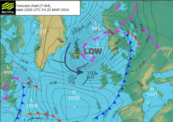
Things change on Friday with a plunge of Arctic air, but don’t be expecting a UK-wide covering of snow. A deepening area of low pressure will move across Iceland on Thursday night, throwing its cold front towards the UK. As that band of rain reaches right down to London by Friday morning, the colder air from the Arctic arrives. The low centre is forecast to move southwards, down to the North Sea with a rash of showers whirling around it.
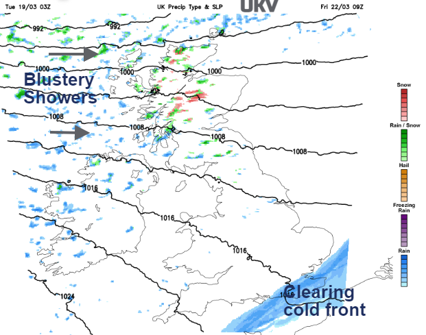
The first of those showers arrive in the early hours of Friday, mostly as rain but including hail and wet snow over the Scottish mountains. This feed of showers will spread over Northern Ireland, and Scotland into Cumbria, the Pennines and Gwynedd by Friday evening as the wind begins to veer. The westerly wind of Friday will turn to a colder northwesterly by Saturday as the showers continue. There will be a mix of rain, sleet, hail and snow blown in on chilly winds for the start of the weekend.
Areas that could see a slight temporary covering would be; Snowdonia and the Brecon Beacons, in exposure to the west or northwesterly wind. Northern Ireland could see some flurries on Friday night with perhaps an early dusting for the Sperrins. The brisk wind could push wintry showers towards the Peak District, the western side of the Pennines, the Yorkshire Dales and Cumbrian Fells. The same for the Southern Uplands with a bit of snow for the high ground of Dumfries & Galloway inland.
As the low centre begins to move over the North Sea the flow of the showers will change. The fresh and gusty westerly wind bringing showers into western Scotland through Friday will veer to a northerly and catch other parts. The central and Northwest Highlands will catch most of the showers, including Fort William and Lochaber into Saturday. Here the snow could linger at the weekend but it is only likely for mountain tops.
Through Saturday night the showers transfer across to the Cairngorms with a flow from the north. There will be snow over the tops, then sleet and rain down to lower levels. That dig of northerly air could bring snow showers to other parts of the Pennines, even the Cheviots and North Yorkshire Moors. Whether any of the wintry showers work their way down to Norfolk is still uncertain. The focus of any snow showers remains across the far north of Scotland on Sunday.
There is a signal throughout next week that northern parts of the UK could see more rain, sleet and a bit of mountain snow. Perhaps from frontal bands coming up against the cold air, even the possibility of more significant snowfall for Scotland. The wintry weather could affect Northern Ireland and the high ground of northern England and north Wales. It looks too mild next week for much of England and Wales.
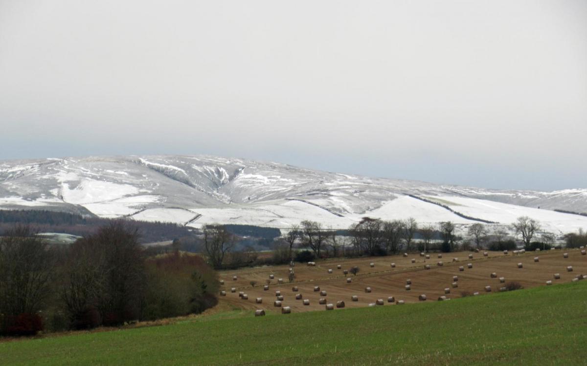
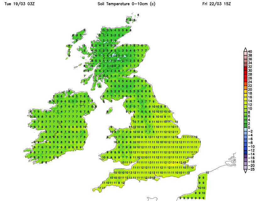 The ground has been warming up in the mild southwesterly flow and the spring sunshine by day. So even if there was a wintry flurry, it would struggle to settle in the south, especially with all the standing water.
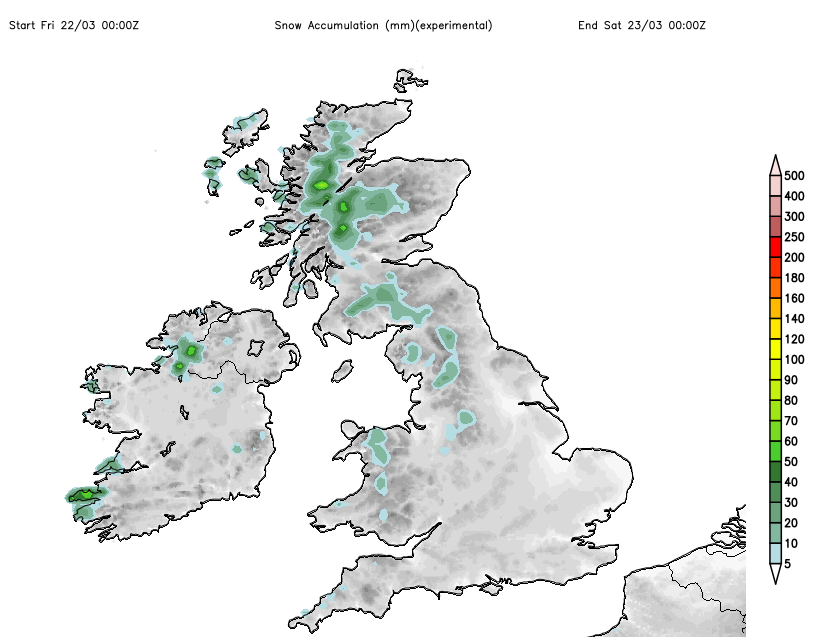
Some of the charts that the tabloids have been highlighting to suggest widespread snow cover need interpreting. The weather models work on a grid system. The grid squares vary in size depending on which model and geographical focus, but they have also improved over time.
“The deterministic UK forecast uses a variable resolution model which has a high-resolution inner domain (1.5 km grid boxes) over the UK and Republic of Ireland, surrounded by a coarser grid (4 km) outer domain with a variable resolution transition zone in between. “ Met Office
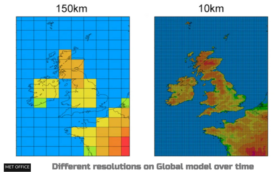
The MOGREPS is 2.2km and the Global model 10-20km as the fine detailed UKV resolution needs extra processing power. It is focused on the land areas and gives a better picture. The larger coarse grid gives an indication but not the detail, it needs interpreting and doesn’t mean that vast areas will be covered in snow.
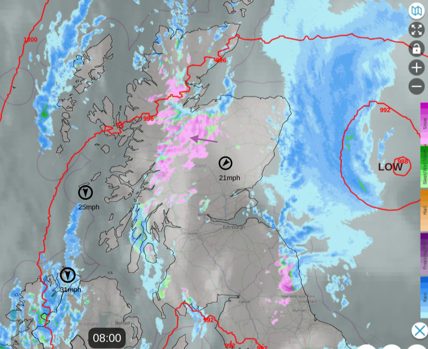 It’s worth remembering what precipitation can look like on the Radar with gaps and heavy showers. That can be what the model is trying to show. The UKV does this well but other models will appear less delicate. If you do see headline images with a covering of deep snow, do know that it isn’t looking likely this week.