Today and the weekend will see showers or longer spells of rain affecting many areas at times, but there will be some drier and brighter spells too. Despite a cold night tonight, it will be generally rather mild over the weekend. Staying changeable next week too, though not as wet.
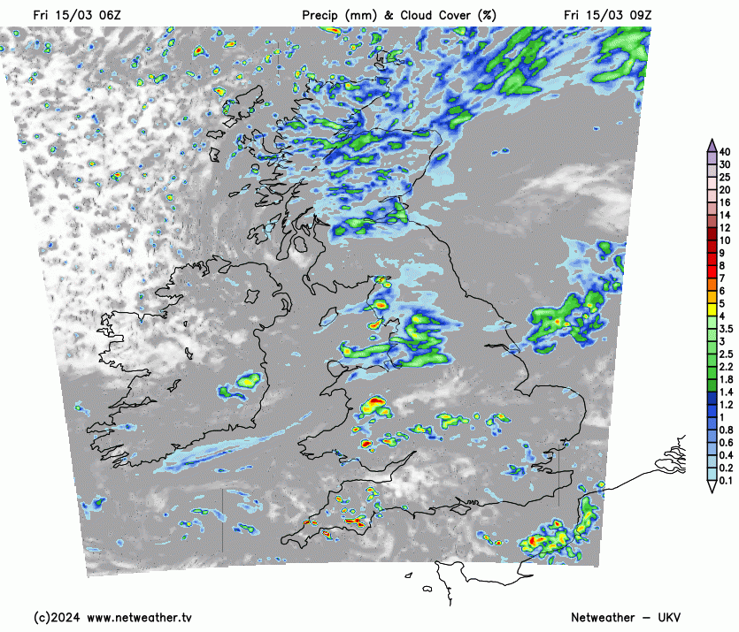
Thursday saw some blue skies and warm spring sunshine across southern areas before showers moved in during the afternoon, the temperature reached 18C at St James Park in central London. It’s not looking quite as warm today, with a brisk southwesterly breeze across the south blowing in showers, with more limited sunshine on offer. Generally, the story for much of the UK today will be sunny spells and scattered showers.
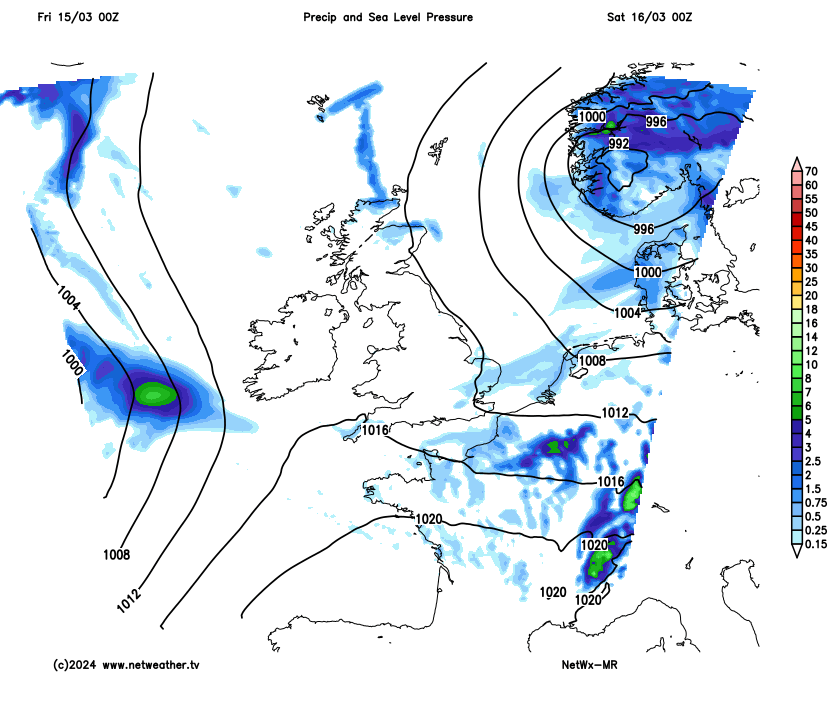
The weekend is looking mixed weather-wise, Saturday mostly dry and sunny in the morning after a cold start, but cloud and rain moves in across western areas in the afternoon, before reaching all parts in the evening. Rain clearing the east first thing Sunday, followed by sunshine and showers for most.
For now, generally cloudy this morning, showers for the word go and continuing through the morning across south Wales, the Midlands and southern England, also showers over northern England and more general rain and hill snow pushing south over Scotland. A mild start across England and Wales, colder across Scotland. Showers becoming more widespread and heavier from late morning across the south but with some sunny spells developing in between the showers, hail and the odd rumble of thunder possible.
Rain across Scotland pushing south across NE England, followed by showers across eastern half of Scotland, wintry over high ground. Best chance of staying dry and sunny across the far west. Temperatures reaching 13-15C across southern, central and eastern areas, 11-13C for N. Ireland and northern England, 7-10C across Scotland.
Showers fade, skies clear and winds fall light tonight across most areas, with the flow from the north it will turn cold overnight, with temperatures falling close to or below freezing across northern areas, leading to a frost.
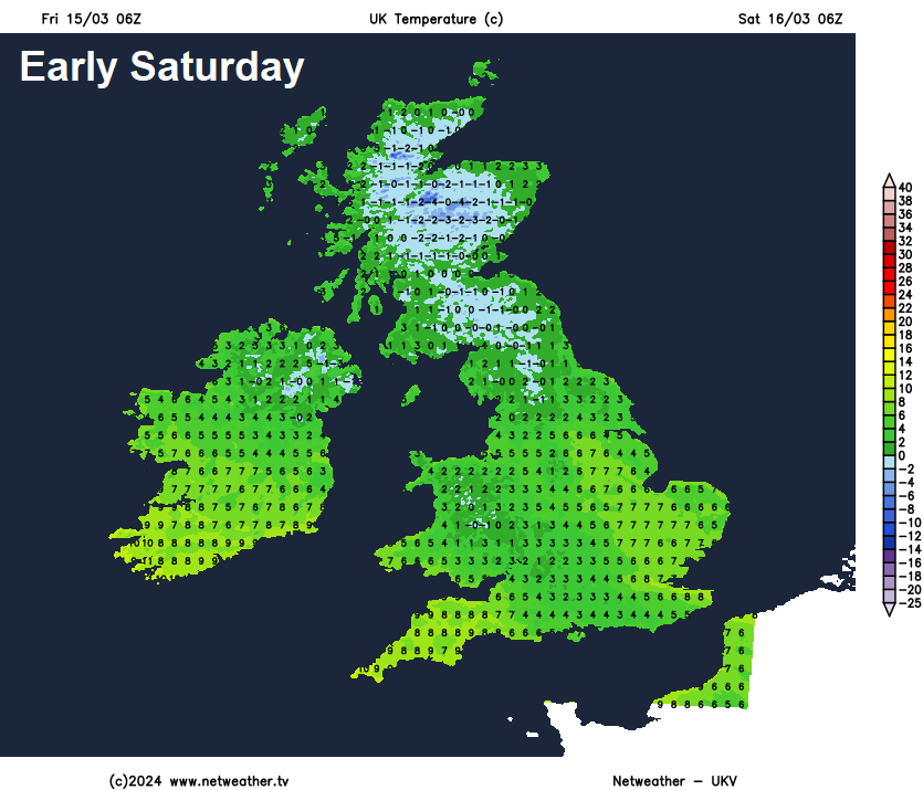
So a cold and sunny start to Saturday, with a risk of icy patches on wet surfaces in the north. The morning sunshine becoming increasingly confined to eastern areas through the afternoon, as cloud and outbreaks of rain spread in off the Atlantic across western areas. Rain reaching eastern areas through the evening. Another mild day, temperatures reaching 8-13C.
Cloudy with rain in the east to start Sunday, this should clear through the morning, last to clear SE England and East Anglia. Sunny spells and scattered showers following across most areas. Very mild everywhere, temperatures reaching 13-16C.
Next week isn’t looking as wet on the models as it was yesterday morning, with southern, central and eastern areas looking drier now next week. Monday is looking mostly dry and bright or sunny towards the east, showers to start in the west but these easing to a drier and sunnier afternoon. An area of low pressure moving northeast close to the northwest on Tuesday will bring a spell of showers or a longer spell of rain east across most areas through the day, but some sunny spells too. A ridge of high pressure building in mid-week could bring a mostly dry and bright Wednesday before rain returns from the west later in the day or on Thursday, though wettest across the north and west. Friday may be blustery with sunshine and showers. It will remain very mild through much of next week though, with winds from southwest, temperatures reaching the mid-teens in the south.