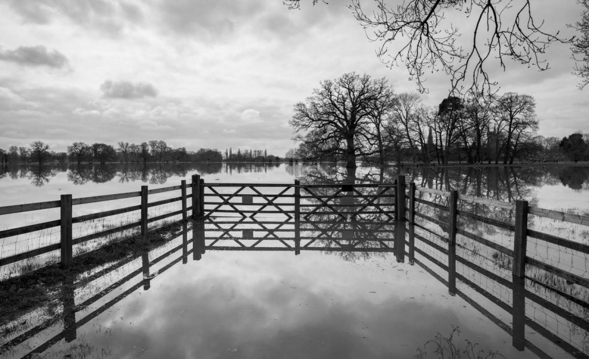
It's been a very wet start to March in southern Britain, following the 4th wettest February and the wettest 12 months since records began in 1871. Further rain is likely at times over the next 7 days, but there are signs that it may dry out and settle down after that.
It’s been rather wet so far this month across southern parts of Britain, parts of SE England have already seen their average March rainfall. Heathrow Airport in London has measured 125.7% of the total March average already. The site has seen 52mm so far this month, the average rainfall for the whole of March is 41mm.
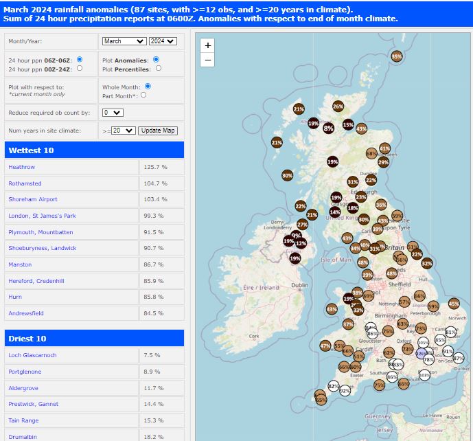
Data courtesy of Starling Roost Weather
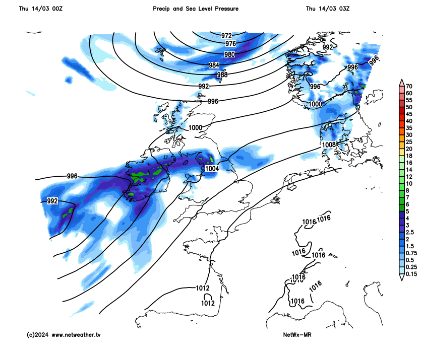
Conversely, it has been drier than average across the northern half of Britain. Parts of the western Scottish Highlands and Northern Ireland have seen less than 10% of the March average. As a result, wildfire warnings were issued recently for parts of western Scotland, though rain over the next few days will see the risk vanish.
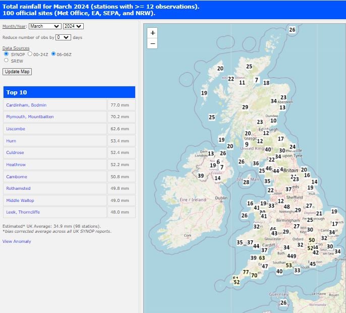
Data courtesy of Starling Roost Weather
The wet weather in southern Britain so far this month follows an exceptionally wet February across England, the 4th wettest February since 1871 with 225% of average rainfall. This follows the wettest 12 months in England since records began in 1871.
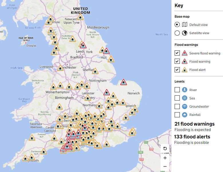
With the ground saturated, there are, as of 12 noon on Thursday, 21 flood warnings in force across southern England, most of them for groundwater flooding in Wiltshire and Dorset. There are also over 130 flood alerts, some for groundwater, some for rivers and a few of these area for coastal flooding from spring tides at the moment.
So, can we expect much more rain over the coming days? Unfortunately, the weather looks to remain unsettled with areas of low pressure moving west to east close to or over the British Isles over next 7 days at least.
Most of the rain, over the next few days, looks to fall over more northern and western parts of the country, with southern England that has seen the wettest start to March not as wet as recently, but still prone to showers, some of which could be heavy. A wet story for Scotland on Thursday and Friday, with more persistent rain here at times, turning to snow over the tops of the Highlands on Friday as colder air filters in behind low pressure clearing east. More showery further south across England and Wales both days, some showers heavy and perhaps thundery. It will be very mild though south of Scotland, temperatures in any sunshine perhaps reaching 16-17C in the south.
Rainfall accumulation over the next 7 days: north and west wettest initially, but southern areas wet at times too from the weekend.
A brief ridge of high pressure will bring drier and sunnier start to Saturday, however, rain looks to move into western areas in the afternoon before spreading east across all parts during the evening and overnight. Rain clearing the east Sunday morning, followed by sunshine and showers. Still pretty mild over the weekend, especially towards eastern areas – where temperatures look to reach the mid-teens.
Staying unsettled over the next 7 days, with more rain for many
Low pressure looks to remain in control through early next week too. Two pronged attacks by lows moving off the Atlantic early next week, with a large an quite deep low moving northeast close to the northwest of Britain, bringing sometimes wet and windy conditions to the north and west Monday and Tuesday. While a secondary low closer to the jet stream threatens to bring a spell of heavy rain to southern and eastern areas of England on Monday morning with another spell of rain possible pushing north across southern England and south Wales Tuesday night, but less certainty here by then. However, we may see high pressure build in from the southwest through the second half of next week, but some uncertainty on timing and how far north it will build and bring increasingly drier weather. Unsettled and windy conditions may hang on across Scotland to the end of the week, while England and Wales turning drier and sunnier.
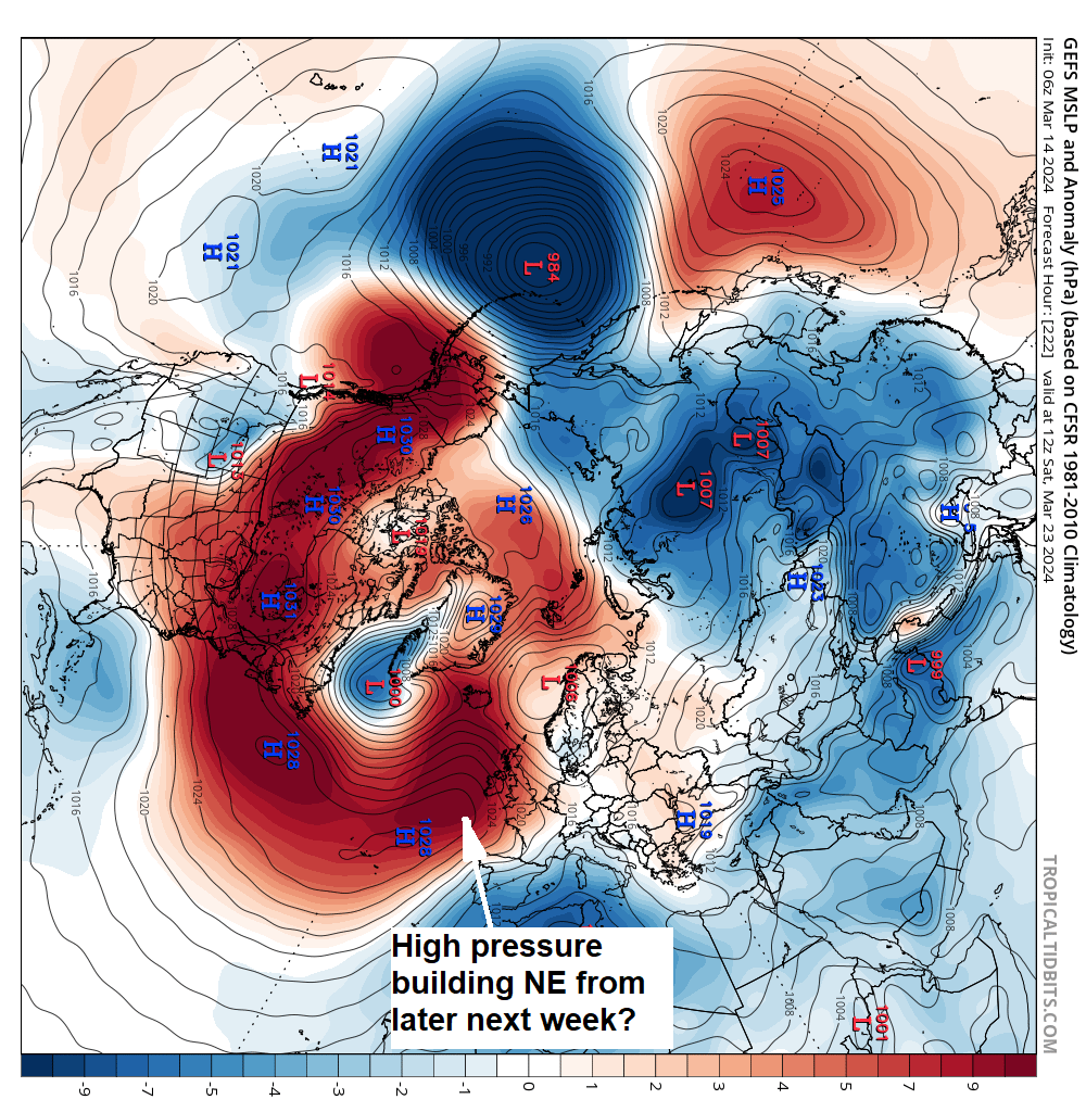
But more rain to come at times for another 6-7 days at least, before perhaps the opportunity of drier and more settled conditions building in by the weekend of 23rd/24th.