A mobile week with bands of rain squeezing by. A change to a milder southerly flow will lift the UK temperatures for mid-March, warmer by Thursday.
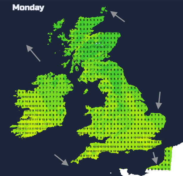
The damp easterly flow off the North Sea resulted in a nippy weekend for most of the UK. The highest temperatures only just crept into double figures, with 11.5C on Sunday in Gosport. Temperatures by night had dipped below freezing away from the brisk east wind but a shift is signalled this week. UK temperatures could reach 19 or 20C by Thursday in a warmer southerly flow. There will be rain, particularly in Wales, NW England, SW Scotland and around the Irish Sea. The frontal band almost gets stuck in the middle of the week. Other areas will see a mostly dry week, for the rest of England and northeast Scotland. There looks to be another air mass shift at the weekend.
High pressure builds over Spain early this week gradually through the Mediterranean steadying the weather for southern Europe. Low pressures and frontal bands track north of this, across northwestern Europe and Scandinavia. On Monday, the easterly loses its hold and the UK falls under the slack area of a Col. One small low pressure nips in from the Atlantic and across southern Britain on Tuesday. Another Atlantic low will deepen as it moves to the northwest of the UK bringing windy weather for the middle of the week and rain in the north. The trailing front from this low could be problematic. Some western areas could see heavy and persistent rain with travel disruption possible and localised flooding.
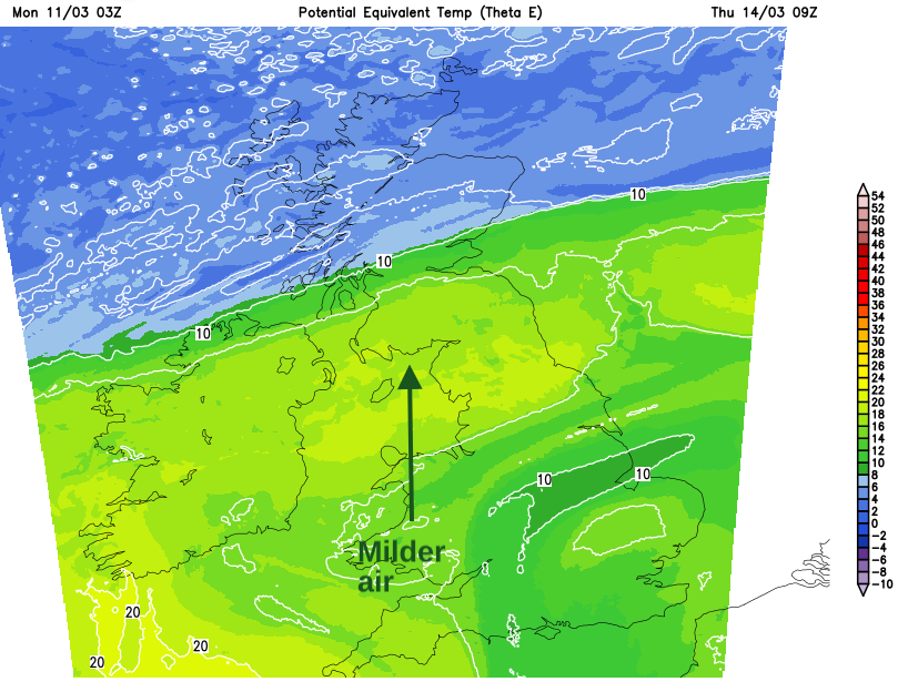
To the south of this boundary will be the milder air, pulled up to England and Wales by Wednesday night and through all of the UK on Thursday. The setup is so mobile that soon a cold front will pass through and the southerly flow will be cut off. For the start of the weekend, there looks to be a brief, showery northwesterly before more Atlantic rain arrives on Saturday night.
Much of the UK will be under the grey cloak of cloud off the North Sea with a cold damp feeling in the air. Western counties of Britain should see bright even occasional sunny breaks with a few appearing to the lee of the Pennines inland. An occluded front will edge over Northern Ireland to Western Scotland today bringing outbreaks of rain. Overall it will be a grey day but with the cloud lifting and brightest in the west.
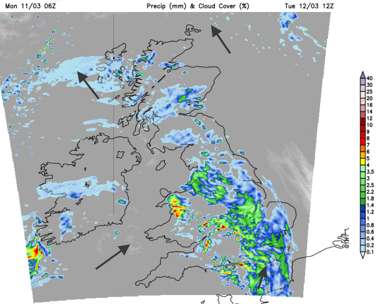
The rain from the occlusion in the far northwest will drift up over the Northern Isles tonight. Rain will move from Ireland across the Irish Sea, then to Wales during Monday night. Most of BRitan will be cloudy and murky but there could be the odd clear spell allowing temperatures dipping down to zero.

As eastern England starts Tuesday with light winds, a fair amount of cloud and bright spells, further west it will be wet and windy. The main frontal rain should soon clear Northern Ireland but it looks very wet for Wales on Tuesday morning. There will be heavy downpours across the West Country and southern Wales, persistent rain for North Wales into NW England and frontal bands extending over the Midlands and Peak District eastwards.
The south to southwesterly wind will pick up with high lee gusts for the Scottish mountains. Temperatures will be higher than on Monday with the southerly flow around 9 to 14C. They will continue to increase on Wednesday and Thursday but it won’t feel as mild if you are under the rainband.