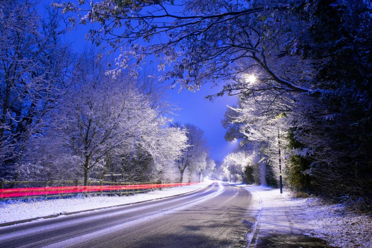
Northern Scotland has seen a week of snow showers, disruption and icy conditions. Other parts of the UK have stayed dry, cold and sunny, perhaps with the occasional flurry and temporary covering of white. There has been frost where conditions are calm, and plenty of frozen puddles but in the north wind straight from the Arctic, it felt raw on Monday. No one will miss that cruel wind.
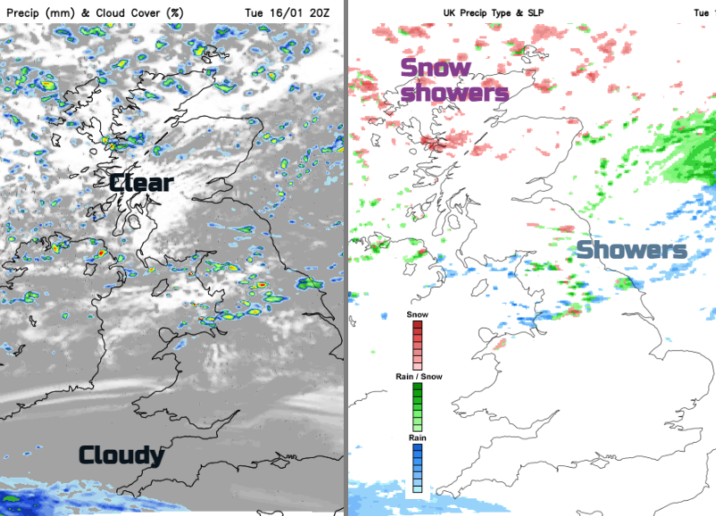
A little low pressure ran in from the northwest early this morning. It was a bit further south than the UKV had modelled and brought early sleet and snow to Northern Ireland. It then fed across the Irish Sea, clipping the far southwest of Scotland and there was coastal rain for NW ENlgnad with sleet and snow inland. That feed, west to east, continued through lunchtime with rain showers over Northern Ireland and a cold miserable picture for Morecambe Bay, the Solway Firth and the Isle of Man. For inland Cumbria and Lancashire, the Yorkshire Dales and the Pennines, there has been snow today in this interruption to the northerly flow.
For the rest of Tuesday, it leaves a messy picture over northern Britain with a mix of sleet, rain and snow edging east or southeast. The feed of snow showers in the far north just keeps on coming and there is a larger area of snow over the northeastern half of mainland Scotland out to the North Sea. The main areas of precipitation managed to miss the Central Belt of Scotland today.
“Frequent heavy snow showers will continue to push inland, likely disrupting travel across the region.” MO
The widespread yellow ‘Snow and Ice’ warning from the Met Office merges at midnight into another similar one for Northern Ireland and a good part of Scotland. Central and southeastern Scotland has an Ice warning for Wednesday and northern England
“Ice will readily form on untreated surfaces this evening leading to hazardous conditions.”
Within these snow-warned areas, it is not a guarantee of snow, just that the "low likelihood" of snow would carry "a medium impact" if it did occur. Be prepared for cold wintery conditions especially if you have to travel midweek.
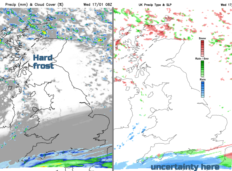
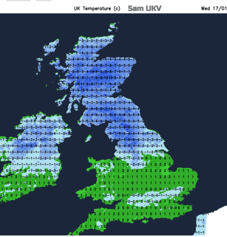
As the little low pressure and its frontal precipitation clears away to the southeast this evening, skies clear in the north. The feed of snow showers into northern and northwestern Scotland doesn’t give up but temperatures are going to plummet over northern Britain tonight. It will be colder than it has been so far this week for many with -14C appearing on the UKV charts. This means a hard frost, more ice and snow showers reaching the north coast of Northern Ireland too.
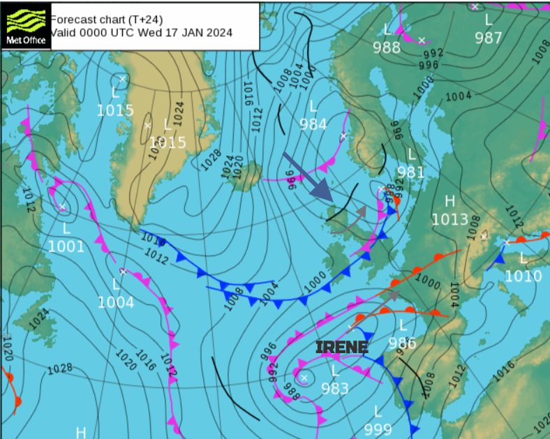
Further south it will be a quieter night with mostly light winds and enough high cloud to save the temperatures from plummeting again. This veil of high cloud links to a low pressure away to the southwest which has been named depression ‘Irene’ by Meteo France. It has already brought strong winds and rain to Spain and Portugal but it was named for the impactful and potentially disruptive snow and freezing rain forecast for France midweek. Northern France has seen months of wet weather with ongoing flooding similar to parts of England. There are warnings for flooding in France but also heavy snowfall as the frontal bands from Irene slide eastwards.
There has been some excitement/concern about the frontal band's progress over the English Channel which might have brought snow to southern England. It looks like a wintry mix should reach southern Cornwall and the south coast of Devon by the small hours of Wednesday. This would bring snow to Dartmoor and potentially icy conditions for the morning commute on higher routes but there will be rain in the mix too.
This damp, wintry mix could still be brushing the coast of southwest England, also the Isle of Wight by morning. There is still uncertainty about how far north the precipitation will end up and if there will be much snow from it. The UKV seems more keen for tomorrow, which could see snow over the South Downs, High Weald and the Kent Downs by late morning. However, an earlier run kept the whole lot away over the English Channel away from southeast England.
For much of the UK, it will be a dry cold day with the northerly flow and a very cold day where snow is lying in the north. It will be back to the wishbone formation for the snow showers on Wednesday night and Thursday. More showers for northern Scotland and showers clipping western or eastern exposed areas in the northerly flow.
Loading recent activity...