A rather cold start to the new week, with raw easterly wind in the south blowing in some snow showers on Monday, bringing a slight covering perhaps in the southeast. The rest of the week will be mostly dry, less cold later in the week.
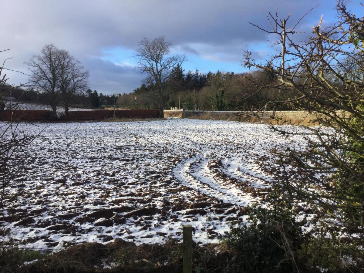
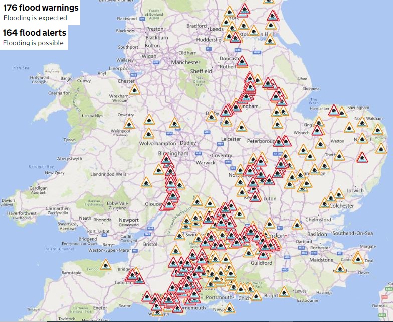
High pressure has built this weekend, finally bringing an end to the seemingly incessant rain of recent weeks. However, we are still seeing impacts from the recent heavy rainfall, with all that rain that fell during the week still working down through river systems and still threatening flooding, with rivers Thames and Severn bursting their banks in places, while there remains flooding risks from rivers across parts of the SE Midlands and eastern England. There are still 176 Flood Warnings and 164 Flood Alerts in force across England.
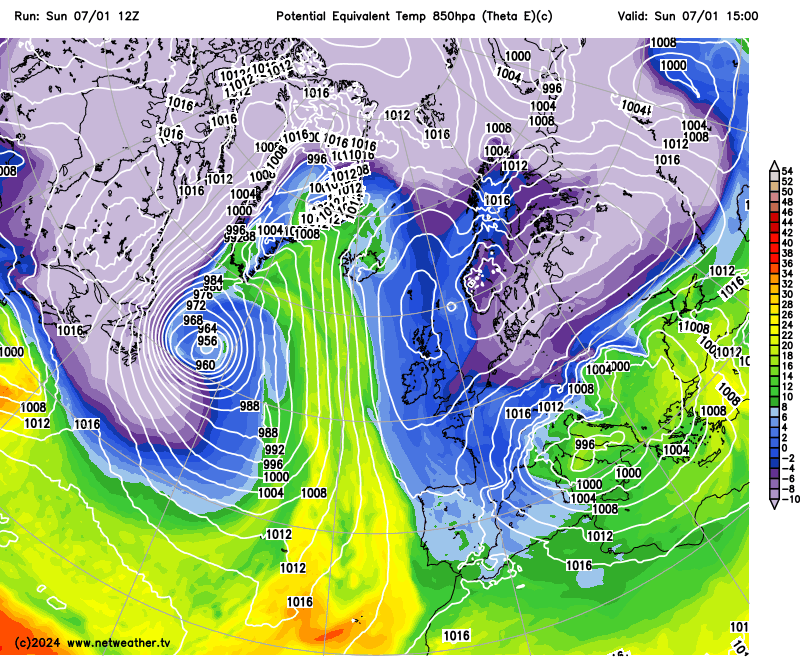
Fortunately, it looks to remain mostly dry through the coming week, with high pressure firmly in control centred over the North Sea early in the week. However, the high will pull in cold air from the east, and it will feel particularly raw across southern areas where the east-to-northeast wind will be strongest.
High pressure in control this week, but pulling in some bitterly cold air from the east across the south for a time early in the week
Sunday has been perhaps a chilly shock for some across England and Wales, especially in the south, in the brisk, raw northeasterly wind, after weeks of mild weather since the last cold snap that ended at the beginning of December. However, lighter winds across the northwest today have meant fog that developed overnight across eastern parts of N. Ireland, the Central Belt of Scotland, and parts of Cumbria have been stubborn to clear today, still lingering in places. Glasgow Airport and Belfast have been under freezing fog all day, with temperatures at or below freezing. Elsewhere has seen some pleasant winter sunshine, which makes a change after one of the dullest Decembers on record, though the easterly wind has brought more in the way of cloud from the North Sea this afternoon away from the far west.
Flights cancelled at Belfast Airport today because of freezing fog
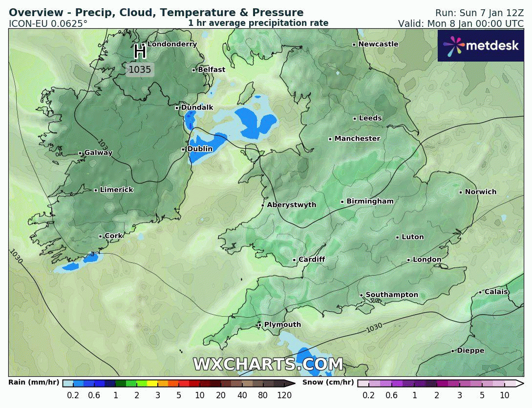
As we head into the new week, high pressure stays close to the north, continuing to feed in a cold and raw easterly or northeasterly wind across the south during the first half of the week, before less cold air arrives via the north, spilling down around the high as it drifts west in the second half of the week. For many, it will stay dry throughout the week, with some sunny spells but also cloudy at times, especially over northern and eastern areas. But there will be a few exceptions to the generally dry picture. Sleet and snow showers will affect southern areas of Britain on Monday, perhaps giving a localised covering of snow, especially on higher ground. While thicker cloud coming in off the North Sea across northern and eastern areas could bring some drizzle or light wintry mix over higher ground.
A pool of deep cold air currently over the Baltic Sea will move west-southwest and cross southern England on Monday, so Monday will be a particularly cold day. This cold pool and breeze convergence will also support sleet and snow showers across southern Britain during Monday, perhaps forming localised more persistent bands or streamers of snow showers across SE England in the afternoon and evening. These streamers of showers could give a covering of 1-3cm in places, especially to the south of London, as per Met Office ice warning in force, but I think there could be locally more than this if showers turn heavy or snow turns persistent, especially over higher ground such as the North Downs and High Weald.
Elsewhere across England and Wales, cold with occasional sunny spells and cloud from the east at times - which could bring the odd snow flurry. Winds lighter the further north you go, which means fog that reforms tonight over northern England, N. Ireland and Scotland could be slow to clear again, keeping temperatures close to freezing where it lingers. Away from the foggy areas, best of the sunshine across Scotland.
Drier and sunnier across the south on Tuesday and Wednesday, but still with a cold easterly wind. Grey and murky at times across Scotland, particularly towards the north and east, along with northern England. Cloud perhaps thick enough to produce drizzle or light rain, wintry mix over hills.
Thursday and Friday turning less cold and could be rather cloudy away from the far west, but staying mostly dry away from eastern coasts – where some drizzle is possible.
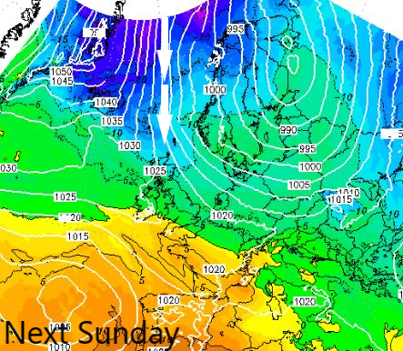
There are signs that next weekend could see another surge of cold air, this time from the north, as high pressure moves away towards the northwest and low pressure deepens over Scandinavia to pull down cold arctic air by the end of the weekend. However, there is some uncertainty about when and how far south this will occur. But if it does, there is an increasing risk of snow in the northeast by the end of the weekend.