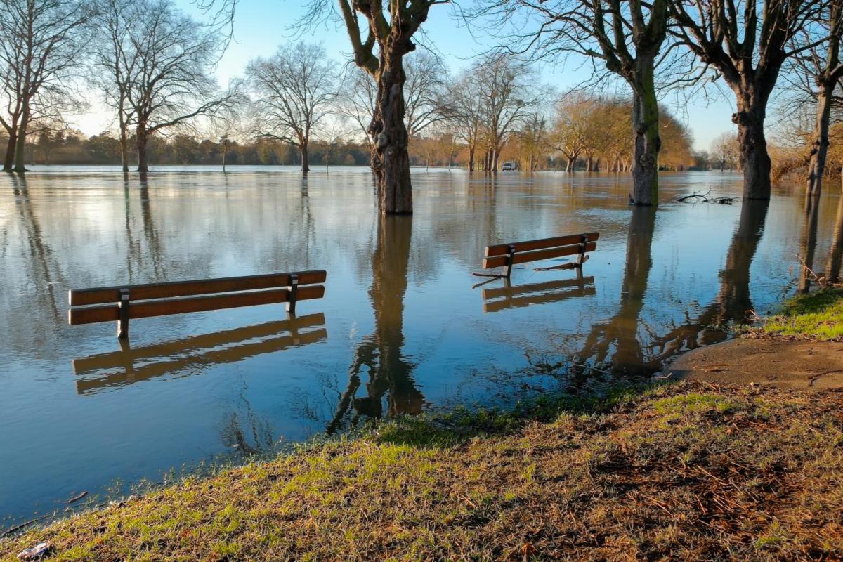
Thursday was a wet day across much of the UK, particularly so across southwest England, where some stations recorded 2 – 3 inches of rain in 24 hours, half the December average rainfall in a day. As a result, there was and continues to be some flooding issues across SW England, particularly Somerset, where a deluge a few days ago has meant rivers and streams were still high when yesterday’s rain arrived. It has also been rather wet in eastern Scotland.
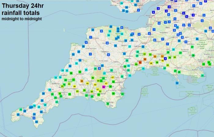
.JPG?w=700) Rainfall data courtesy of Starling Roost Weather
Rainfall data courtesy of Starling Roost Weather
Not so wet today for most, with more in the way of sunshine, though some showers across the west while N. Ireland will see a wet day. But more widespread spells of rain are on the way over the weekend, with a band of wind and heavy rain spreading north and east across most parts on Saturday, followed by windy conditions with gales in the west. Then another band of wind and rain looks to sweep east across all parts on Sunday. In between the rain bands there will be drier conditions, but also some showers in the west. But further rain falling on already saturatted ground and into rivers and streams already on flood alerts or warnings, could mean there could be further flooding in places over the weekend. Fortunately it looks to turn drier though from the middle of next week, as high pressure builds.
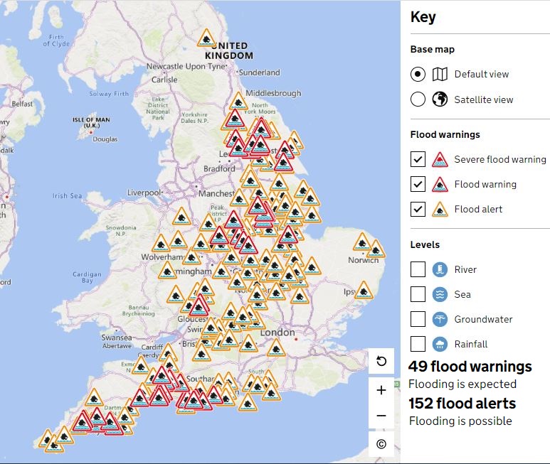
Flood Warnings in Scotland (SEPA)
For now, much of central, southern and eastern England will have a dry day with sunny spells, but with low pressure close to the northwest, it will be windy with scattered showers affecting Scotland, NW England and Wales, with more prolonged spells of rain across N. Ireland. A few showers may also affect Cornwall and Devon. Temperatures reaching 8-9C across Scotland, 9-11C across England, Wales and N. Ireland – which is around the average maximum temperatures for early December.
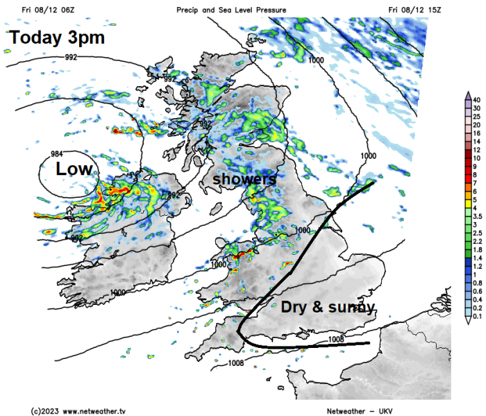
This evening, an area of heavy rain will clear N. Ireland but will spread northeast across southern and central Scotland overnight. Elsewhere, showers dying out in the west then most dry with clear spells for a time, before a band of heavy rain spreads northeast across Wales, central and southern England before dawn.
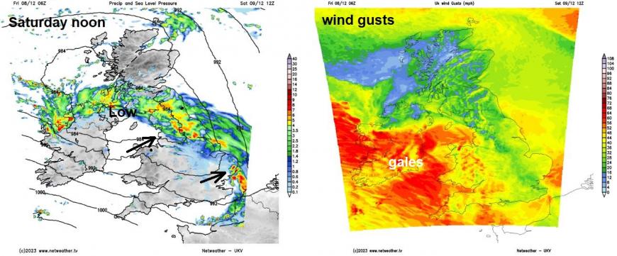
A band of heavy rain will sweep north and east across N. Ireland, England and Wales during the morning, reaching southern Scotland later in the morning. Drier and brighter but windy conditions following from the west across Wales and much of England during the morning and through the afternoon, though with scattered showers in the west. Very strong westerly or northwesterly wind with gales developing across the Irish Sea and around western coasts. Band of rain looks to stall and linger through the afternoon across parts of N. Ireland, southern and central Scotland, as an area of low pressure crosses here. Northern Scotland seeing bright or sunny spells but also scattered showers, northwesterly gale developing across Northern Ireland. Temperatures reaching 9-11C across the north, 12-14C across the south – which is above average for early December.
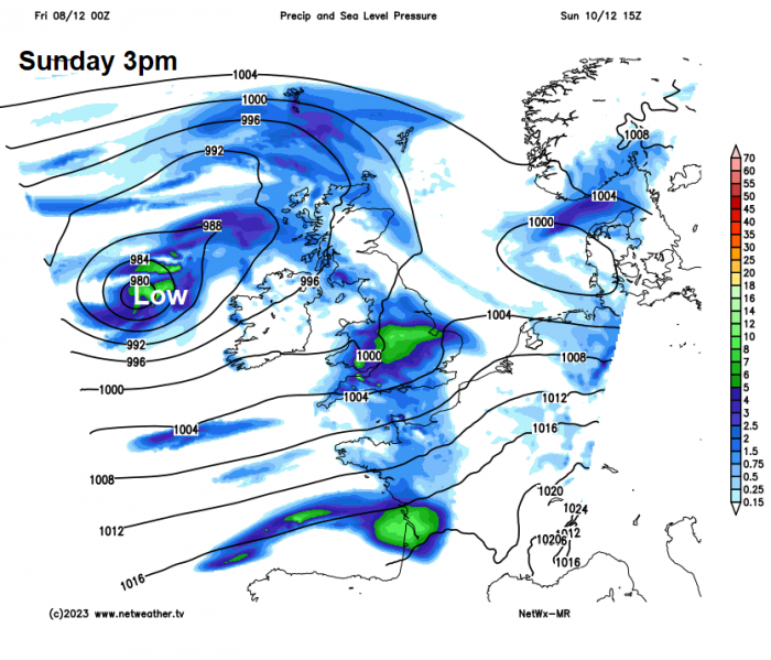
Then another area of low pressure, deeper this time, looks to approach the north of Ireland on Sunday. A band of rain, heavy in places and accompanied by gusty winds, looks to sweep eastwards ahead of the low across most areas through the day, clearing England out over the North Sea during the afternoon and Scotland early evening. Brighter but blustery conditions following from the west, with scattered showers across the west, most frequent across N. Ireland – where they merge into longer spells of rain. It will be rather windy too, with gales developing across Ireland, N. Ireland and the Irish Sea by evening, as that deep low approaches off the Atlantic. Temperatures 8-10C in the north, 10-12C in the south.
The changeable conditions look to continue early next week, as one low clears east out over the North Sea on Monday and other low replaces it from the west on Tuesday. Monday, for now, is not looking too bad, some early showers in the east as that low clears east before a temporary ridge of high pressure builds in to bring a mostly dry and bright day otherwise, with just a few isolated showers left. Then another low rolls off the Atlantic over southern Ireland Monday night, a band of rain spreading north and east across the UK ahead of it in the early hours of Tuesday, clearing England during Tuesday morning to sunshine and heavy showers for the rest of the day, but rain may linger across Scotland and NE England. May even turn wintry over hills, as cold air undercuts from the northeast – as the low tracks southeast from Ireland towards France.
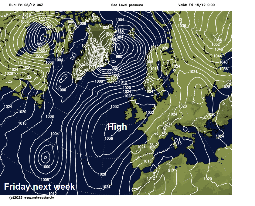
Turning colder and drier mid-week, as a ridge of high pressure topples in from the northwest following Tuesday’s low moving southeast over the near continent. Wednesday possibly mostly dry and sunny, though showers may linger for a time in the south and east, with a risk of frost overnight. High pressure looks to build in over the southern half of Britain for the rest of the week, so becoming mostly dry and settled, perhaps on the chilly side by day with a risk of overnight frost and fog developing where skies clear. Could be cloudier, milder and breezier across the far north though.
Loading recent activity...