The UK's sixth warmest autumn on record finished with much colder weather, which has continued on into December. The wintry conditions will continue with further snow in places but gradually milder air will move up from the SW during the coming days.
Autumn 2023 was another warmer-than-average autumn overall, the 6th warmest on record for the UK as a whole according to the Met Office mean temperature series that dates from 1884. The warmth was assisted by the exceptional heatwave in early September and also spells of unusually warm weather in early October which especially affected the south. In keeping with the general trend of East Anglia and the south-east warming faster than other regions of the UK, East Anglia had its third warmest autumn on record, while in Scotland it didn't make the top 10 warmest autumns.
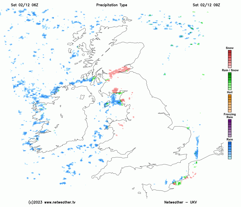
However, the autumn ended on a cold note. Snow has turned out to be quite widespread, for depressions moving from west to the south of Britain led to us tapping into a cold pool over Scandinavia and, despite modification of those air masses over the North Sea, it has proved cold enough to support snow for some, with falling and lying snow affecting many counties bordering the North Sea, notably the Tyne and Wear area. Snow also fell widely in the south on Thursday 30 November, including some of the normally snow-free low-lying areas of Cornwall and Devon. Exeter had falling snow for a while and accumulations locally penetrated to sea level in Cornwall. That said, many inland parts of the UK have been dry and snowless.
As 26-28 November 2021 had fairly widespread snow as well, this makes 2023 the second year out of the past three that had fairly widespread snow at the back end of November. Thus, although the frequency of November snow cover has progressively declined since the 1980s in response to the warming trend in our climate, it is clear that November snow events are not yet a thing of the past.
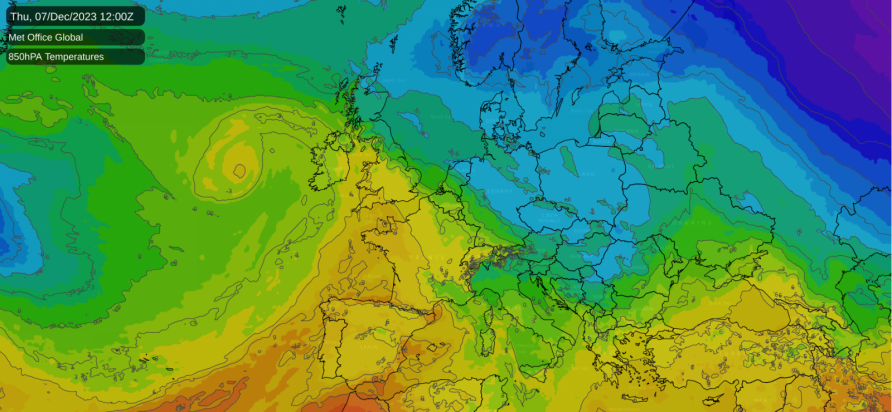
This cold weather is set to be slowly pushed away from the south-west into early December as low pressure systems push in from the south-west and introduce milder south-westerlies. However, the process will be slow and complex, as the Atlantic depressions and fronts will be pushing against extensive blocking anticyclones to the north of the UK which have been responsible for the current cold spell. The mild air will eventually spread to all parts of the UK but it may take several attempts before it makes it into northern Scotland.
Today has started with widespread freezing fog in the Midlands and southern and eastern England, which resulted in some locations staying below freezing yesterday. This fog may persist for most of the day in many eastern parts of England, but it will tend to shift by evening as the weather starts to turn more unsettled from the west and a breeze starts to pick up.
Showers, falling mainly as sleet or rain in south-west England and near west-facing coasts but producing snow inland, will become more frequent in Wales and north-west England as today progresses. These showers will increasingly spread into the Midlands and north-east England during the afternoon and evening, though eastern coastal areas will tend to stay dry. Scotland and Northern Ireland will generally be dry and sunny, but with a few wintry showers near west-facing coasts and near the Scottish/English border.
Temperatures will rise in Devon and Cornwall with less cold air moving in, reaching 5 or 6°C in most lowland areas, and much of Wales and Northern Ireland will see highs of around 4°C. However, the rest of the country will be very cold, except near west-facing coasts, and in most parts of England and Scotland, temperatures will climb no higher than 2 or 3°C. Where freezing fog persists in the eastern half of England, temperatures will tend to stay below freezing.
Tonight, showers and longer spells of precipitation will move eastwards through England and Wales, affecting all counties from Yorkshire southwards. Less cold air will push in from the south, so to the south of the Midlands it will be rain at low levels, but for the Midlands and northern England, and on high ground in Wales, there will be widespread snow. The Met Office has issued a yellow weather warning for snow and ice covering much of east Wales, the Midlands and north-east England.
Sunday will be a much milder day in south Wales and the southern half of England, with southern coastal counties of England reaching 7 or 8°C, but it will remain very cold over much of Scotland, Northern Ireland and northern England. It will be cloudy in most parts of England and Wales with further outbreaks of rain spreading from west to east, with sleet and snow affecting parts of the Midlands and northern England, but for Scotland and Northern Ireland it will generally be dry and sunny, with scattered wintry showers around the coasts.
Through Monday and Tuesday, rain will spread from the south-west to affect much of England and Wales. It is anticipated that snow will not be widespread on its northern flank, as milder air will push in prior to its arrival, but in the Midlands and northern England there may be substantial snowfall on high ground. But for Scotland and Northern Ireland it will remain cold and sunny, with some wintry showers near the east coast of Scotland, and milder air will not push into these regions until next Thursday.
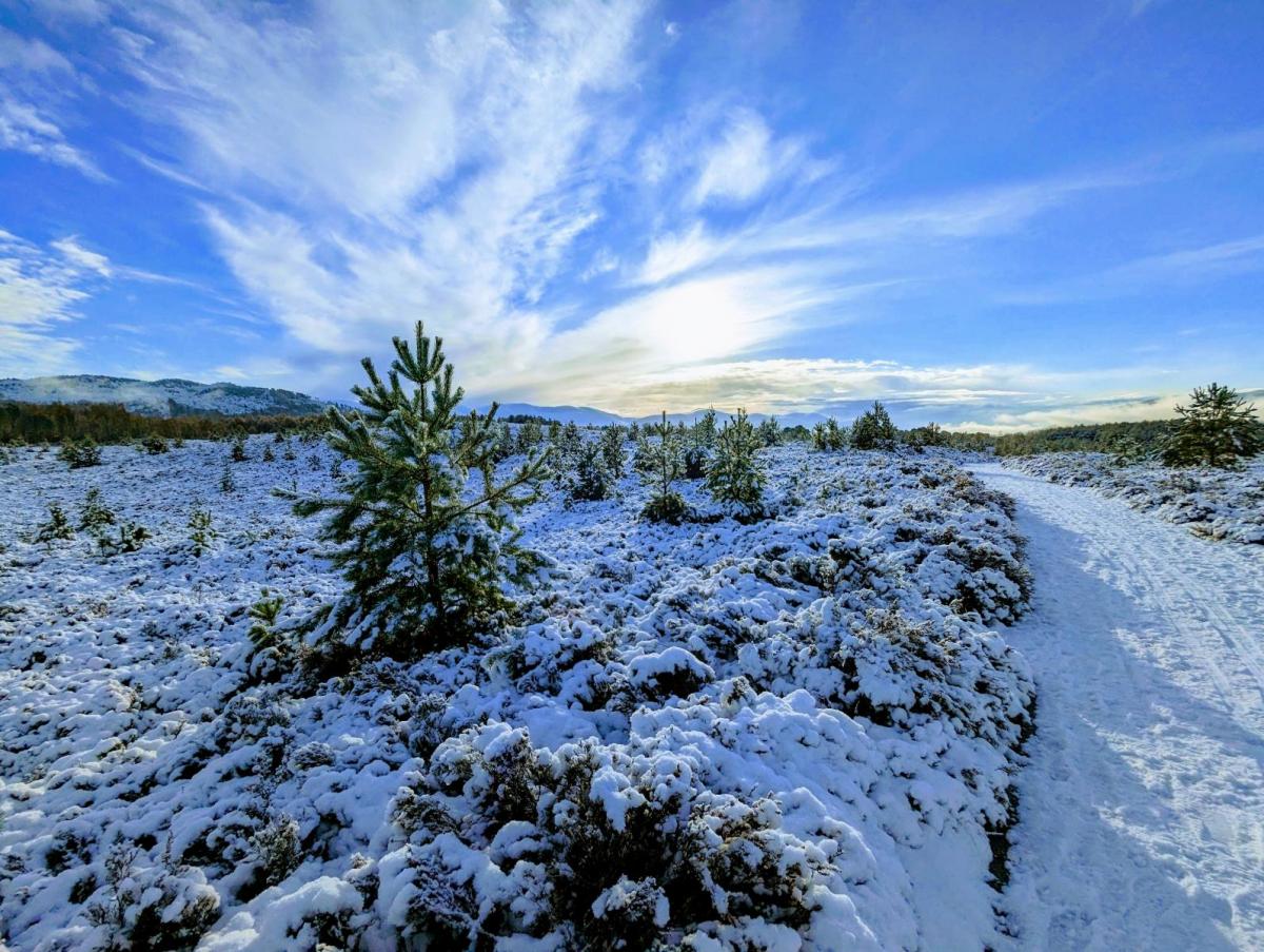
Today's photo - taken yesterday in the Highlands.