The Arctic chill continues with frost and a risk of ice. The showers fade from eastern Britain but appear around the Irish Sea, then for southern counties, of rain and sleet.
The cold air will have a firm grip across Britain for the end of the week. For the snow fields in the Scottish mountains, temperature could fall below minus 15C by night in the Cairngorm National Park. Shap in Cumbria fell to -9.4C last night and many places awoken to a hard frost with problematic ice on Friday morning. Remember the advice is to walk like a penguin. Feet splayed, standing a bit stooped and arms & hands out to help balance. I’ve managed to find my rubber spiked grippy overshoe things so I don't have to do the funny walk.
Ice, frost and even freezing fog will be around this weekend with hardly any wind and the continuing cold. There will be a change for the areas seeing showers. The rain, sleet and snow showers fade from eastern Britain, moving further out over the North Sea. It will be the Irish Sea with more showers and these will drift to the Inner Hebrides, the Isle of Man, Cumbria with hill snow and western Wales.
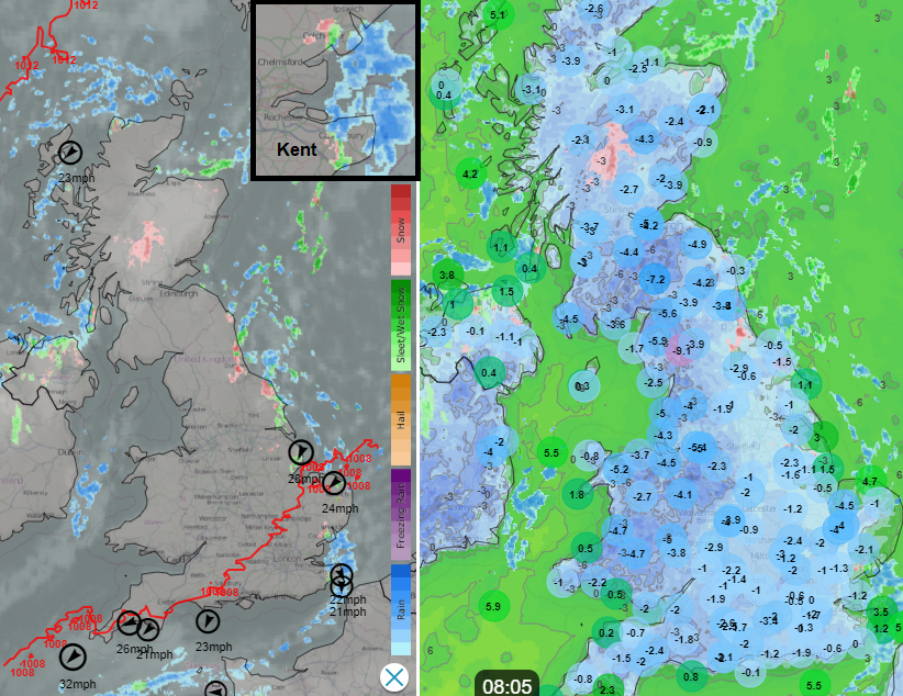
Netweather Radar Extra with top ten gusts, model pressure and precipitation ON, showing rain and snow showers. Then observed air temperatures with model temperature colour field
In addition, showery rain will move in from the west and cross southwest and southern counties of England during Saturday night and then more on Sunday. This will bring more cloud and the air won’t be as cold but there still could be a little bit of snow over the tops of the Downs and Moors.
Overall it will be a cold weekend, with no significant snow to get too excited about. If you (or the children) were hoping to head off sledging it seems highly unlikely unless you already have snow lying. However, it will be frosty and icy and that could affect sporting plans or if you were hoping for a run or a bike ride. We are now into meteorological winter (the months of December. January and February), and those heading to the hills, do be respectful of the cold and prepare well.
Temperatures by day remain near freezing but with hardly any wind, that won't enhance the chill. On Saturday there will be sunshine around although with more cloud for Northern Ireland and western Britain later in the day. There is some uncertainty about how much of southern Britain will be affected by the cloud and precipitation from the west during Saturday night. The UKV Model has a wider reach over more of Wales into the Midlands with the risk of rain, sleet and hill snow or even a bit of wet snow to lower levels. These pulses of precipitation continue to swing eastwards during Sunday, again with the chance of snow over the Welsh mountains. Sunday looks more cloudy overall away from northern, particularly northwestern, Scotland.
There are further Snow & Ice warnings from the UK Met Office for coastal areas exposed to rain, sleet or snow showers. It has been treacherous in places so do leave plenty of time to defrost and de-ice your car, mine took 30 minutes this morning as the ice was so thick.