A look at what will be a be a generally cold week ahead. Rain clearing south Monday then turning colder from the northeast into Tuesday. Many places staying dry rest of the week, but there will be some wintry showers and potential for spell of rain, sleet and snow on Thursday in the south.
Sunday will be another chilly day, but unlike Saturday, it will be a cloudier day after a widespread frosty start. A shallow area of low pressure moving in from the west is bringing the cloud but will also bring some patchy rain eastward across N. Ireland, England and Wales.
The low moving southeast across southern Britain tonight and through Monday will briefly bring milder air across southern areas and more cloud and rain across England & Wales tomorrow. But as the low moves into the near continent later on Monday, cold air will return from the northeast across all parts by Tuesday. The rest of the week will then stay cold in a north or northeasterly flow, with some wintry showers around, thanks to low pressure nearby, along with a risk of overnight frost where skies clear.
After a milder blip tonight/tomorrow across the south, cold air returns from the NE for the rest of the coming week
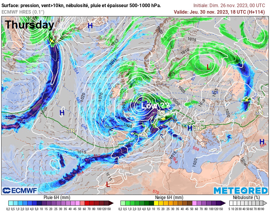
The exception to this may be Thursday, which may see an area of low pressure move up from the southwest towards southern England – which could bring a spell of snow, as associated precipitation bumps into cold air in place. However, this low is currently just west of the Azores, so its track towards western Europe may change. Models were previously tracking the low into France, so the track may revert back to this more southerly path.
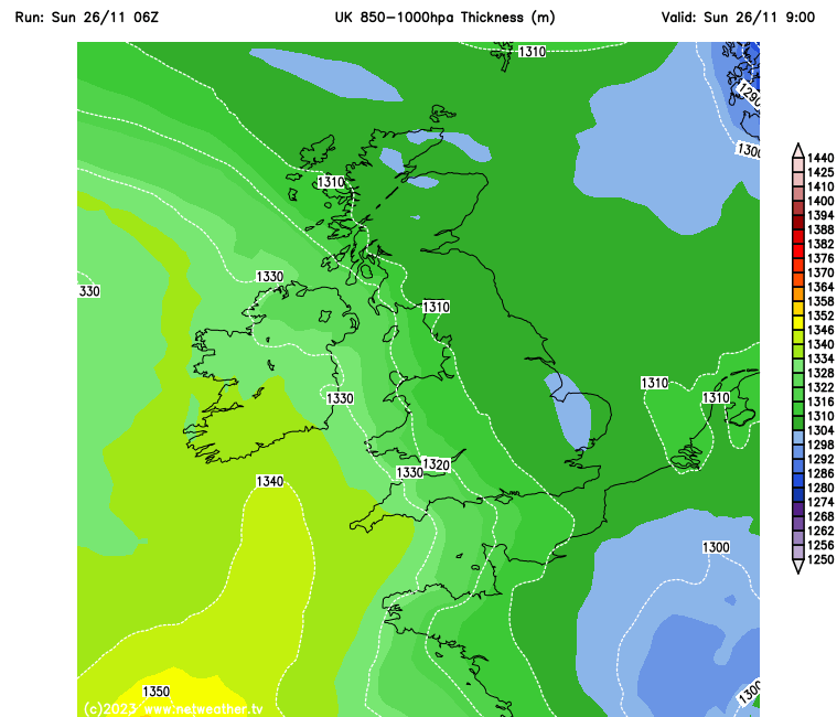
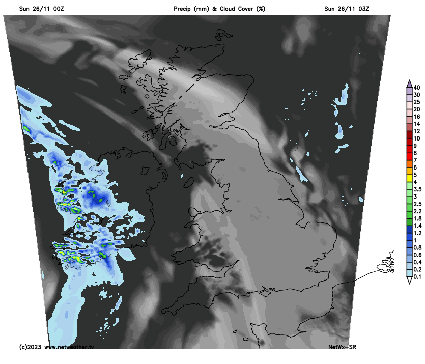
Last night saw another widespread frost across Britain, temperatures fell as low as -4C as far south as Oxfordshire. High cloud has been spilling in from west through the morning across most areas after the bright and frosty start in the east, the cloud thick enough in the west to produce some drizzle across southern areas and some showery rain moving in across N. Ireland and SW England. It will remain cloudy for many through the afternoon, the cloud trapping the cold air from the overnight frost, so it will be chilly too. Showery rain will also push eastwards across England and Wales through the afternoon and perhaps into SW Scotland. So a cold and damp end to the afternoon for some. We may hang on to some sunshine across the northeast though. Temperatures reaching 4-6C in the north, 6-8C in the south, except for SW England, west Wales and N. Ireland – which will turn milder, here reaching 10-13C.
Turning milder across the south tonight, as an area of low pressure tracks southeast across central areas, pulling in milder air from the west. Also turning quite wet across northern England, parts of southern England and East Anglia, as the fronts around the low moving southeast become more active. Showers elsewhere over England and Wales. Clearing skies over Scotland will mean it will turn cold and frosty here overnight.
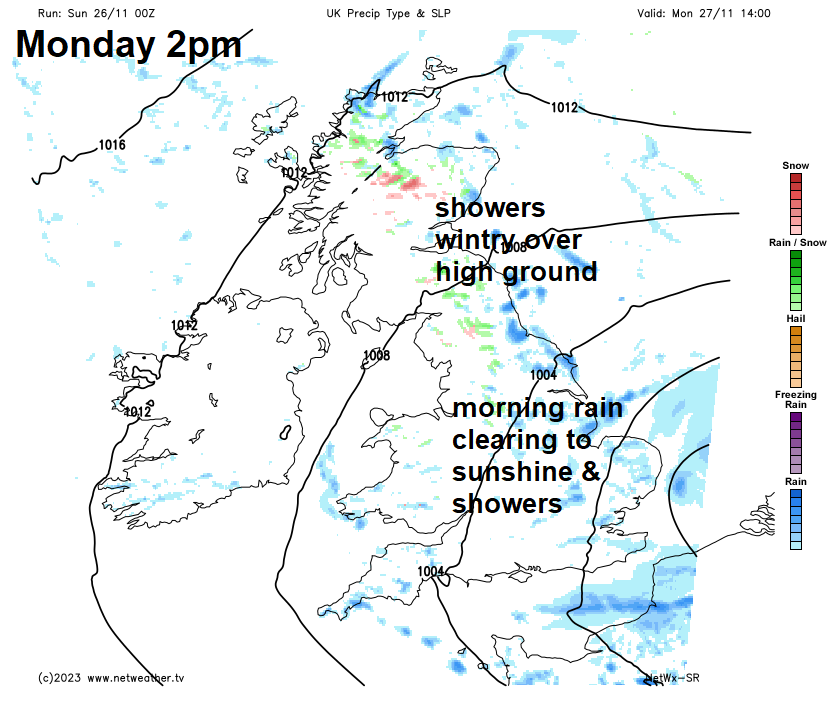
A wet start across parts of northern, central and eastern England on Monday, perhaps some snow for a time first thing over the tops of the Pennines too, as cold air undercuts from the north. The rain clearing south through the morning, followed by bright or sunny spells and scattered showers for the rest of the day, heavy and frequent towards North Sea coasts and wintry over high ground in the north. Drier and brighter over western Scotland, N. Ireland and NW England. A cold northeasterly wind across all parts pegging back temperatures to 7-9C, perhaps a milder 12C in the far southwest sheltered from the wind.
Tuesday should see isobars space out more, with lighter winds and more in the way of sunshine and most places staying dry, but it will be on the cold side, with some scattered showers affecting eastern coastal areas, perhaps getting inland across northern England. Showers wintry over high ground. Temperatures reaching 4-7C, perhaps 9C in the far southwest.
Wednesday looks to see a ridge of high pressure build in, so it’s looking like a mostly dry and sunny day, just a few showers around coasts possible. The exception looks to be northern Scotland, which could see some sleet or snow showers blown in by a strengthening northeasterly wind here. Cold again. Risk of widespread overnight frosts Tuesday and Wednesday nights.
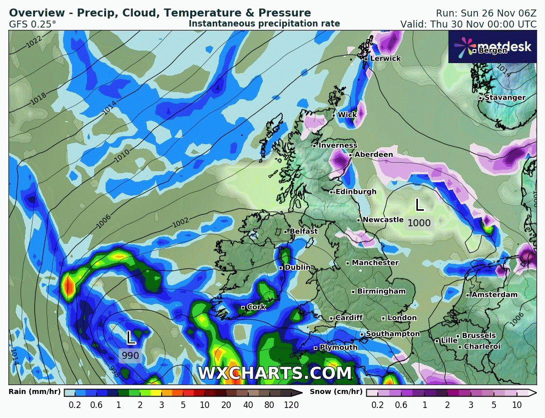
A big question mark over Thursday for England and Wales with regards to how far north an area of low pressure moving up from the Azores gets. GFS is deepest and subsequently furthest north with the low and brings the threat of a snow event on the northern flank of the low across parts of England and Wales, as the rain bumps into the cold air. Other models are further south with the low, with rain and hill snow affecting south Wales and southern England. Rest of UK seeing sunny spells and showers. A cold day likely.
06z GFS for Thursday shows a possible snow event in the south, though it is likely OTT with snow signal, depth of low and track too far north
Friday likely to see a cold northeasterly wind across the UK, blowing in wintry showers towards eastern areas, perhaps falling as sleet and snow inland at lower elevations too. Drier and sunnier in the west, but a cold day everywhere and feeling raw in the wind.
Likely staying cold next weekend, with further wintry showers in places and a risk of overnight frosts where skies clear.