After a mild weekend and temperatures close to or above average much of this coming working week, cold arctic air will try and spread south by the weekend, but some uncertainty how far south. Could be some snow for Scottish hills though.
It’s been very mild this weekend, especially in the south, with temperature reaching close to 17C in SW England yesterday. Temperatures will return close to average the next few days, perhaps even with a frost in sheltered spots overnight where skies clear -as high pressure builds, before becoming milder than average Wednesday and Thursday, with temperatures reaching 13-14C during the day.
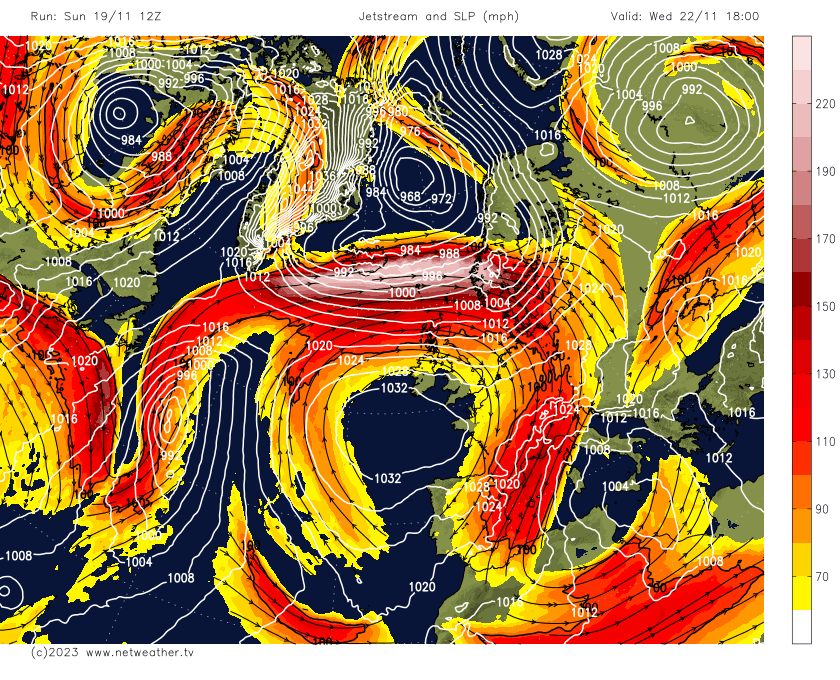
However, it looks like it will turn colder later in the week, as the jet stream buckles to allow high pressure to build north over the Atlantic to the west while allowing low pressure to drop southeast into Scandinavia from Greenland. This will pull cold air south across the UK for a time, however, there is uncertainty between weather models how long the cold incursion from the north will last and also how far south.
Watch how the jet stream buckles later this week, sending low pressure SE into Scandinavia and building high pressure to the west = northerly winds
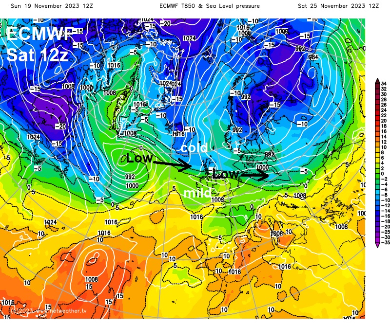
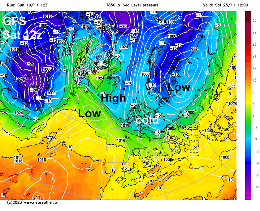
Cold air floods south by the weekend on 12z GFS
The main weather models diverge how far south cold air will get by the weekend. GFS and UKMO get the cold arctic air all the way south by Saturday. However, ECMWF continues to differ from these two models, by bringing areas of low pressure in from the west across northern Britain over the weekend – which prevents the cold getting further south than Scotland. GFS and UKMO has a ridge of high pressure to the west preventing low pressure moving off the Atlantic – so has an uninterrupted northerly flow flood cold air south across all parts by the weekend.
But we could see some wintriness from showers in the north at least as early as late Friday, as cold arctic air digs in here with snow over high ground. Could even be a more prolonged spell of sleet and hill snow if a more organised area of precipitation with low pressure moves in off the Atlantic, as per ECMWF and bumps into the cold arctic air trying to push south. But too far out to have any confidence – given the disagreements over how far south the cold air gets and whether low pressure moves in off the Atlantic.
12z ECMWF does eventually get cold arctic air south across all parts the early the following week, as the last of two lows moving east across northern Britain next Monday clears southeast into the near continent and high pressure builds to the west. A cold northeasterly develops from Tuesday on the model. But this ‘second bite at the cherry’ is too far out to have any confidence.
.jpg)
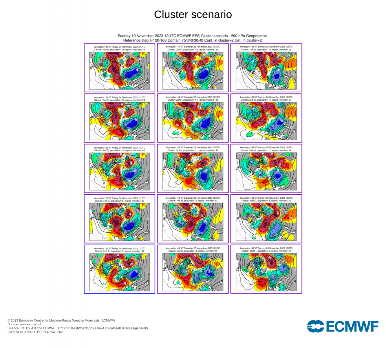
When there is disagreement between the models, forecasters consult the ensembles for guidance. However, the ensembles tonight don’t necessarily paint a clear picture either. The largest cluster in the EPS ensemble clusters, of which there are 5 clusters Friday-Sunday, does side with the 12z GFS operational run and 12z UKMO with the clean uninterrupted northerly by the weekend. The 12z EC deterministic and control were not in this cluster, but the other 3 clusters do show the large spread of solutions from a less cold northwesterly or no northerly incursion at all - thanks to weaker or no blocking to the west.
12z GEFS (ensembles) more supportive of its operation with its uninterrupted northerly by the weekend, more than half supporting the robust ridge to the west – which prevents low pressure moving east off the Atlantic which then prevents cold air getting all the way south.
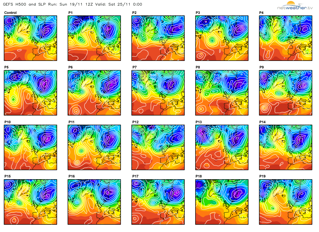
But still too much spread for my liking to have confidence on cold arctic air spreading across all parts by Saturday. There is similar lack of strong support in the EPS clusters for the 2nd attempt to bring cold air across all parts into the following week too.
But it looks increasingly likely it will turn colder before the end of the month, but how cold remains to be seen and any snow looks, for now, to be confined to high ground in the north.