The big weather-related story at present is Storm Babet, which has delivered exceptional rainfall totals in many areas of the country, and has led to widespread flooding. In particular, in eastern Scotland, as predicted by a rare red weather warning from the Met Office, strong to gale force easterly winds combined with persistent moderate to heavy rain have resulted in unusually large rainfall totals to the east of high ground. As a result, some areas have had well over a month's worth of rain in less than 24 hours. The Met Office has issued a further red weather warning for today for north-east Scotland, covering parts of Angus and Aberdeenshire.
Three people have been killed so far, two in Angus and one in Shropshire. Earlier, there were floods around Dundee and the north-east coast of England was inundated with high waves from the North Sea, resulting in flooding near the coast around South Shields and Sunderland. Currently, the biggest problems have transferred to north-east Scotland, where there are no trains and a number of people have been sleeping in emergency accommodation.
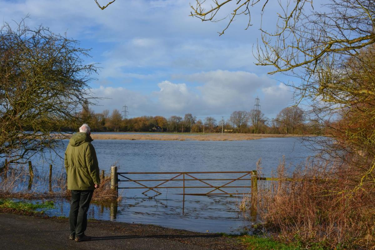
Parts of England have also been strongly affected, particularly the East Midlands, where more than a month's worth of rain fell yesterday in some areas. A number of areas in Derbyshire, Nottinghamshire and Leicestershire remain flooded. The river Derwent is currently at record high levels, and further north, Leeds Bradford Airport has been closed since a TUI flight from Corfu skidded off the runway yesterday.
The big question is whether there will be considerable further rain today, which could add to the flooding. For many of us, the answer is no, but the north and north-east of Scotland will face further persistent and, at times, heavy rain, accompanied by strong north-easterly winds, which will exacerbate the flooding problems.
The rain will eventually clear away northwards during the afternoon and evening. Coastal areas of north-east England are also currently seeing rain. This will clear away around midday, but some intermittent, mainly light, rain will affect East Anglia and the south-east during the rest of today. Some brighter spells mixed with heavy and locally thundery showers will develop in the south-east in the afternoon. Elsewhere, for much of southern Scotland, Northern Ireland, northern England, Wales and the West Country there will be some sunny intervals mixed with a scattering of showers, and many places will remain dry.
Temperatures will be near or slightly below what we would normally be expecting at this time of year, with highs of 13 to 15C in East Anglia and the south-east, and 10 to 12C in most other parts of the country.
Sunday will be a bright day for most, with some scattered showers, the majority of the showers in western areas, and some places will miss the showers altogether. Some heavy and thundery showers may spread into the far south-east. Temperatures will generally be a degree or two higher than today's, with a maximum of around 11C in most parts of Scotland and peaking at around 15C in East Anglia and south-east England.
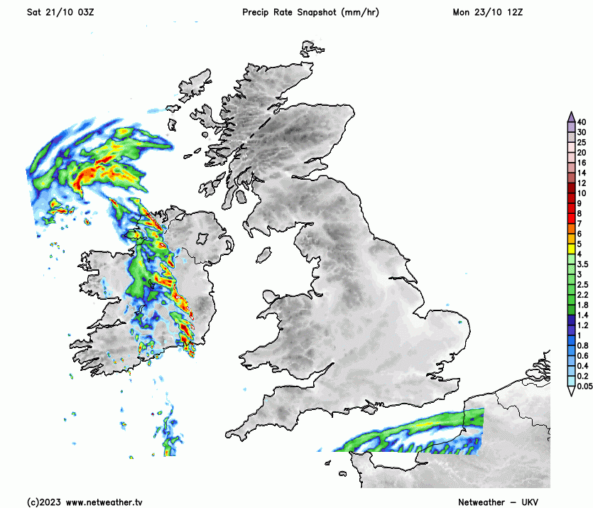
Through early next week, we will need to closely watch another area of rain moving in from the south-west. It will mainly affect Northern Ireland and the south of England on Monday, in regions that have not so far been strongly affected by flooding, but through Tuesday and Wednesday, it will push through the Midlands and into northern England and Scotland. Winds will be south-easterly as the rain reaches Scotland, most likely during Tuesday, which may result in further heavy, persistent rainfall for eastern Scotland.
So, after a respite through Sunday and Monday, the east of Scotland will need to be prepared for some exacerbation of the flood risk through Tuesday. Parts of the Midlands and northern England will also be susceptible to further flooding. Brighter weather with some showers, these heavy and thundery near the south coast, will spread into southern areas during Tuesday and Wednesday.
The long term outlook is for low-pressure systems to continue to track further south than usual as they head into western Europe, resulting in a continuation of the generally unsettled weather with rain belts interspersed with brighter, showery weather and temperatures generally close to the seasonal average.
Loading recent activity...