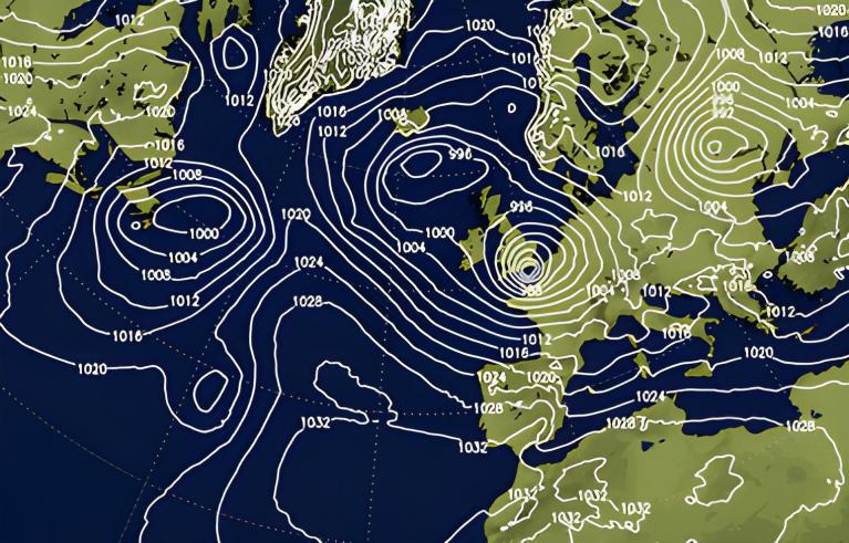
After the taste of summer last week, we have an autumnal low whirling in tonight. Frontal rain will move from Northern Ireland across Scotland this evening then NW England and Gwynedd tonight. There will be gales for the far northwest but warm air is set to return by the weekend.
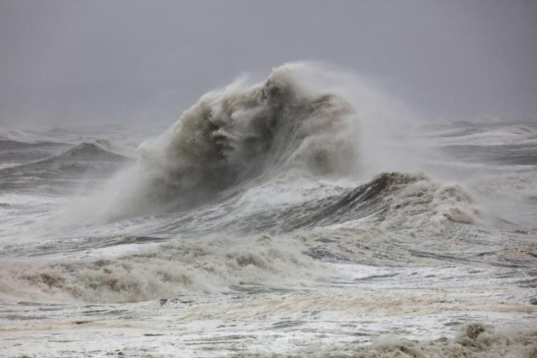
As the low centre nears Lewis after midnight, there will be sharp showers and strong, gusty winds. The Inshore Waters forecast mentions gales and severe gales for The Minch with rough or very rough seas. It will be a windy but mild night across the north. The low slowly pulls away to the north on Thursday morning and further disruption to ferry services is likely for the Scottish Islands. The Northern Isles will be windy through Thursday
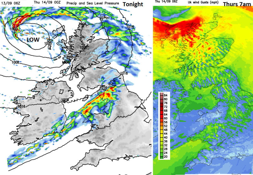
Last night it was cool yet with enough clear skies for some people to see the Aurora. There was a ground frost last night in the far north of mainland Scotland. Dalwhinnie down to +1.3C and Braemar +1.4C and the air does feel cooler and fresher now, before the sunshine gets to work. There is a chance of seeing the Aurora again tonight but there will be plenty of cloud from this Atlantic low as its trailing front lingers across Wales and central then northern England.
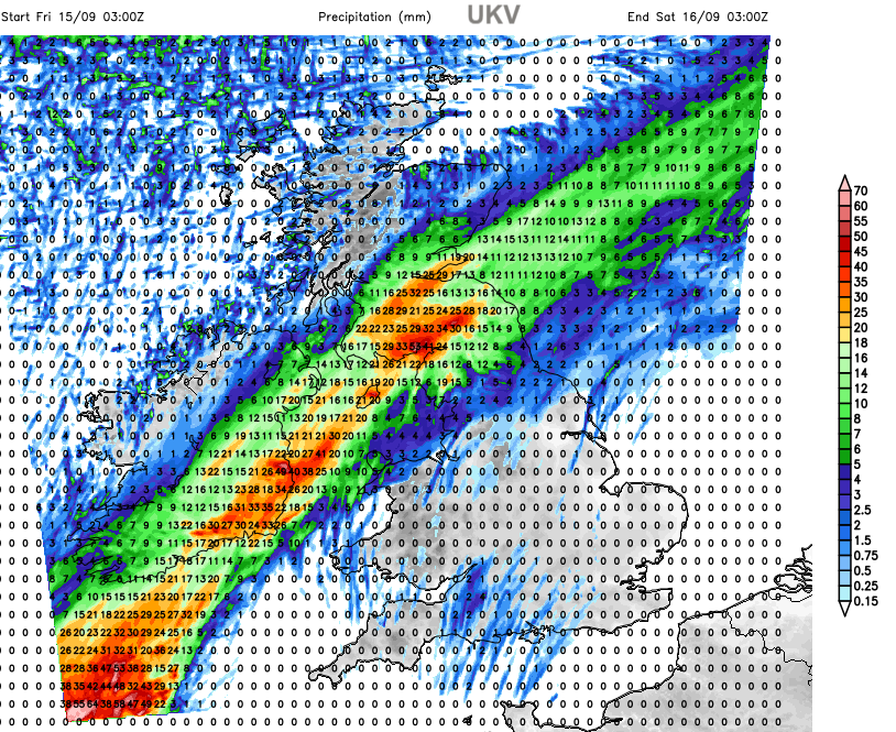
This frontal divide doesn’t want to give up and will linger into Friday night as it reaches over Northern Ireland and Scotland to end the working week. There is some uncertainty around the progress and timing of this band
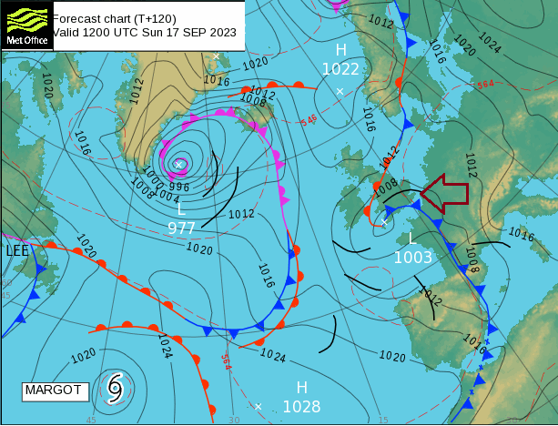
A new low centre could develop off NW Spain and it is around this that continental warm air looks to be driven northwards to the UK. Generally, temperatures look to be in the high teens and low to mid-twenties this weekend but they could go higher. 27 to maybe 30C is possible.
Friday evening
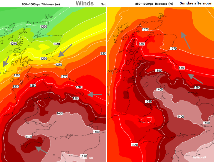
The frontal band of rain will be slowly edging northwards into Scotland and lingering over Northern Ireland on Friday evening. There will be heavy and persistent rain within this band which could cause surface water issues on the roads and localised flooding. To the north it will be cool in a northeasterly wind and to the south it will be milder with a very light southerly then easterly breeze.
Early on Saturday, there is a signal for showers to break out in the southwest of Britain with some heavy, even thundery, downpours.
Much warmer air will be pushing up into England and Wales as the cool air clings on in the far north of Scotland. The grey, damp frontal band will still be around bringing outbreaks of rain across a portion of Britain. To the south of that, there will be clusters of showers and still the risk of a few heavy downpours with more feeding up across the Channel in the afternoon. With a breeze off the North Sea, the east coast will be comfortable, cool in the northeast. But inland it will feel warm for those in the sunshine with temperatures for England and Wales widely around 20 to 26C.
The models diverge for Sunday. The Netwx MR shows clusters of showers pulsing up through Ireland which clip western Britain, even with thundery downpours for SW England and Wales. It shows more of an east to southeasterly flow but again with temperatures inland well into the 20s Celsius. It also shows higher temperatures for Northern Ireland and SW Scotland, up to 21C. The ECM model shows a steadier surge of showers with a wider reach over the UK from the southwest. This takes longer to reach up to western Scotland on Sunday but covers much of the UK by the end of the weekend with some hefty downpours. Again, there will be the risk of thunderstorms and it will feel quite close and muggy. With two hurricanes in the Atlantic, the transition to post-tropical cyclones of Lee over eastern Canada and Margot's interactions in the north Atlantic bring tropical energy and uncertainty to the forecast models.
"Lee will be much weakened before reaching Newfoundland ...building surf conditions and rip currents are expected along the Atlantic coast of Nova Scotia over the coming days - particularly on Friday." CHC
If you are packing for a weekend away, this might all be a bit frustrating. For northern Scotland, it will be cool, for southern England, it will be warm and humid but likely to rain in the southwest. There is a risk of heavy downpours but as always with showers, some places will miss them. It is not a time to concentrate on exact timings on weather apps. Think about the overall picture and look at the radar nearer the time. Also, the frontal band during Friday does look rather wet as it moves northwards.
The warmth this weekend looks to be cleared away on Monday, pushed aside by a fresher Atlantic flow. So, we are not in for another seven days of 30+C.
Loading recent activity...