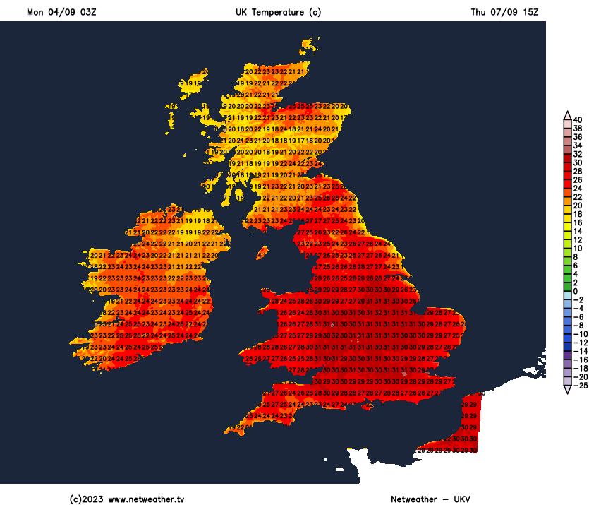
High pressure close to the east and low pressure to the southwest will draw in very warm and increasingly humid air from the near continent this week, with clear skies allowing temperatures to reach the low 30s in the south each day.
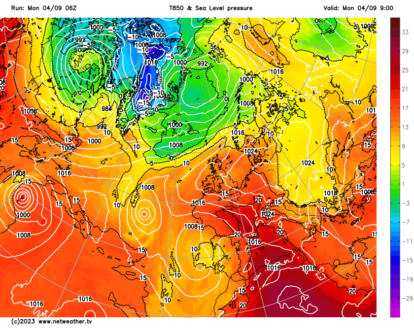
Heat is building across the UK this week, thanks to strong high pressure becoming established across northern and eastern Europe and low pressure to the west of Iberia pulling in hot air from the near continent. With clear skies across many areas this week, temperatures will rise into the mid to high twenties widely across England, locally into the low 30s. Mist and fog will form in places overnight though and this may become more extensive later in the week – as humidity levels rise.
Very warm air gets dragged north from France into the UK this week, allow temperatures to rise into the low 30s in the south
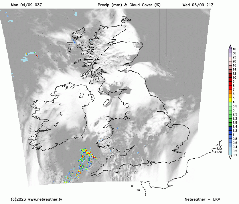
More of an easterly breeze across eastern coasts will prevent temperatures getting as high on Tuesday, but further inland over England and Wales we may again see the high 20s, perhaps 30C in a few spots. From Wednesday to Friday central, southern and eastern areas may see temperatures reach 31-32C, as winds turn more southerly, which is some 10-14C above the average high for early September. Across Wales, Scotland and N. Ireland – temperatures reaching the low to mid-twenties generally this week. From late Wednesday, we may see some thundery showers push up from the south across more western areas, but eastern areas of Britain look to stay dry through the week, allowing the those temperatures to build.
Official heatwave criteria look to be met this week across large parts of southern Britain, as temperatures look likely to exceed 30C. As well as high daytime temperatures from Tuesday until the end of the week at least, it is likely to be uncomfortably warm at night as well as humidity levels rise. There is a chance of ‘tropical nights’ when the temperature falls no lower than 20C. The highest overnight minimum temperature on record for September is 21.7C – a record which may be threatened later this week.
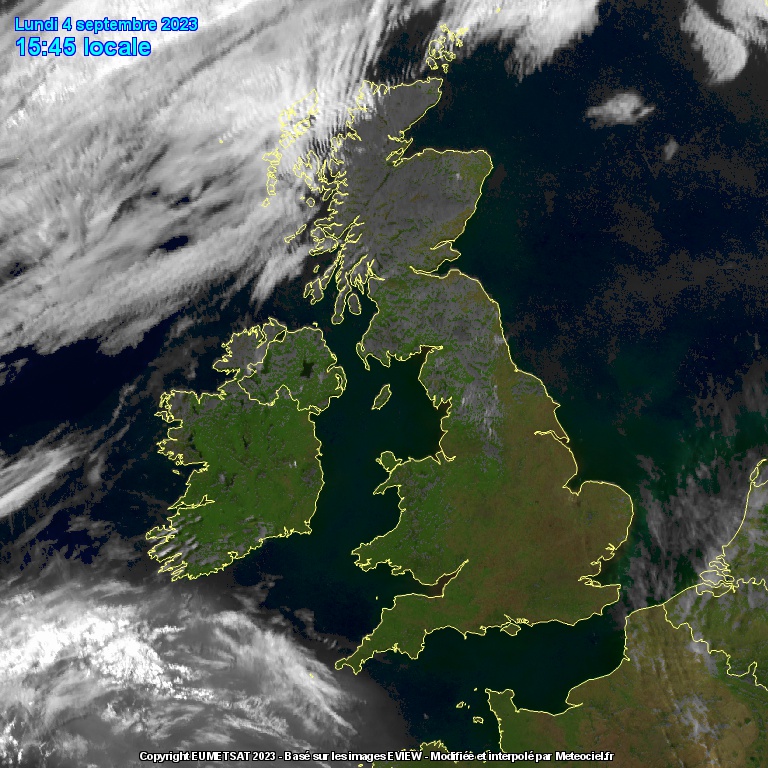
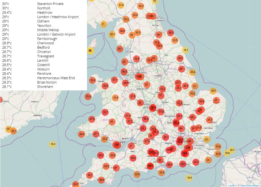
The rest of today will continue to enjoy clear skies, very warm or locally hot late afternoon. The temperature has reached 30C at London Northolt Airport and also Staverton in Gloucestershire. Elsewhere quite a few stations across southern England have reached 29C, 27C across the Midlands and south Yorkshire and south Wales. The exception is the far NW of Scotland – where a weak front will continue to bring more in the way of cloud with the odd spot of rain or drizzle in the Western Isles.
Remaining mostly clear overnight – which will allow some mist and fog patches to return once again, but remaining rather mild overnight, with temperatures in low to mid-teens. Bit chillier in sheltered rural Glens in the Highlands though.
Tuesday will start off with the odd mist or fog patch in places, risk of the odd isolated shower clipping the far southwest of England, otherwise most places will remain dry with mostly clear skies and wall-to-wall sunshine. Very warm or locally hot, temperatures ranging from mid-20s in central Scotland, northern England and Wales to high twenties across central and southern England, perhaps 30C in a few spots. A stronger easterly breeze will keep eastern coasts cooler.
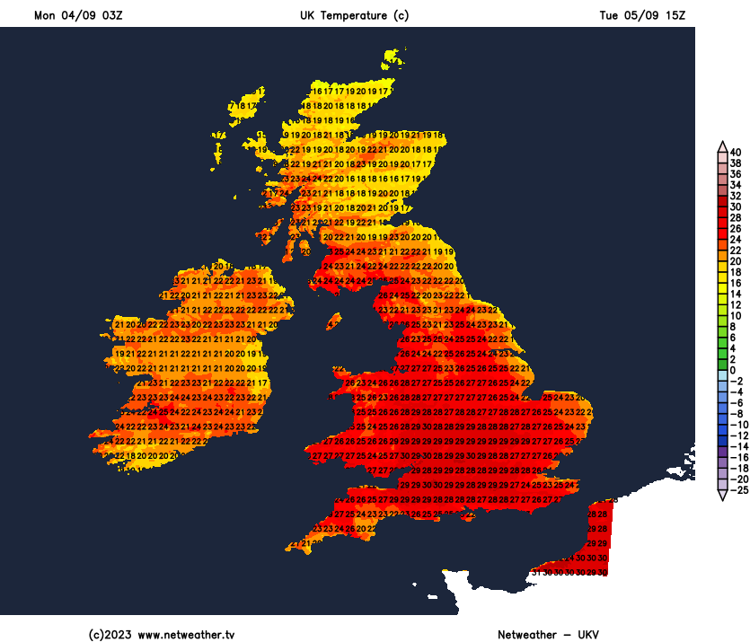
A repeat for most on Wednesday with most very warm or hot and sunny after any early mist, fog or low cloud burns off. May stay cloudier across the far west – which may thicken to produce a few showers later. Temperatures widely reaching mid-to-high 20s across England, 30-31C across SE England and East Anglia. Elsewhere low to mid-20s.
Thursday looks to see low pressure moving closer to the west which could throw some fronts or troughs towards the UK which may bring some thundery showers north across Ireland, western and northern areas of Britain through the day. Otherwise another very warm or hot and sunny day across central and eastern areas. We could reach 32C in the southeast. The record for September is 35.6C at Bawltry, Doncaster on 2nd, 1906. More recently 34.4C was reached at Gravesend on 13th in 2016.
Threat of showers in the west and north on Thursday
Friday looks another humid, very warm or hot and sunny day for many, temperatures again reaching 30-32C in the southeast. Some uncertainty, but some thundery showers may push into the south and some western areas later in the day.
Next weekend, for now, is looking humid, very warm and sunny, locally hot in the southeast, though some thunderstorms may break out in places across the south, while cloud and rain along a front could affect northern Scotland.