Guests arrive in Denver this weekend for the start of WeatherHoliday's USA storm chase Tour 1 in Tornado Alley. So what are the prospects for severe weather next week?
It’s that time of year again, when the WeatherHolidays Team, part of Netweather, run 10-day storm chase tours for groups of guests across the Great Plains of the USA between early May and mid-June to experience supercell storms and hopefully see a tornado.
Weather Holidays have been running storm chase tours since 2007, I was on the very first tour way back when. Since the first tour, which was just one car with 4 guests, the yearly storm chase tours quickly became popular following the legendary Michael Fish MBE joining a tour in 2008 and also through word-of-mouth. Now we run 4 Tornado Alley Tours during peak season for storms in late Spring and early Summer.
Tour 1 starts this Monday, the 8th of May, with guests arriving on the 7th, the day before. So, what are the prospects for severe storms across Tornado Alley next week and beyond?
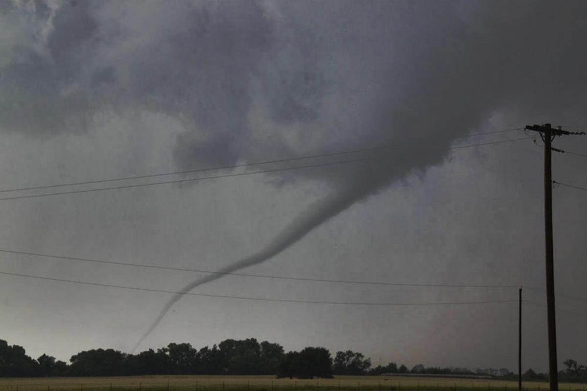
It’s been a slow start to the month by May standards, the peak season for severe storms in the Plains. Some isolated severe storms have been affecting the Texas High Plains over recent days, shifting a little further east across Nebraska and Kansas yesterday. Today the greatest risk focuses north Texas and southern Oklahoma – with an Enhanced Risk of severe weather. But, again large hail the main risk today, the tornado risk is low.
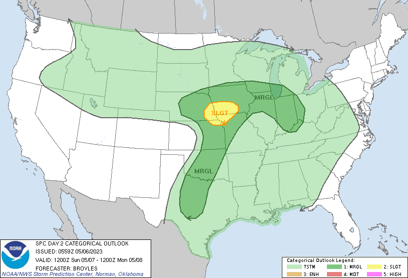
Moving on to tomorrow when Tour 1 guests are due to arrive in Denver in eastern Colorado, though some may land a day or two before this - no severe risk forecast in the vicinity Sunday. A slight risk of severe weather across southwest Iowa, eastern Nebraska and far northwest of Missouri, too far to reach the same day, unless all guests have arrived on the Saturday.
Sunday's severe risk
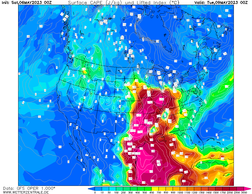
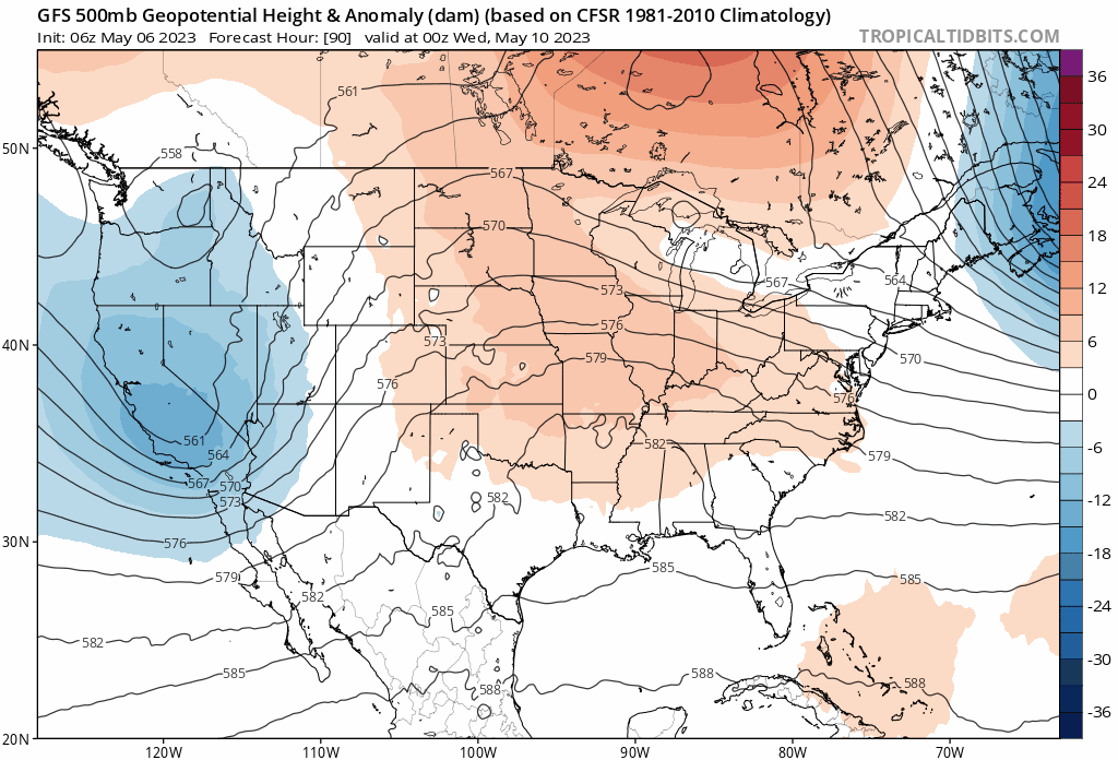
Then prospects for next week are looking like increasing chances for severe storms by mid-week. Although a warm and moist airmass looks to be in place across the southern and central Plains throughout the week, with a strong reservoir of CAPE (Convective Available Potential Energy) available, there will be an upper-level ridge of high pressure building north over the Plains, putting a lid on any widespread severe storms until midweek.
Strong resevoir of CAPE (Convective Available Potential Energy) over the Plains next week
There does look to be an isolated risk of severe storms over parts of the Central Plains to Midwest Monday and Tuesday. Monday sees a slight risk of severe weather for Missouri and southern Illinois. Tuesday, the focus for severe storms may switch further west to cover Kansas and Missouri. Again an isolated risk of thunderstorms.
Monday's risk from SPC
Tuesday's risk for severe storms may be further west
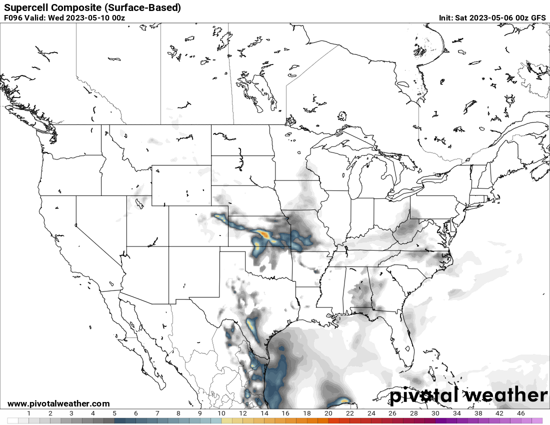
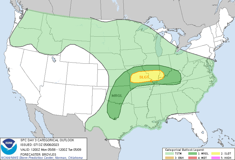
On Wednesday, an upper-level low moves from the west over the Rockies towards the High Plains, inducing lee cyclogenesis east of the Rockies over the High Plains. Although models diverge on detail with increasing uncertainty this far off, we may see a more widespread risk for severe storms develop from western Nebraska, south over western Kansas, western Oklahoma and northern Texas on Wednesday – as the upper low engages the western edge of the reservoir of warm humid air over the Plains.
This risk perhaps shifting further east over eastern Kansas, Oklahoma and north Texas Thursday, as the upper low ejects out over the central Plains. The upper low moves NE over the northern Plains towards the Great Lakes on Friday. Uncertainty, but perhaps a risk for severe storms over the Midwest / Great Lakes.
Upper level low moves out over the Plains mid-to-late week
Coverage of severe storms may increase from mid-week over the central and southern Plains
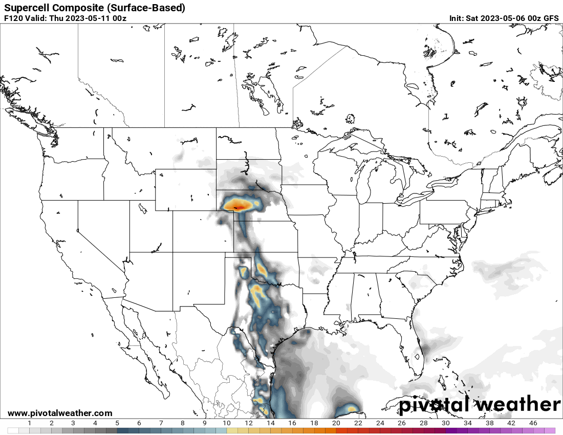
Beyond that, confidence becomes increasingly lower. But I’m sure there’ll be chances for severe storms over the Midwest or much further west over the High Plains, despite the signal for upper-level ridging to build over the Plains for now.