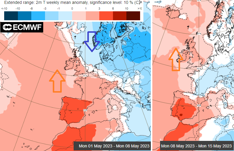
The days between the Bank Holiday weekends start off settled, mostly dry but cool and cloudy. There will be a shift to a milder flow but the forecast looks mixed. Sunny spells and hefty showers by Friday.
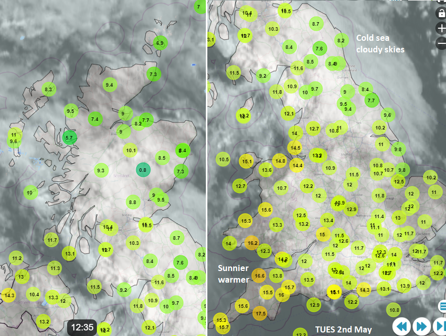
For the start of the working week, cooler air will move down from the north but its main path will be over the North Sea and Scandinavia. High pressure between Norway and Iceland is a steadying force allowing a lot of quiet, often cloudy but dry weather. NE Britain and North Sea coasts continue to feel cool under all of that cloud but the main chillier flow will miss the UK.
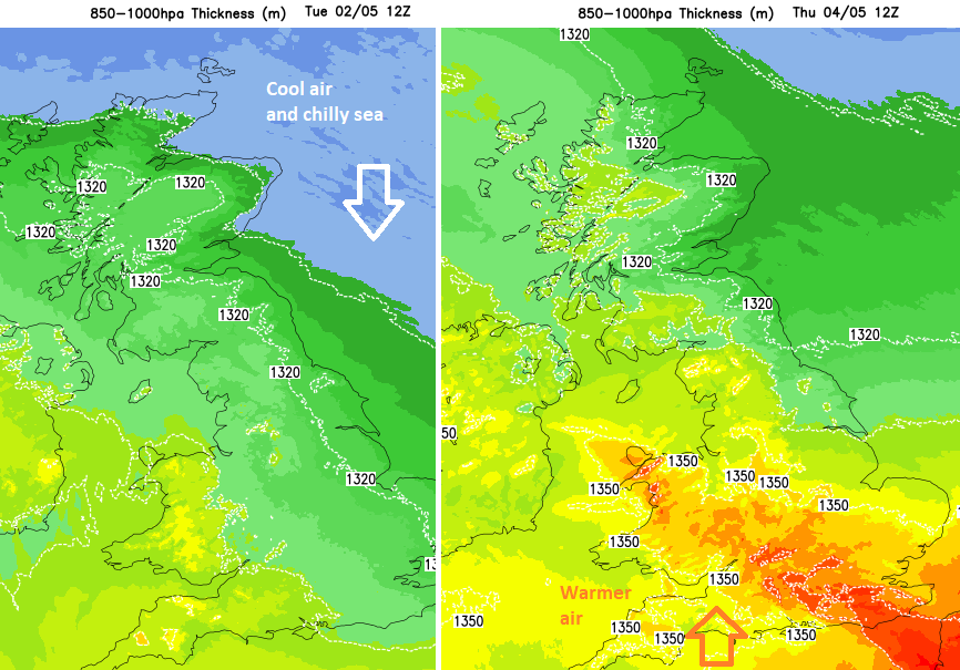
Out in the Atlantic, a developing secondary low slides northward and tries to guide warmer air up through western mainland Europe towards southern Britain. Early on Wednesday will be nippy for eastern England with hardly any wind. By Thursday, the wind will be picking up with a squeeze in between the low and high pressure. There is also the threat of frontal rain from the southwest which edges northwards through Britain on Thursday night. Behind that is a very showery picture for Friday.
Tuesday and Wednesday still have a good deal of cloud across the UK but not heavy rain. Weak weather fronts will trail over the west coast of Scotland by Wednesday morning and here there will be low cloud and outbreaks of rain with drizzle. This pushes over northern mainland Scotland during Wednesday afternoon and evening.
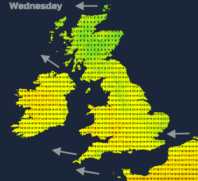
The easterly wind will make the Thames Estuary feel cool. Again, further west it will feel milder around the Bristol Channel and for the West Midlands in any sunny spells.
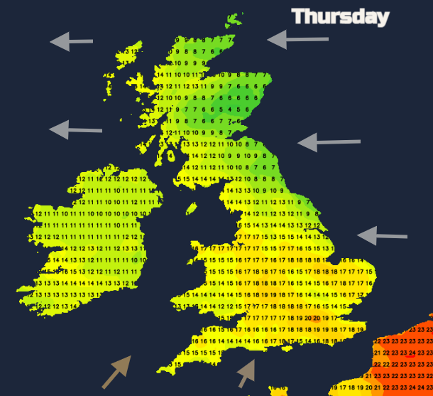
The nights remain cool, well down into single figures but by Thursday the brisk wind will be more noticeable. There will be more gaps appearing in the cloud cover and so warm sunshine. It will be a blustery day but with the airflow veering to the south then southwest. So, the potential for temperatures in southern Britain to move up to perhaps 18 to 22C. Frontal showery rain will show itself over SW England and then Wales during Thursday. Later in the day, it will reach the Irish Sea and Northern Ireland. By Friday, the more southerly flow will extend up through most of the UK and with a shift in the wind direction, other areas could see temperatures into the high teens.
It's going to be an unsettled game this week to attain the higher temperatures. We start with lighter winds, but lots of cloud and a cooler airflow. Then a milder air stream but brisk winds and more breaks in the cloud and the chance of sunshine but the showers start to go up and they could turn heavy even thundery by Friday.
The usual midweek issue of the weekend forecast will include the Coronation and Bank Holiday weather. The milder air will push its way northwards, at least for the start of next week but it doesn't mean it is going to be fine and dry for everyone.