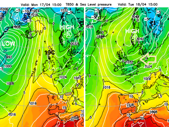
High pressure over Scandinavia will draw an easterly flow towards the UK. The North Sea is chilly at this time of year but any sunshine can feel warm. You'll need to stay out of the breeze or keep your coat on.
Warmer air fed up from the south for the start of the new week with Co. Fermanagh reaching 18.7C on Sunday. A southerly flow at this time of year can result in higher temperatures, reaching into the twenties Celsius with sunshine in April. However, as most schools return after the Easter break, we will see a cool easterly flow taking hold and temperatures dipping away this week. It will be nippy by night and feel cool in the wind but with a fair amount of dry, settled weather due to a nearby high pressure. Tree pollen levels are high at the moment and air pollution levels are forecast to be moderate in places as the week progresses.
A change to easterly flow this week
High pressure extended from the Azores to Scandinavia through the weekend. This enabled the more settled spell after last week’s hefty showers. With a large low pressure out in the northern Atlantic, warmer air moved up western Europe. Spain starts the week with temperatures in the mid to high twenties Celsius and, like inland Portugal, seeing temperatures tipping into the low 30s.
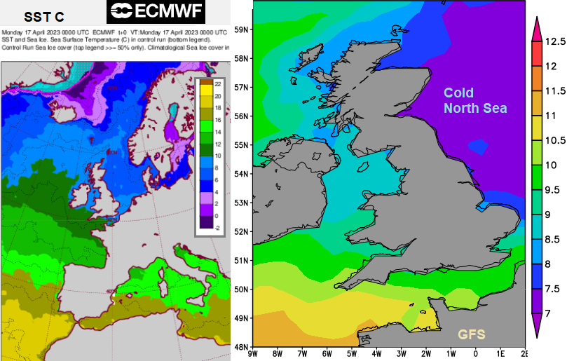
Here in the UK, we begin to see a cooler feed off the North Sea but in any sheltered sunshine, it will still feel pleasantly warm. The high pressure over Norway and Sweden exerts itself and we draw in our weather from the east. This will give a noticeable cooling wind. It brings more low cloud off the chilly North Sea. There will be pockets of showery rain caught up in this flow with a particular disturbance showing up by Friday over England and Wales, maybe more of the UK. This would bring more widespread rain but for the detail, it is still four days away.
The nights get gradually colder as well as the week progresses and there is still the risk of a touch of frost away from urban centres.
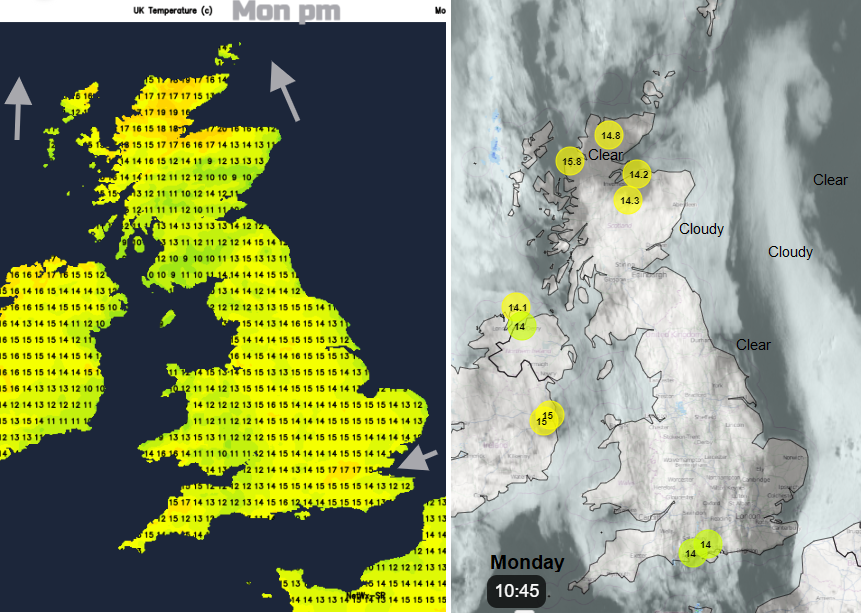
On Monday NW Scotland should see the highest temperatures with 19C maybe 20C likely in the southern flow. Northern Ireland will also feel warm in any sunshine. You can already see breaks in the cloud cover, almost a slot running north-south. All of this is edging westwards so by Monday night there will be more cloud over Ireland and western Britain keeping the temperatures up but a cooler night under the clear band for parts of Britain.
Then another band of low cloud will move in from the North Sea. By Tuesday morning there will be a lot of low cloud covering Britain although sunny spells for western and north-western areas and also, for Northern Ireland. East Anglia will poke out the other side and brighten up. The cloud will thin and break, the day will brighten and warm in any sunshine. Yet the air will feel a bit cooler. As the easterly wind picks up for eastern and SE Britain, that will add to the nip in the air. The cloudy Forth will feel the wind too. Again, Highland Scotland and around the Moray Firth could reach the high teens but for many temperatures will be in the mid-teens. Southern Britain will see a bit more cloud filtering in, brought around on the easterly flow but for most, it will be a fine Tuesday.
Showery bits will move eastwards through the English Channel on Tuesday night and affect southwest England, perhaps clipping Cardiff, by Wednesday morning. It will be a mixed picture of grey skies adding to a cool feel midweek but then breaks and sunny spells, lifting the day. A brisk easterly wind will add to the cool feel through Wednesday and Thursday.
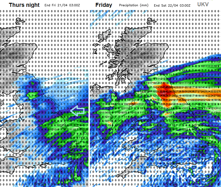
It looks like outbreaks of rain will reach England from the east on Thursday, reaching Wales during the night. By Friday the rain could be heavier and more persistent. Currently, that looks to be over northern England and then edging northwards towards the Central Belt with a wind off the sea and affecting NW England and Northern Ireland. The ECM model is a bit slower and keeps more of the rain on Friday over England, then Wales.