A showery low will be over the UK by Saturday with a mix of downpours, bright spells then more blustery showers. Sunday will start off more settled but not as mild.
The weekend is looking showery and mild. The cold Arctic air will be away from the UK and there will be a showery flow around a low pressure to start the weekend. This low weakens giving a calmer lull by early Sunday but we’ll have to see when the next Atlantic fronts arrive from the west.
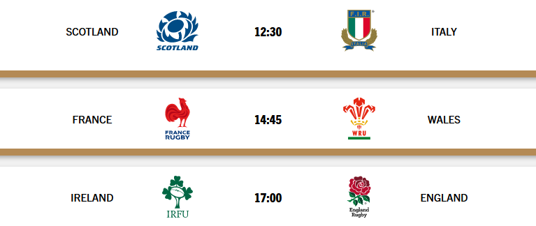
Six Nations weekend
The weather looks fair on Saturday for Murrayfield with a small chance of a shower for Edinburgh and a bit of a breeze. Paris could see showery rain on Saturday afternoon, linked to our UK low pressure. Dublin will feel cool and damp by the early evening.
The ECM model has the next frontal system over Ireland and western Wales by mid-afternoon on Sunday. The Met Office model is also keen on frontal rain arriving from the southwest on Sunday afternoon. The GFS model keeps Sunday fine once early cloud and dampness has left NE Britain. Rain only reaches the Western Isles by midnight at the end of the weekend. And the NMM model is similar with rain skirting N. Ireland and NW Scotland after dark on Sunday night.
The start of the weekend is a bit more clear cut although the nuance of shower timings will not be shown on a weather app, if you are looking at symbols and hourly slots. Friday evening looks mild early on with temperatures of 7 to 12C but with a brisk southerly wind. Northeast Britain will have very light winds and temperatures will fall away for northern Scotland. There will be showery outbreaks of rain, so where it is breezy and damp it will feel a bit nippy.
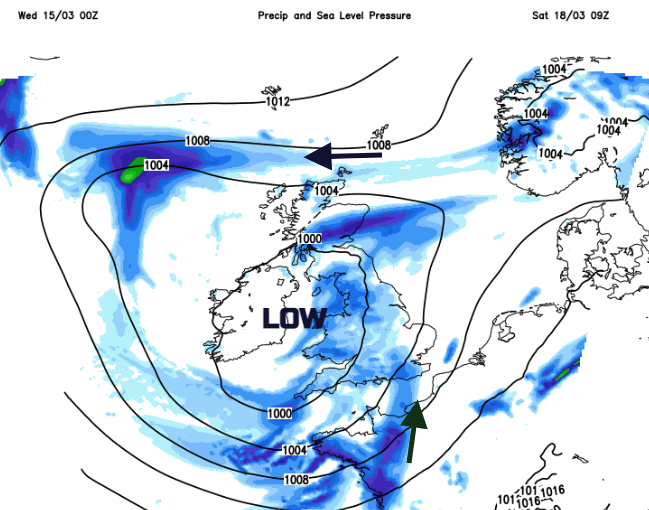
Showers and heavier bursts of rain then swirl around the low on Saturday. The far north of Scotland will be in colder air with a chilly east wind. Icy rain here will make the day feel cold and there could be more snow for the mountains. Elsewhere there will be a good deal of grey cloud, heavier bursts of rain off and on and a brisk southerly wind which could affect SE Britain on Saturday morning. For those standing out on sports pitches, playing or watching it will feel quite different to what the air temperature figure may suggest.
In between the showers, there will be chinks of warm sunshine or brighter spells but take a coat or an umbrella if you do happen to head out in a brighter slot. It is not likely to last. Glasgow and Belfast 10C, Manchester and Bristol 14C with London and Norwich up to 15C.
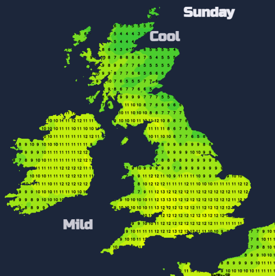
As the low pressure pulls away early on Sunday there will be a slight nip in the air for Scotland and NE England with a northerly wind. There should be bright or even sunny breaks appearing in the cloud through the day. This will make it feel warmer for a time with light winds although we’ll have to see how the next Atlantic fronts develop to end the weekend.