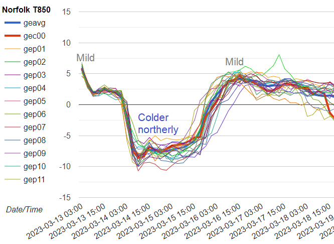
A cold northerly returns with snow and ice warnings for the next two days. Lying snow is mostly for northern hills but after Monday's rain, the ice risk is widespread. Mild and wet again later this week.
Monday saw a wild but mild start for England and Wales. It was very windy with gusts around 50 to 60mph in a brisk south-westerly flow. There were temperatures of 13C to start the day, reaching 15C by 11am in eastern England. The mild air was due to mild air from the SW following a warm front but colder air is set to return for a few days with snow & ice as a northerly takes hold.
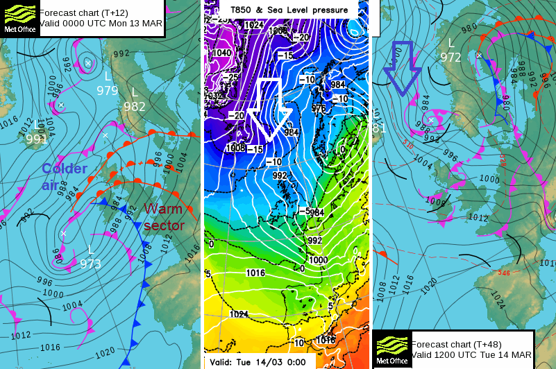
System clearing eastwards as colder Arctic air follows
There has been very heavy rainfall. This, combined with melting snow, has led to flood warnings and alerts appearing as river levels rise and surface water lingers. Monday’s weather is really mixed. We have rain, sleet and snow. A temperature range of 14C with sunshine and blustery mild winds for some, yet a chilly northerly and wet snow for others. Occluded fronts will edge southwards this afternoon and evening with heavier bursts from the Irish Sea over Wales, northwest England and the Pennines.
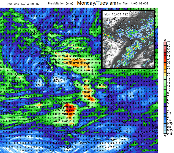
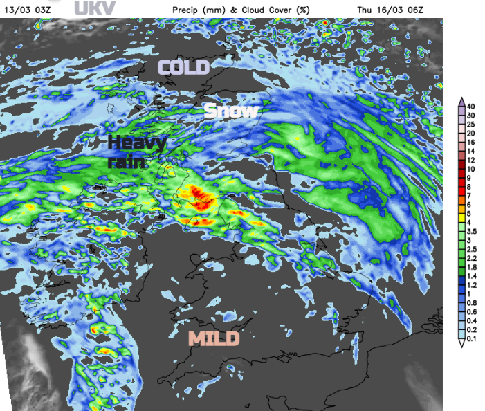
24 hour rainfall totals and 7pm Mon UKV rain snapshot
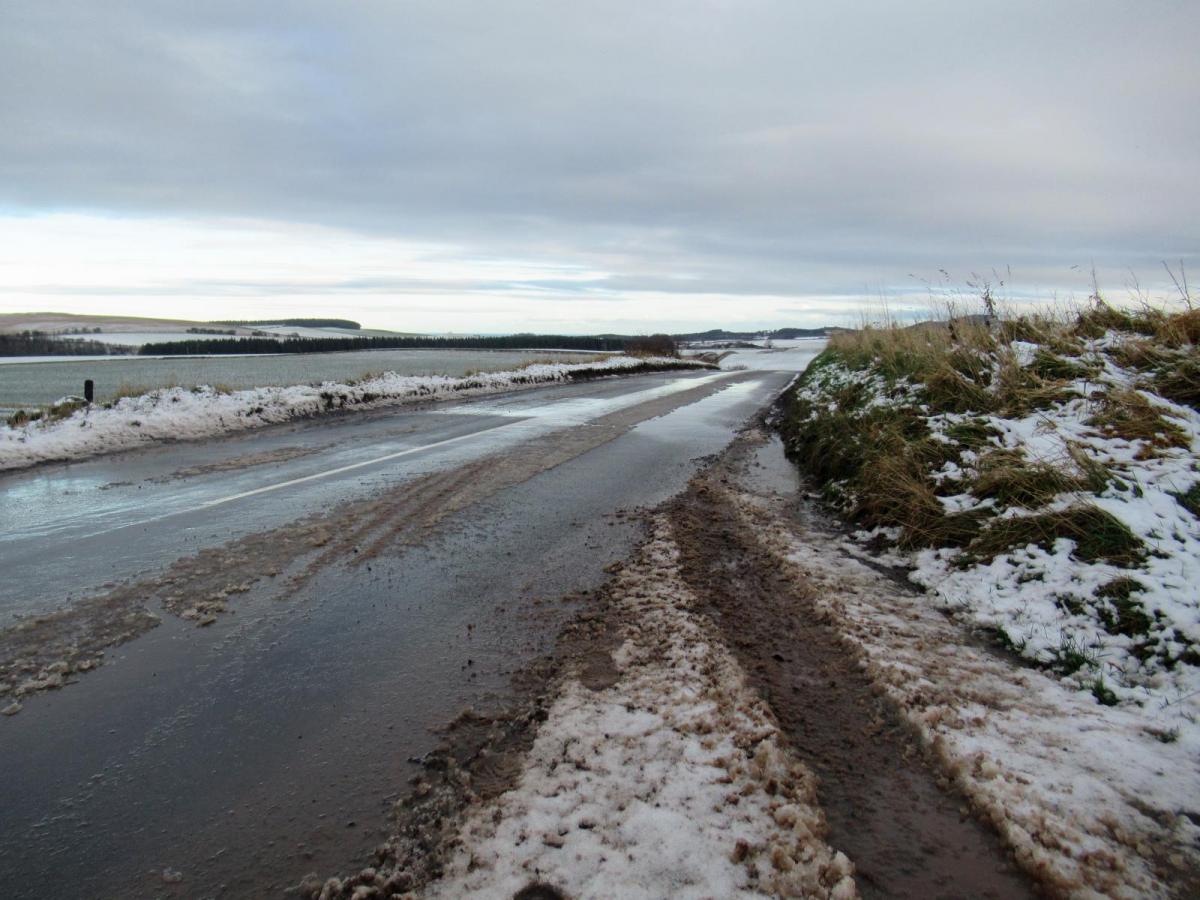
The main frontal band pushes south-eastwards into the night with more rain over central, then southern Britain. To the north showery bits turn to sleet and hill snow for Northern Ireland and northern England. There will be wet snow to lower levels for Scotland and several cms falling above a few 100m. The skies will then clear from the north and temperatures will fall away. There is a widespread risk of ice tonight with further snow showers from the NW. It will be a wintry night and after all the wet weather by day, conditions could be difficult.
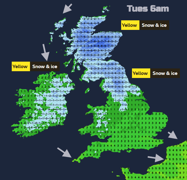
A cold and icy night with warnings from the Met Office as temperatures fall below zero
A band of cloud and rain, with sleet on the back edge and possible hill snow will stretch from south Wales across to Norfolk before dawn. This cloud may save the temperatures from falling to zero overnight but the colder air is on its way.
The last of the cloud and damp weather will clear SE England on Tuesday morning leaving cold sunshine for much of the UK. Clusters and bands of sleet and snow showers will work their way southwards. They will bring a white covering to some parts of Britain, with flurries for Northern Ireland. It will be worth watching the Radar to see what is on its way.
After another chilly night, Wednesday brings rising pressure and a dry fine day.
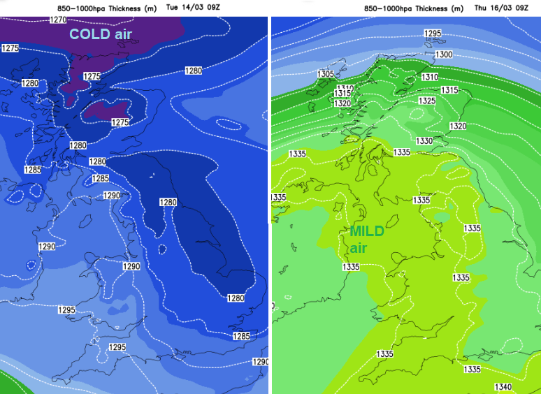
Change in thickness - colder air early Tuesday then milder air from the SW for Thursday
Temperatures fluctuate this week. Monday night will be cold and icy and Tuesday not as mild as Monday. It won’t be as windy but still, there will be a moderate westerly wind and temperatures of only 7 to 9C for much of southern Britain. 5 or 6C for Glasgow and Belfast
Wednesday will be a quiet day but an Atlantic front will reach southern Ireland by lunchtime with patchy rain extending over SW Britain and the Irish Sea during the afternoon. Northern Scotland will see an early frost before the high cloud reaches in. Rain, sleet and hill snow spill over Northern Ireland in the afternoon, then more of Britain through Wednesday night. Through the night the main snow will be over the high ground of Scotland and readily turn to rain on Thursday.
Further flooding concerns late this week as heavy and persistent rain affects SW/W Scotland, Cumbria, IOM possibly Northern Ireland.
Northern Scotland stays in the cold air but the rest of the UK will be mild with temperatures in double figures. The warm front and occlusion may straddle a swathe of Scotland through the day with heavy and persistent rainfall, which would bring further flooding issues. The cold front does force its way eastwards during Thursday. The mild cloudy weather ahead of it and brighter but showery conditions behind.
Friday looks even milder, with temperatures into the mid-teens in the south to SW wind. Greater London could see 15 or 16C. Northern areas will be cooler where the north wind persists.
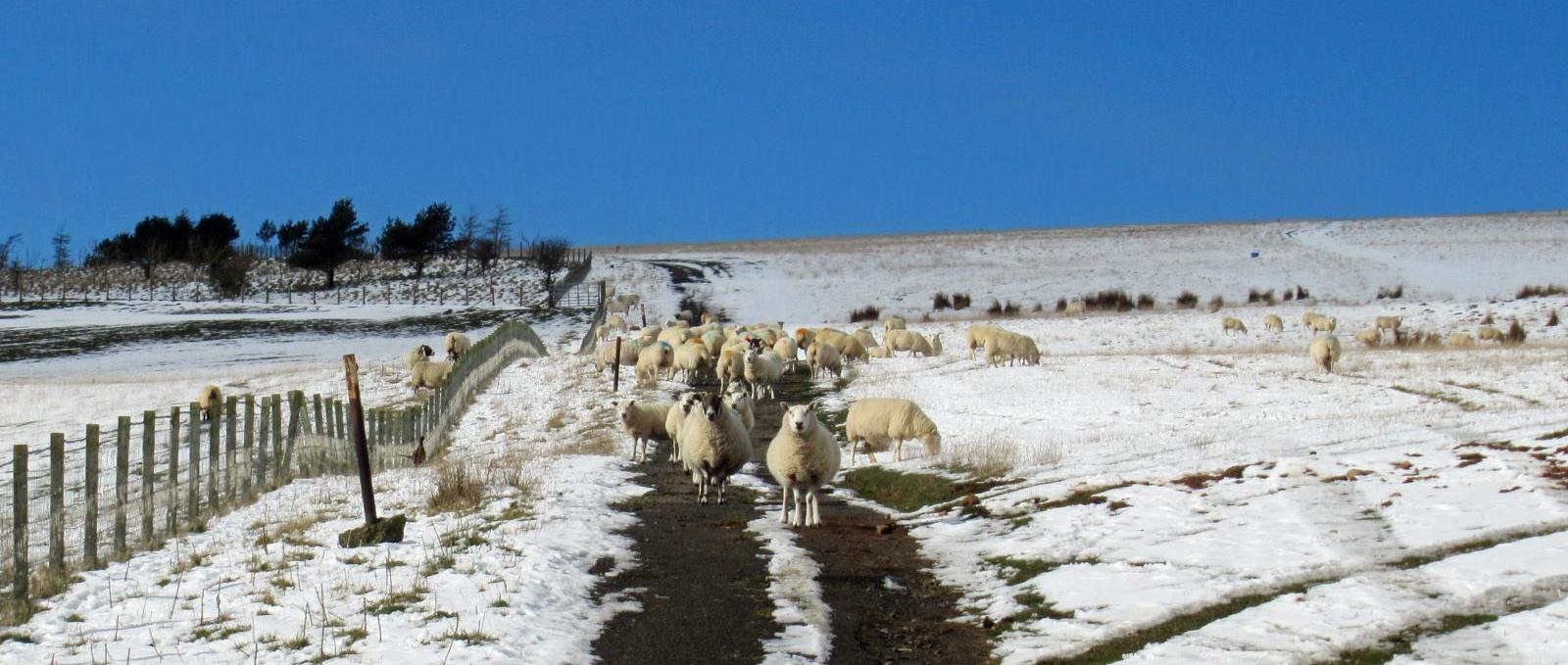
Harsh lambing conditions with this heavy rain, cold winds and snow
The weekend has lower confidence. The NMM model has a low centre over southern Ireland. The frontal boundary looks to persist into the weekend with a cold easterly wind for the northern half of the UK and further snow for northern Scotland. Further south will be mild, showery weather with little breeze.
The ECM model has a low centre to northwest of the UK, putting everyone in a cooler, showery regime. The UKV is in-between and has a lot of heavy showers for Saturday.
A look at the Netweather Spring forecast