


Dispelling the recent hype about an SSW, it has warmed up top, but not enough for a reversal that will work its way down to impact our weather. If anything, westerlies will strengthen next week, bringing unsettled & windy weather, at least to the north, but high pressure may fight back early February.
There has been some hype recently about a sudden stratospheric warming (SSW) and polar vortex breakdown perhaps leading to the Beast from the East. There has been a minor warming and deceleration of zonal winds towards the top of the stratosphere following the stronger than normal zonal winds earlier in January. However the vortex is forecast to recover from its recent deceleration and although zonal winds have reversed and turned easterly at the top of the stratosphere, they haven’t at and below 10 hPa (where if it had it would be a technical SSW), with no downward propagation of easterly winds towards the troposphere. This means the minor warming will unlikely impact the troposphere, where our weather happens, and reverse surface winds to bring high latitude blocking and cold easterly winds.
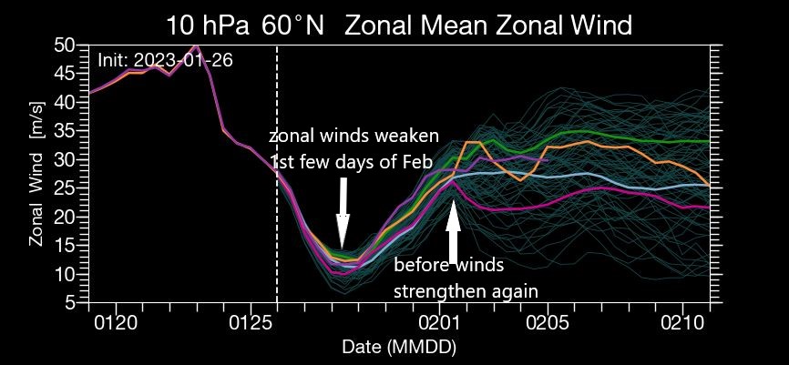
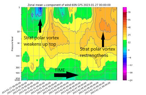
Conversely, a minor warming with wind reversal towards the top of the stratosphere can ‘flush’ down westerly winds that were present high up in the stratosphere, from when the stratospheric polar vortex was recently strong, towards the troposphere and actually strengthen the tropospheric polar vortex and the westerly flow over the mid to high latitudes. Indeed, the weather models have over recent days forecast a strengthening the tropospheric polar vortex over northern Canada and Greenland.
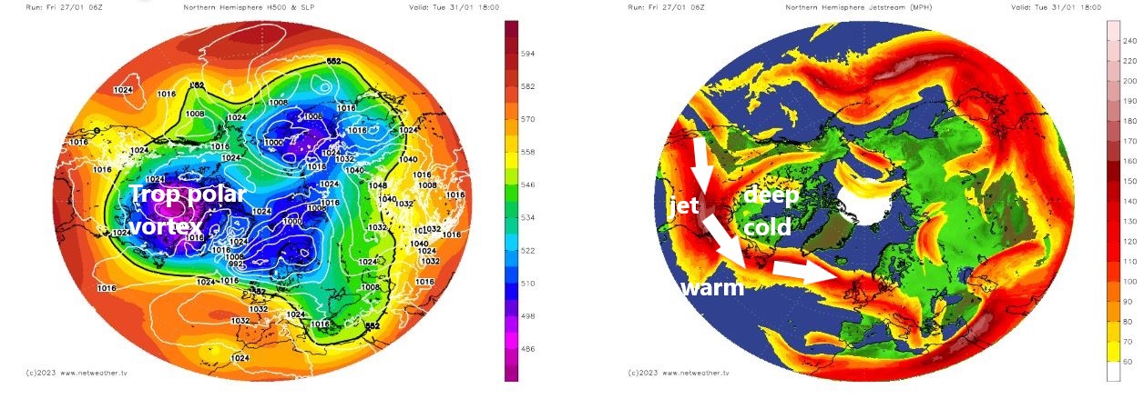
This strengthening of the tropospheric polar vortex over northern Canada and increasingly cold arctic air pushing down across North America looks to create an increasing thermal gradient over the far northwest Atlantic into next week. This looks to fire up the jet stream which will slowly erode the influence of high pressure across the north next week, after anticyclonic conditions bring dry and settled weather for most over the weekend.
Turning increasingly unsettled towards the north next week, as westerly flow strengthens, the south staying mostly dry though, high pressure returning late in the week.
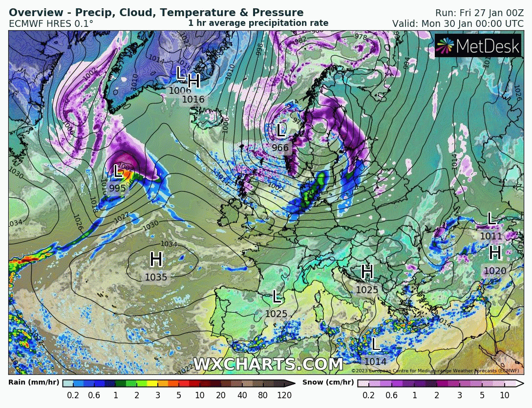
Next week will see a strengthening westerly flow as a result, particularly towards the north, as areas of low pressure moving west to east to the north of Scotland look to bring often windy conditions with spells of rain or showers. 00z ECMWF deterministic run this morning, like yesterday’s 12z run, brings a deep low close to the north of Scotland on Tuesday, bringing severe gales here. 00z GFS has a shallower low further north, yesterday's 18z GFS had a similar deep low and track to ECMWF. We have still yet to see the first-named-storm of the season, must be the latest without naming one, so quiet it has been. The Met Office name a new alphabet of storms each year, which seems pretty pointless I think, they may as well just carry on with the previous year's list until they get to Z.
ECMWF wind gusts for 6pm Tuesday next week
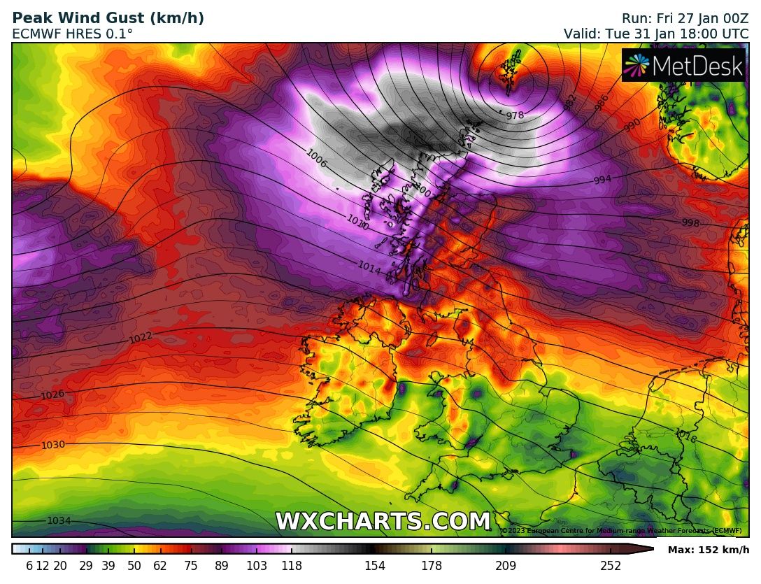
Also, the westerly flow next week could be cold enough across the north, as the strong westerly jet stream slips further south to run across central Britain, for snow over Scottish hills from wintry showers or more organised areas of precipitation.
However, southern areas look to stay mostly dry next week, thanks to high pressure holding on across the south, bar the odd shower / weakening front moving southeast bringing a brief spell of rain.
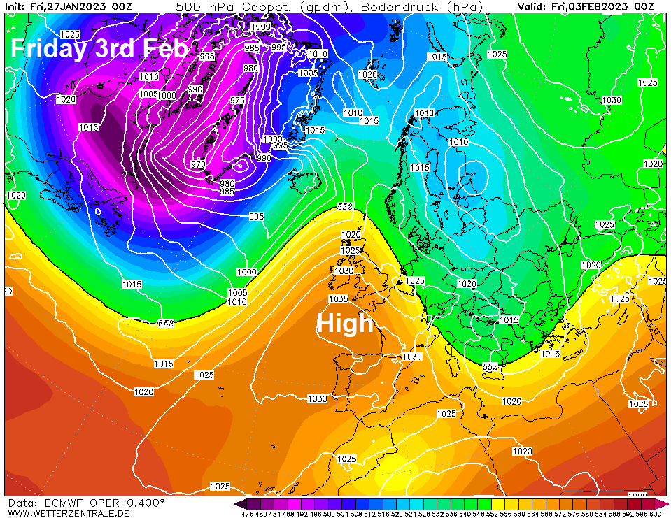
High pressure could become more dominant across UK later next week, building in from the south, so return of unsettled Atlantic westerlies could be temporary as we start February. Some recent GFS operational runs have even morphed the high building north and northeast into a Scandinavian high bringing a cold easterly flow in the extended range. But this is considered a small possibility for now. More likely that high pressure will be over the UK next weekend and into following week, but not ridging far enough northeast to allow an easterly flow.


