It’s been mild for much of England and Wales and rather wet since the beginning of the New Year, the Central England Temperature (CET) is currently running 3.9C above the January average (up to the 11th), while western parts of England and Wales have seen over a month’s worth of rain in the first 12 days of the month, with more to come in the next few days.
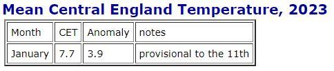
Source: Met Office
However, a pattern change is on the way over the weekend, as the recent zonal west to east jet stream buckles north upstream over the North Atlantic and orientates to flow more northwest to southeast. This will pull in colder polar air from Greenland and arctic northern Canada. The polar air when it reaches us on Sunday won’t be near as cold as it is there, thanks to being modified by the warmer North Atlantic Ocean temperatures, but by the end of the weekend it will make it feel much colder than we’ve been used over the last few weeks – enhanced by the brisk wind.
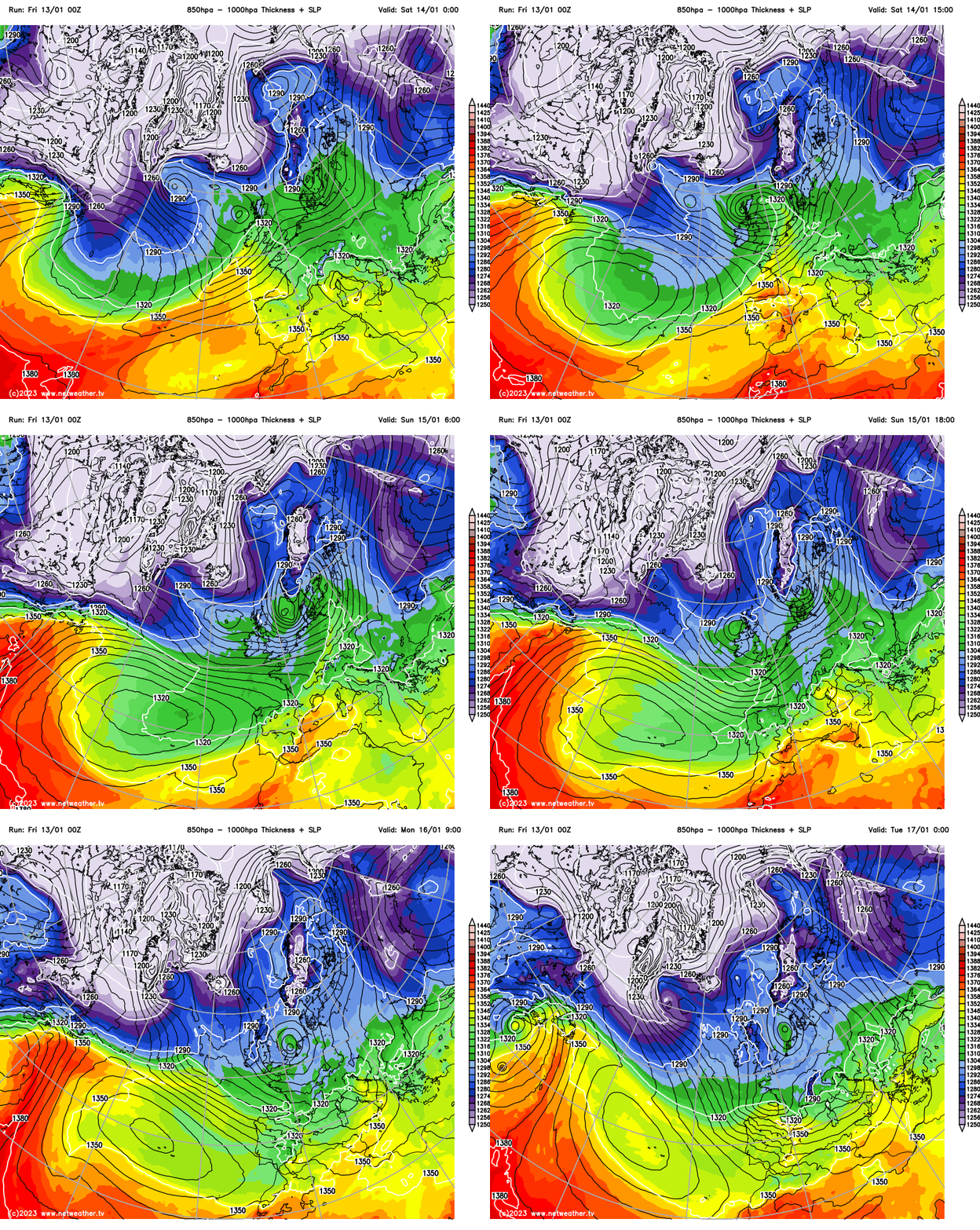
The air will become cold enough to support sleet and snow showers to lower levels across the north on Sunday initially, but increasingly colder air flowing in from the northwest and north early next week across all parts will mean snow will fall to lower levels across many parts, away from coasts, early next week. Areas of low pressure or troughs moving southeast near or over the U.K., could bring more organised areas of snow too. There will also be a widespread risk of frost and ice overnight, where skies clear, as temperatures fall below freezing
The cold northwesterly flow, perhaps veering northerly mid-week, will be generally showery in nature, which will favour northern, eastern and western coastal areas to see wintry showers, which look to fall as snow even to lower levels inland, though whether it settles away from high ground is less certain, night-time more likely, but may settle with heavier snowfall, especially with lighter winds. Some showers will get inland too in places and there looks to be a few lows or troughs tracking southeast with the strong upper flow early next week, but the track and timing of these features is uncertain at this range, with differences between models.
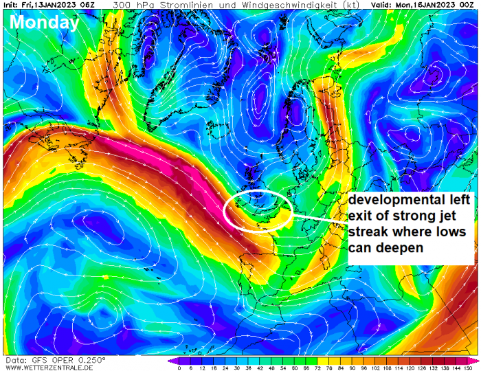
The models show a very active and developmental pattern across NW Europe early next week, with a deep cold polar trough sinking south into Europe, a main area of low pressure to the east and a strong northwesterly jet streak on its western flank forecast to plough southeast over the far north Atlantic towards the west of the UK and on into France and Spain. There is potential for 'secondary' lows to develop to the west and track southeast then east across England and Wales and if they engage the developmental left exit of the jet streak close to the west they may deepen too.
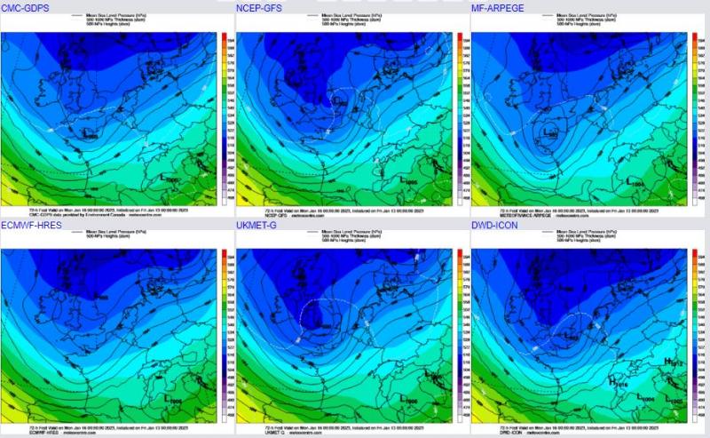
Recent model runs indicate a few potential lows early next week moving on the cold side of the strong jet close to the southwest and deepening as they cross close to or over southern Britain, but not all models agree on this happening. 06z GFS and 00z UKMO shows an area of low pressure developng in the southwest approaches Sunday evening before tracking northeast across England and Wales Sunday night and Monday morning, with perhaps a risk for snow on the back edge of the low as it clears east or northeast as cold air undercuts from the northwest. ECMWF doesn't show this low though. The models have been toying with the idea of another low tracking southeast across southern Ireland and SW England on Tuesday too, deepening as it does so. Model operational runs seem less interested in this possibility this morning, however, there is support from ensembles for this to still occur. Otherwise, low pressure moving over the North Sea and loitering early next week will drive the weather, with the northwesterly flow bringing sleet and snow showers across northern, western coastal areas and, at times, eastern coastal areas when the wind veers northerly.
00z Model operational run comparison for Monday 00z - some show a low over the south, some don't!
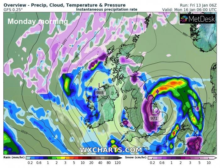
For now, with the models changing run to run over where lows or troughs may form and track in the northwesterly or northerly flow, it’s difficult to forecast any organised areas of snow early to mid-next week away from the wintry showers expected towards windward coasts.
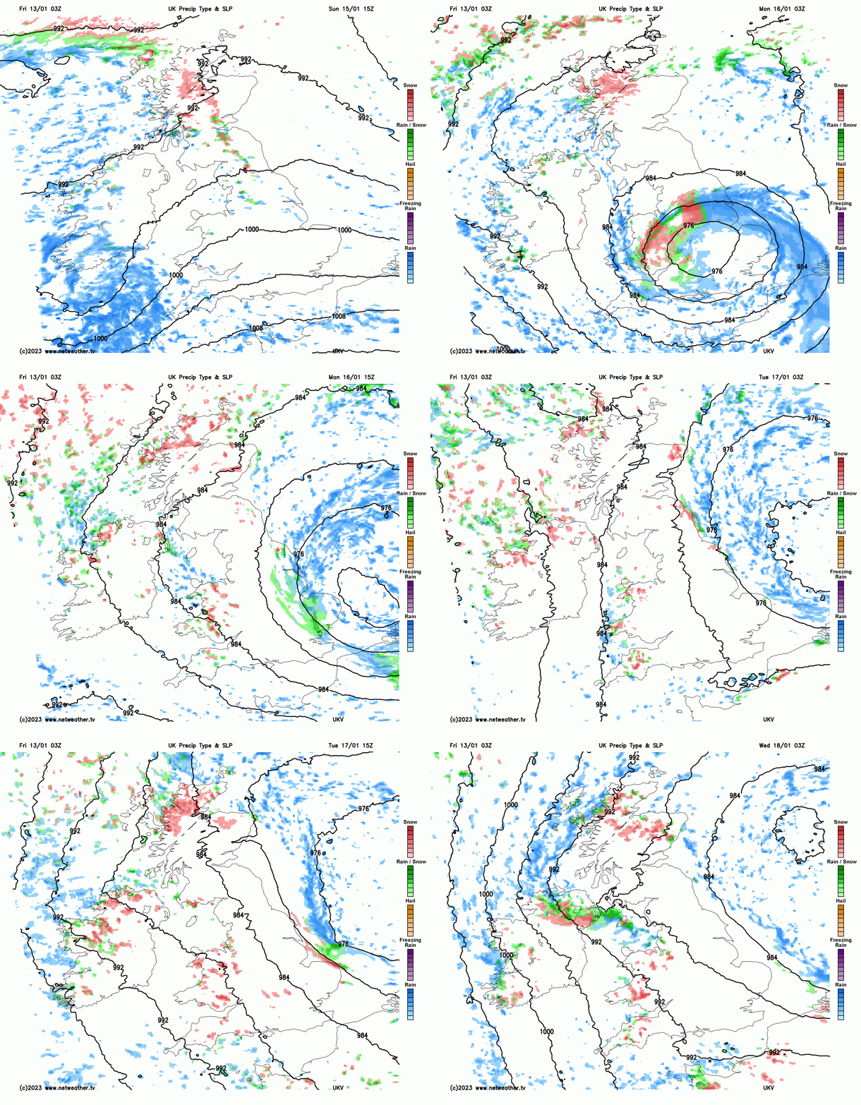
03z UKV shows a low crossing southern Britain Sunday night / Monday morning with perhaps back edge sleet/snow, followed by wintry showers through to Wednesday - especially in the west and coasts:
But stay tuned, we’ll perhaps get a better idea on Sunday, when the cold air arrives, to where it may snow next week, more especially the first half. The colder conditions look to break down later in the week, as the arctic flow is cut-off and winds turn westerly bringing in milder air and spells of wind and rain, but some uncertainty over timing, but most areas milder by the weekend.
Loading recent activity...