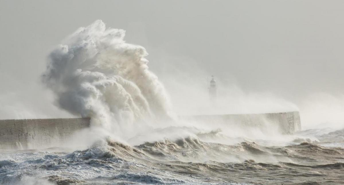
The deep cold air plunge from the arctic that brought the winter storm to parts of America before Christmas will retreat north and northeast from the USA allowing a warm-up over the next few days. But as it retreats northeast it will also spill out over the northwest Atlantic and will meet warm subtropical air spreading up from the Caribbean – increasing the thermal gradient and strengthening the polar front jet stream across the North Atlantic.
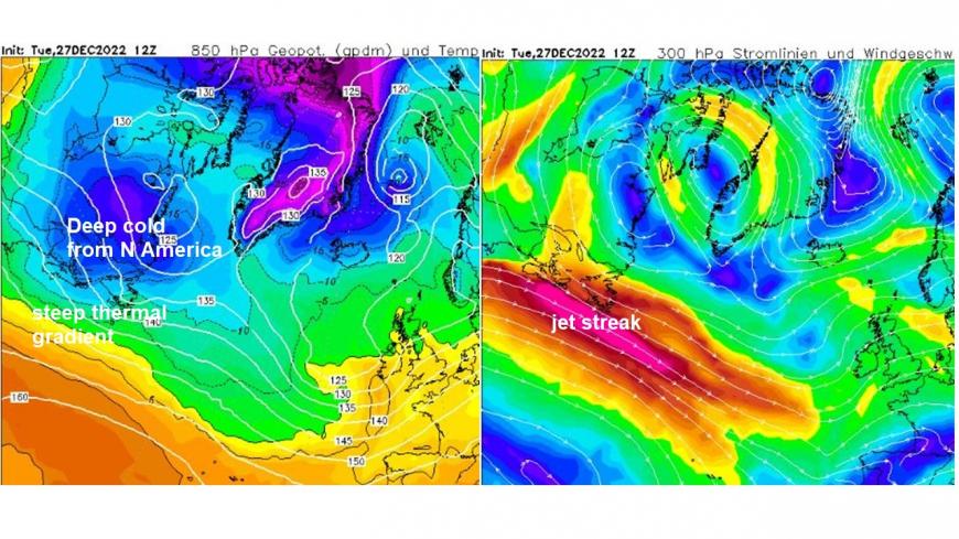
As a result, a strong jet streak, driven by the steepening thermal gradient upstream over the northwest Atlantic, will plough towards Britain by the end of the week. There will be a succession of lows moving northeast close or over northern Britain over the next few days, one today and one on Wednesday. But a third depression arriving close to the northwest on Friday we are keeping an eye on, because the weather models deepen this low in the developmental left exit region of a strong jet streak moving in from the west off the Atlantic later in the week.
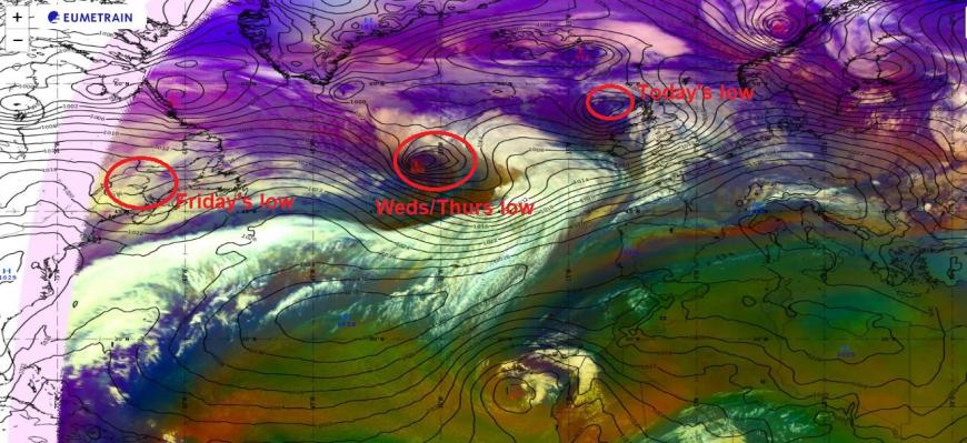
Friday’s low leaves New Foundland Wednesday as a fairly innocuous shallow wave low and rides the strong jet streak across the North Atlantic, but not in the developmental left exit or right entrance regions to the jet streak – where divergence of winds aloft cause convergence at the surface lowering pressure. However, as the low moves closer to the west of Ireland later on Thursday, it may move into the left exit of the jet streak and deepen, though not all models agree on it deepening. 00z ECMWF and 00z/06z GFS forecast a deep low passing over or close the north of Scotland on Friday morning, with a central pressure as low as 961mb. However, more recent 12z GFS shows a weaker low and, like some other model runs, shows a second low moving in from the southwest on a more southerly track quickly following in pursuit of the first low already described passing the northwest and far north. This second low perhaps causing the first low to be weaker as it phases with its circulation, with stronger wind gusts transfering to the southern side of the second low.
Potential for the low leaving New Foundland and carried by strong jet streak to move into left exit and deepen as it approaches and crosses UK on Friday, but uncertainty over track and depth for now
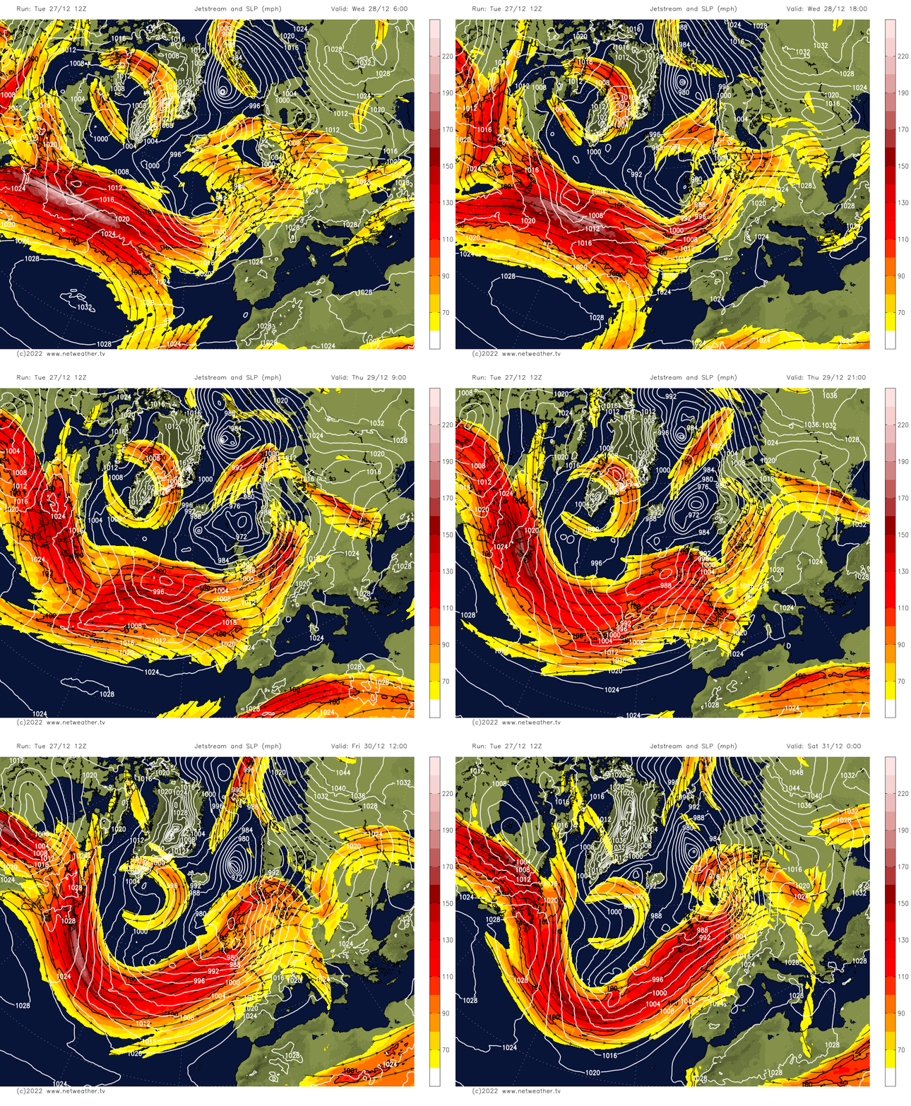
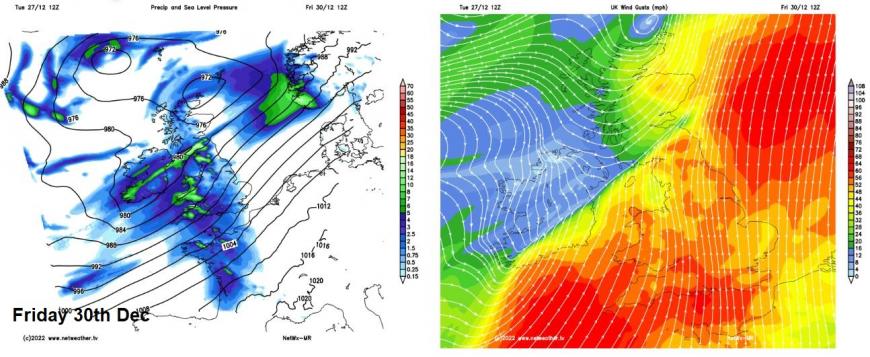
So, still some uncertainty for Friday over the track and depth of not just one but possibly two depressions moving in off the Atlantic and the resultant strength and location of strongest wind gusts. But Friday looks to be the windiest day this week, with potential for gusts of 60-70mph towards western and perhaps southern coasts, 40-50mph possible inland across England and Wales. So, I’d expect the Met Office to issue some yellow warnings for strong winds, but also warnings for rain as well – particularly across western hills and coasts.
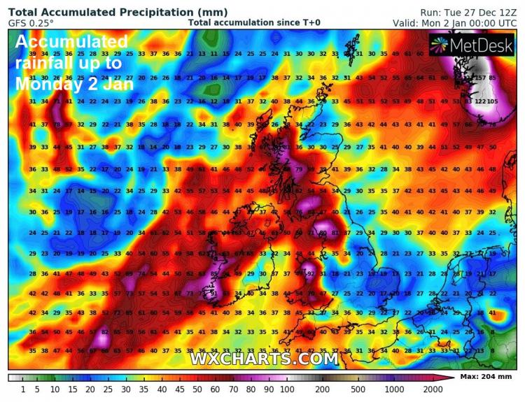
Another deep low arriving for New Year's Day?
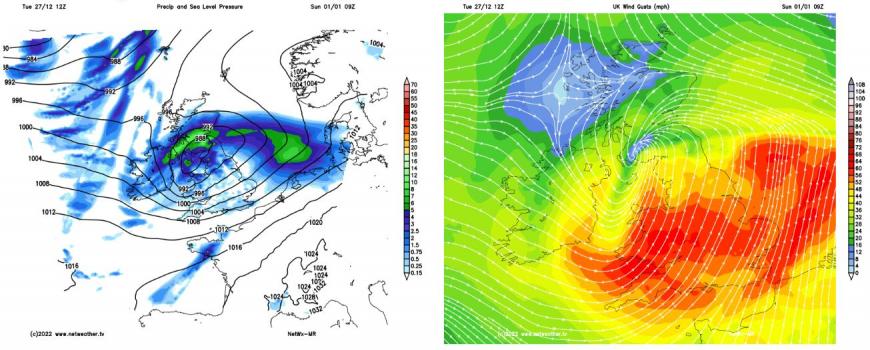
Potential for another deep low over the weekend heading towards the UK too, perhaps early New Year’s Day, as a confluent trough moves in from the west and potentially strengths the southwesterly jet stream ahead of it, which it turn, may allow a low to deepen in its left exit and move towards the UK as per 12z GFS, bringing gales or severe gales, though other models aren't so keen on deepening a low. So some uncertainty over the potentially for rain and disruptive winds over the weekend for now. But we are keeping a close eye on them.
Loading recent activity...