Thought I’d take a look at the weather over the period between Christmas Weekend and the New Year when lots of people will be travelling to visit relatives or go on Christmas breaks.
In summary, it will be a green Christmas for most. Mostly mild Christmas Eve through to Boxing Day, with some sunny spells but also showers towards southern and western coasts, occasional longer spells of rain will move through too, particularly Scotland and the far south. It will turn colder briefly from the northwest later on Christmas Day across Scotland then across all parts on Boxing Day, but with some decent sunny spells. Sleet and snow showers affecting the far northwest later on Christmas Day, perhaps to lower levels for a time and continuing into Boxing Day. Tuesday through to New Year looks to remain rather unsettled, often windy and becoming mild across all areas in a generally southwesterly flow, as a succession of low pressure systems roll east close to the north, bringing spells of rain or showers across all parts.
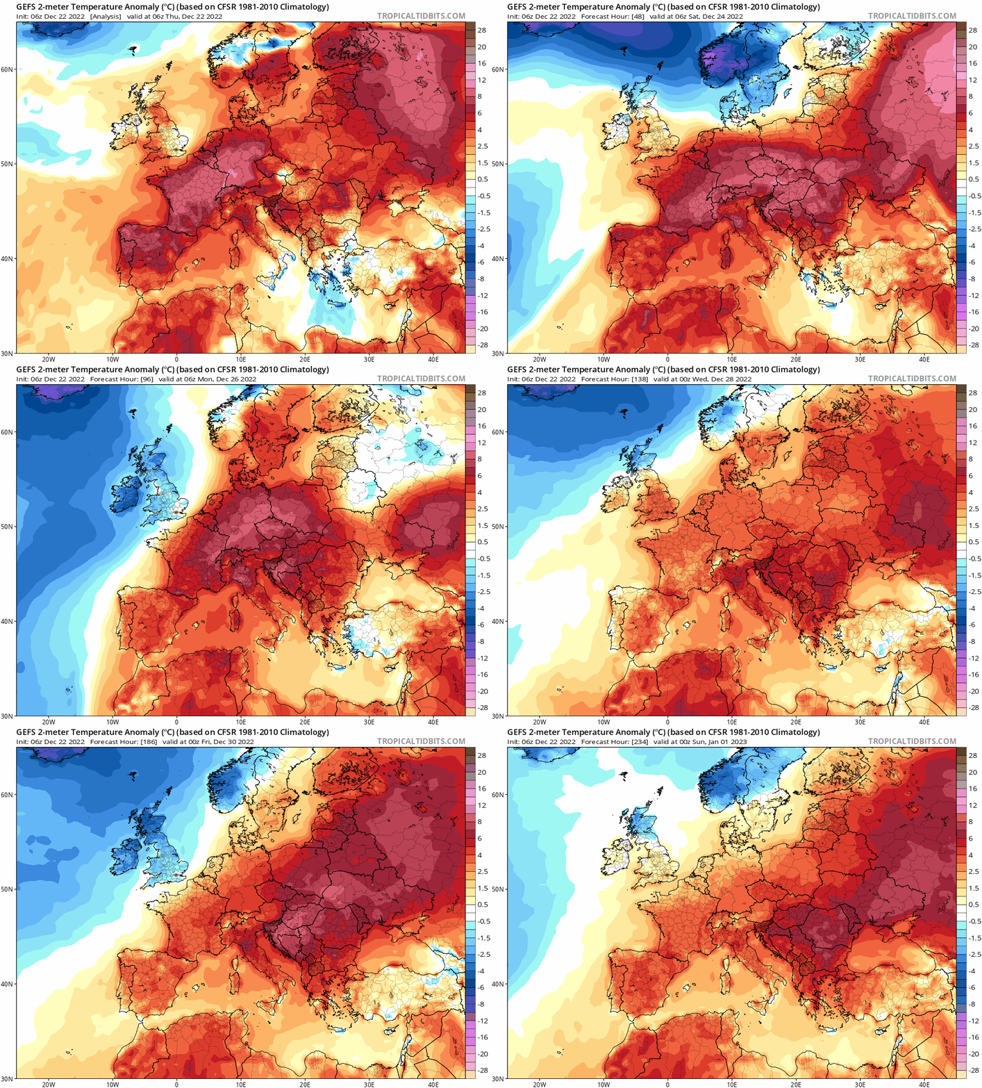
Mild until Boxing Day when it turns briefly colder from the northwest, then remaning mild in the south through to New Year, though northern areas perhaps cooler later in next week.
In more detail:
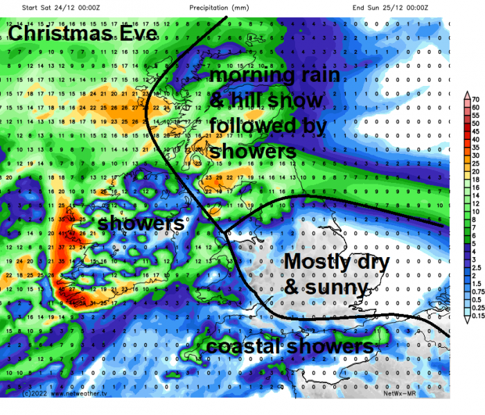
Christmas Eve will see a fairly deep low pressure system centred west of Ireland, which will bring a strong southwesterly flow across most of the UK. A band of rain and hill snow (for a time) will clear northeast across Scotland first thing, sunshine and blustery showers following, showers most frequent towards western and southern coastal areas. Perhaps a more persistent spell of rain spreading northeast from N. Ireland then over Scotland in the evening.
Christmas Day and it’s looking green and mild for most. A fairly deep area of low pressure to the west of Ireland to start the weekend is forecast to move northeast past or over northern Scotland on Christmas Day. For most it looks dry, bright or sunny, but showers along western coasts, which look to merge into a spell of rain which will spread east in the evening and overnight. There is a chance of more organised rain spreading northeast across SE England and East Anglia too, but some uncertainty over this occurring for now. It does look to turn colder from the northwest across Scotland in the evening, as a front bringing rain clears east, cold enough to for wintry showers to move in across the far northwest to fall as snow across northern and western Scotland and perhaps higher ground elsewhere in the north overnight. So it could still be a White Christmas in the far north and northwest.
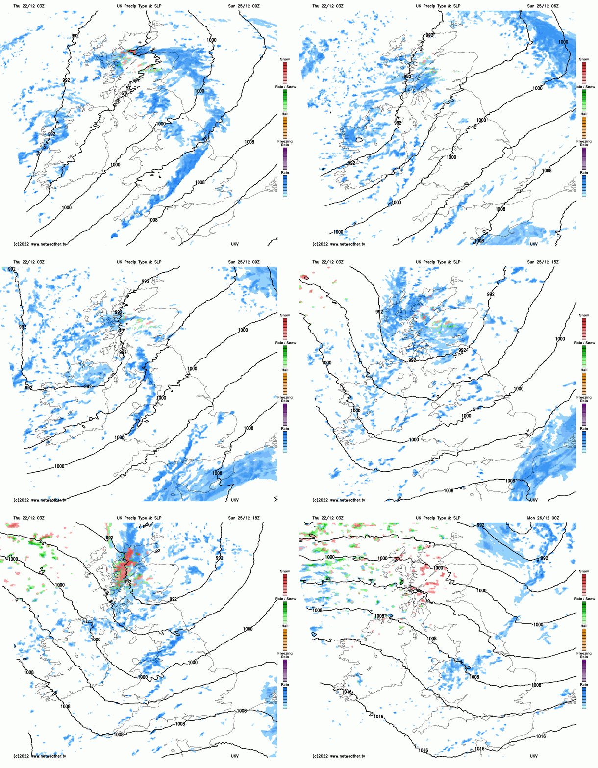
Boxing Day looking breezy, bright or sunny and colder, though nowhere near as cold as it was last week. Most will stay dry, though western coastal areas and the north of Scotland likely to see some showers, which will be wintry across the north, with snow falling to lower levels inland in the northwest. Chance of more rain across the southeast, but some uncertainty over this occurring.
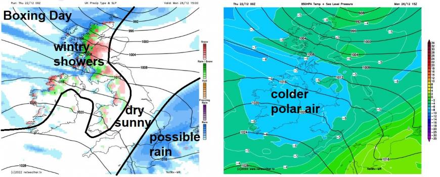
The colder conditions on Boxing Day will be a brief visit, as the next low pressure system moves in from the Atlantic and passes northern Scotland on Tuesday, bringing milder southwesterly winds behind a spell of wind and rain, with hill snow across Scotland, clearing east across most parts during the day.
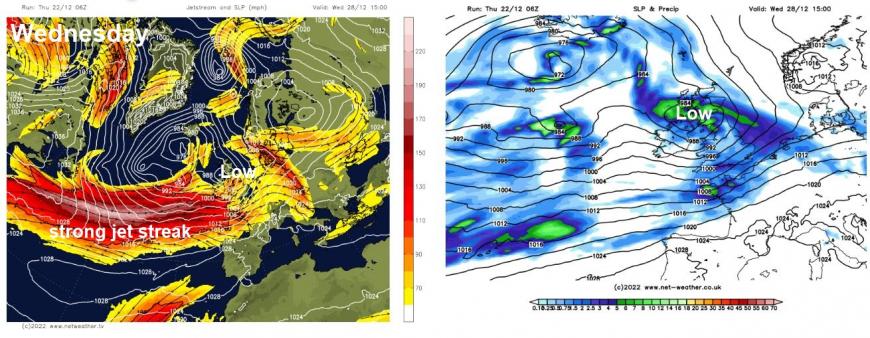
Potentially wet and windy again on Wednesday, maybe gales, as models indicate a very strong westerly jet streak arriving from the Atlantic on Wednesday, which will have the potential to bring a deep low northeast close or over northern Britain. Despite the wind and rain or showers, it will likely be mild.
Westerly jet stream in charge next week, bringing low after low with unsettled and often windy conditions, though jet stream may sink south later to allow less mild conditions, especially further north
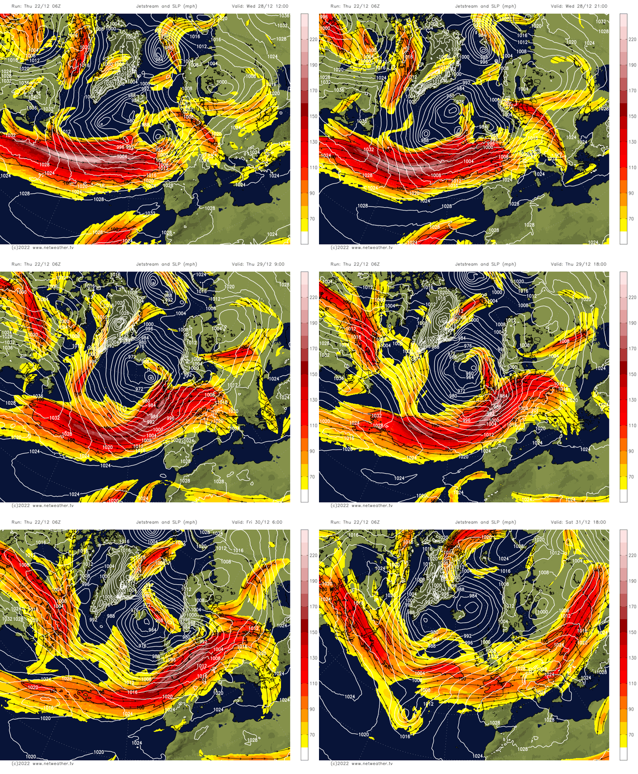
It’s looking windy with spells of rain or showers crossing most parts Thursday, Friday, New Year’s Eve and New Year’s Day. However, with the jet stream sinking further south, perhaps to the south of Britain, it may turn a little less mild, though temperatures still around or a little above average in the south, but could turn briefly colder across Scotland for some hill snow with any showers or longer spells of rain moving through.
Loading recent activity...