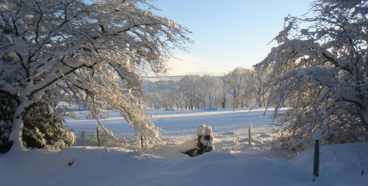
Heavy snow yesterday evening across parts of SE England is leading to travel disruption this morning, with rail delays, a stretch of the M25 shut north of London due to snow and delays at airports – with cancelled flights. Some treacherous driving conditions for the morning commute here but also across other parts of the UK where snow fell on Sunday, such as the West Country and western Scotland, with some icy conditions on untreated roads.
A very cold start to Monday. It’s been the coldest night since January 2021, with the temperature falling to -15.6C at Braemar in Scotland. Temperatures well below freezing across much of Scotland, NW England and Wales before dawn – where skies have cleared. Temperatures around or a few degrees below freezing across central, southern and eastern England – where there’s more in the way of cloud, with mist and freezing fog in places.
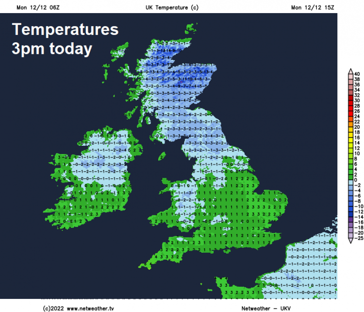
A cold day for all today, but dry for most. Freezing fog patches across central and eastern England could linger in some spots, but generally mist and fog should slowly lift this morning. Cloudy skies this morning lingering for much of the day across southern, central and eastern England – keeping temperatures rising much above freezing, 1-3C at best. The cloud will be thick enough to produce the odd flurry of snow, but generally staying dry. Perhaps some brightness developing later in the south. Elsewhere, for Wales, northern England, Scotland and N. Ireland - a brighter picture and generally staying fine and sunny though there will be some wintry showers around coasts in the north, particularly western Scotland.
Very cold tonight, with a widespread hard frost, particularly over the snow fields. Temperatures falling as low as -10C in the Highlands of Scotland, as low as -4 to -6C elsewhere across Scotland, England and Wales. Dry for most away from coasts, where there is a risk of wintry showers. Freezing fog could form across Wales, N. Ireland, central and northern England, risk of ice on untreated surfaces.
All areas starting off cold and frosty on Tuesday. Some freezing fog patches too across central areas. Fog generally becoming confined to northern England through the morning, where they may linger in places. Cloudy skies spilling north across much of Wales, central, southern and eastern England through the day. Scotland and Northern Ireland staying dry and sunny generally, though some sleet and snow showers will affect northeast Scotland and later the far north of Scotland, as winds turn northerly here. Everywhere cold, temperatures inland struggling to get above freezing, especially where there’s snow cover, perhaps 2-3 at best in the south. Milder in Cornwall though.
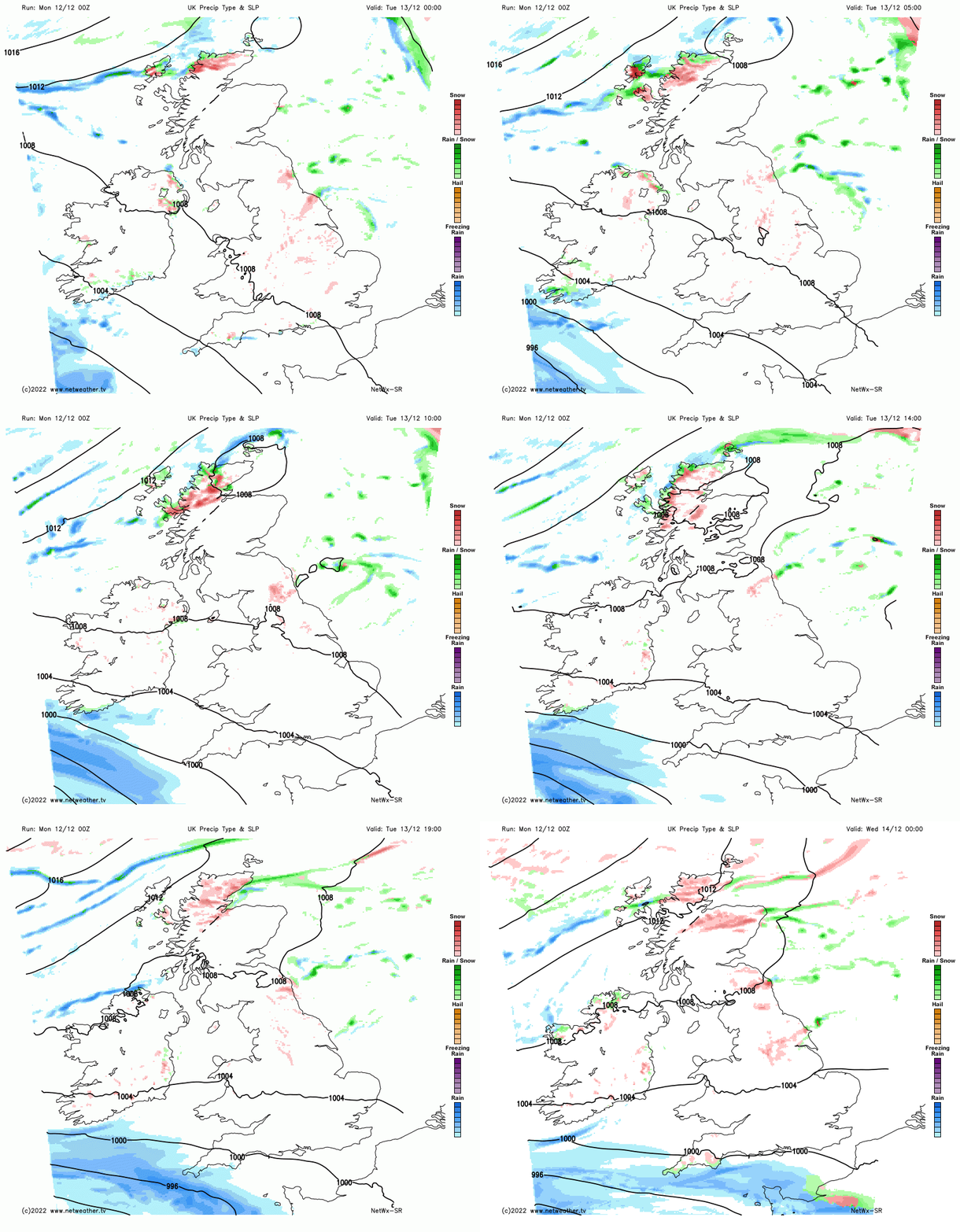
Tuesday evening likely to see some rain push in across Cornwall and south Devon, turning to snow over the Moors before clearing Wednesday morning. Low chance that the rain will reach further north into southern coastal areas further east, where it would turn to snow inland. Other end of Britain a strong cold northerly wind will develop across Scotland Tuesday night, bringing increasingly frequent and heavy snow showers to northern and eastern Scotland – where they will continue through Wednesday, perhaps fringing coasts of NE England too. A Met Office yellow warning is in force.
Otherwise, dry with a hard frost elsewhere to start Wednesday – cloudy in the morning across the south, rain and hill snow clearing the far southwest, then sunny conditions across the north spreading to most parts in the afternoon. Cold everywhere again, highs of 1-3C at best, 4-5C along coasts.
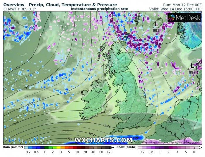
Source: wxcharts.com
After another frosty night, snow showers easing in the northeast on Thursday, as winds back more northwesterly, but wintry showers increasing towards coasts of Western Scotland and north coast of N. Ireland. Otherwise a dry and fine day with plenty of wintry sunshine with good visibility.
Friday likely to see an area of low pressure and associated fronts moving in from the west off the Atlantic bring some sleet and snow across Scotland, rain towards western coasts. Could bring several centimetres in places, which may lead to some travel disruption. Otherwise, England, Wales and N. Ireland will be mostly dry, fine, bright or sunny, though some coastal wintry shower possible in the west.
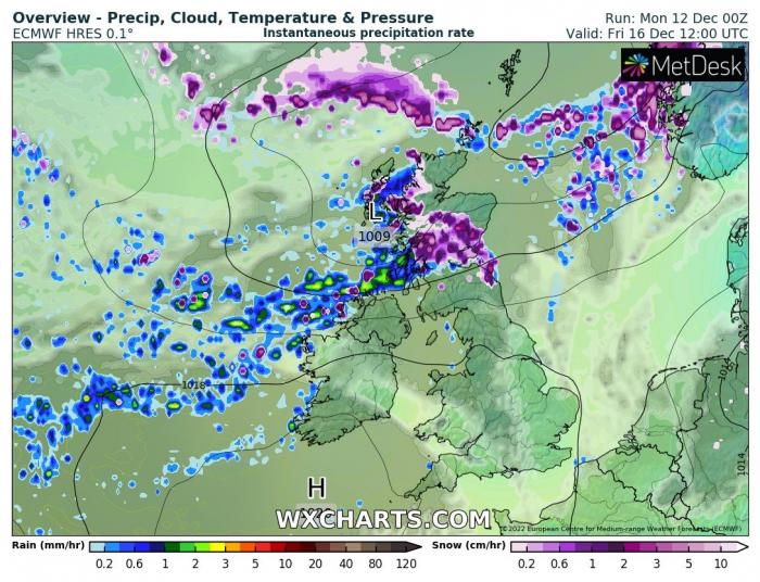
Source: wxcharts.com
Perhaps further sleet and snow on Saturday across Scotland, particularly the north and west, elsewhere dry, cold and bright. Sunday may start to see a change across all parts from the west. After a bright and frosty start, clouding over from the west, with outbreaks of rain, preceded by snow in the north and east and accompanied by strengthening southerly winds, spreading across most parts. Turning milder too for many.
Loading recent activity...