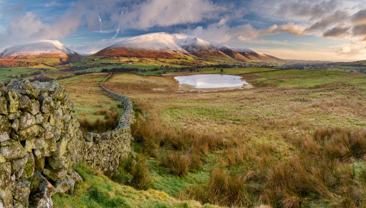
Forget the exceptionally mild air of last weekend, it is turning colder. Back to where we should be for mid-November. A touch of frost by night and even mountain snow, UK temperatures are falling.
Last weekend the top temperature was 21.2C, 70F in NW Wales. This weekend many places will be around 8 or 9C by day. Later this week cold air will move in from Iceland and then Greenland so daytime temperatures will fall away. There will also be frost by night and even some snow for the highest hills and mountains.
Back to where we should be really for mid-November.
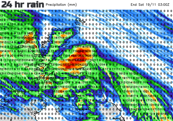
We need to add rain and blustery winds into that picture. The ground is already wet in places and there is a lot of rain in the forecast before Saturday. So, if you are planning a weekend walk, hike or bike ride do be aware that the ground could be rather soggy.
There are flood alerts and warnings already out, before the next soaking and eastern Scotland will continue to see heavy rain and the risk of flooding over the next few days. It has been so mild recently that where any wintry flurries do appear they aren’t going to settle for long by day.
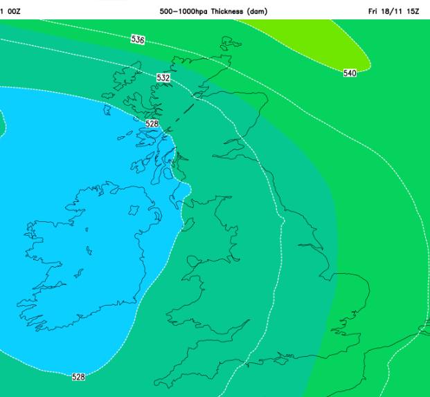
There are even more bands of heavy rain moving through at the weekend, west to east with more chance of seeing snow over the highest ground of northern Britain as that colder air takes hold. The 528 dam line on the 500-1000hPa thickness charts (the vertical distance between two pressure levels 1000 and 500 hPa levels) is a rule of thumb type forecast. If you see that cold air over the UK, you could see something wintry in the forecast. Snow is possible in the colder, more dense air which moves over Northern Ireland, the Irish Sea and NW Britain during Friday night. There are also signs of hill snow during Saturday night on the leading edge of frontal rain moving across Scotland.

The last of the wet weather will be moving away north-eastwards, but still over northern Scotland to end Friday with ongoing strong SE winds for Shetland. The two main high pressure areas will be in place this weekend. The Scandi high, just perhaps a bit to the northeast of Scandinavia and the Azores High which will push a ridge of high pressure towards southern Britain. This will subdue many of the showers over the UK later on Friday and overnight, heralding lighter winds and allowing mist and fog to form.
It is a mixed picture for Friday evening with clearing skies in the south, more cloud further north and the last of the frontal rain over Scotland. NW England will keep murky damp conditions and there will be showers brushing Cornwall. Northern Ireland does look dry and calm.

Saturday should start off fine and bright but nippy for most of Britain. There will be the odd shower for the west coast, maybe also along the south coast of England but overall, a fine Saturday morning. An old frontal band will bring more cloud to NE Britain and perhaps still nuisance rain for eastern Britain until lunchtime. High cloud will increase over Northern Ireland during the afternoon as another frontal band approaches from the Atlantic and the areas that had seen Saturday sunshine will become more cloudy. This cloud cover will save the overnight temperatures from falling too low.
The GFS model has the Atlantic rain arriving earlier than the Met Office model and so that would bring windy weather to Ireland and western Britain on Saturday afternoon with rain for Belfast as well. The ECM model brings the main rain over N.Ireland during Saturday evening with gusty southerly winds. So, another band of significant rain trudges its way across the UK on Saturday night. Any snow looks to be confined to the Scottish mountains but there could be a slight covering for other high ground in the north.

Early on Sunday the rainband will be over eastern Britain and clear away over the North Sea. Behind this, it will feel fresh again with a brisk westerly wind and cool, damp air. There will be showers to start the day with some wintry flurries over the NW Highlands, the Cumbrian Fells perhaps and even the tops of the Welsh mountains. The wind will blow rain showers onto exposed coasts but many parts will be fair and bright, just feeling colder. Temperatures will range from 8 to 13C.
Forecast for your location Will it snow?