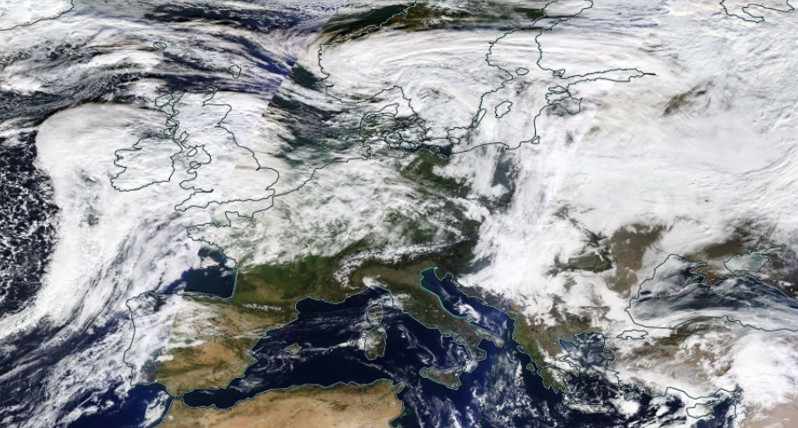
Florida and the Bahamas are watching Nicole which on Tuesday 8th November was still a Subtropical Storm. There are Tropical storms and Sub-Tropical or Post Tropical storms, before and after. “NICOLE FORECAST TO MAKE A TRANSITION TO A TROPICAL STORM AND BEGIN STRENGTHENING LATER TODAY” NHC Tues 8th
Update 9th Nov - Nicole is now a Tropical Storm
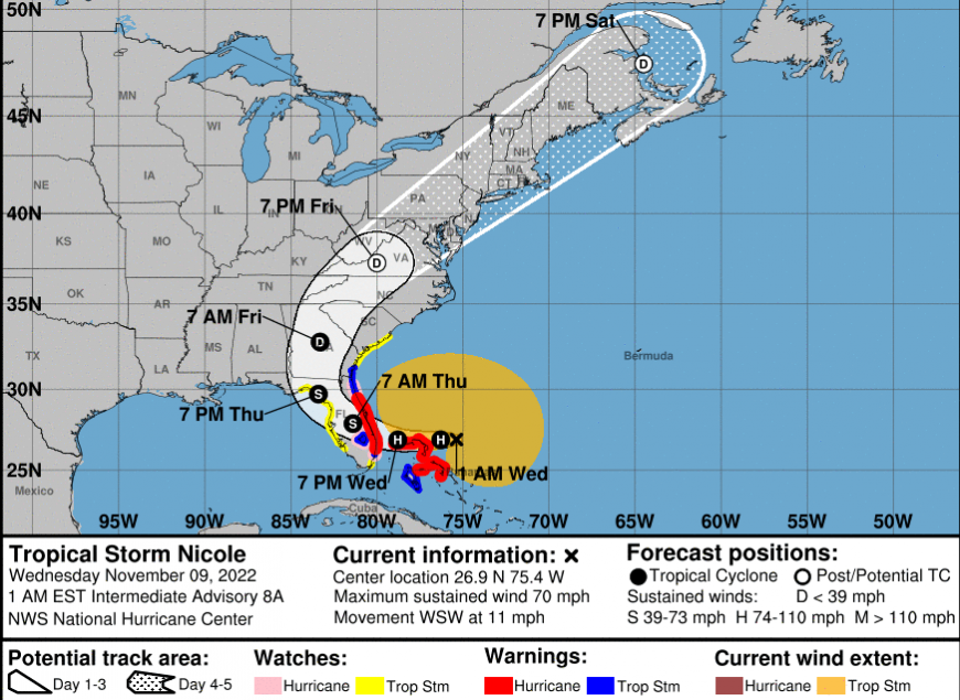
From NWS and NHC - Subtropical Storm Nicole continues to approach the Florida peninsula and is forecast to strengthen to a Hurricane when crossing the northwest Bahamas. Hurricane conditions and a dangerous storm surge are expected in portions of the northwestern Bahamas on Wednesday. It is a large storm and a dangerous storm surge is expected along much of the east coast of Florida and portions of coastal Georgia. The storm surge will be accompanied by large and damaging waves. The centre of the storm is expected to make landfall in Florida late Wednesday then track northwest across the state before curving to the northeast and moving up along the East Coast.
EUROPE
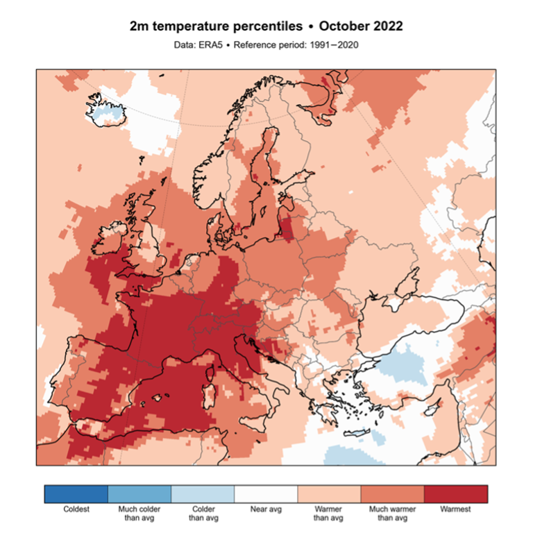
As CoP27 starts in Egypt with representatives from around the world, Europe reflects on its warmest October on record, with temperatures nearly 2°C above the 1991-2020 reference period.
A warm spell brought record daily temperatures to western Europe, and a record-warm October for Austria, Switzerland and France, as well as for large parts of Italy and Spain.” Copernicus
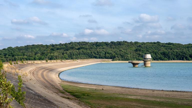
People across Europe are still wondering about the ongoing warm air with comments varying from “really quite mild for the time of year” to “isn’t it weirdly warm?”. October was very warm for southern France, Italy and AEMET the Spanish Meteorological service said that October 2022 was the warmest October since 1961 with an average temperature of 18C. Not only has it been hot, but it has been dry. AEMET said “it was the fourth least rainy October of the 21st century” looking at Spain as a whole although NW Spain did have a more usual amount of rain.
AEMET are concerned about a low pressure developing at the western end of the Mediterranean on Thursday. Thundery showers and heavy downpours are expected. 'It is a typical autumnal situation, not extreme, but locally it can be adverse and we must be attentive to possible incidents, such as floods of dry riverbeds or accumulations of water in low-lying areas.' This often occurs at this time of year with flooding for many well known summer resorts.
Copernicus "In October 2022, it was drier than average over most of southern Europe and the Caucasus. Elsewhere in Europe, over north-western Iberian Peninsula, regions of France and Germany, UK and Ireland, northwest Scandinavia, a large region of Eastern Europe, and central Türkiye, it was wetter than average."
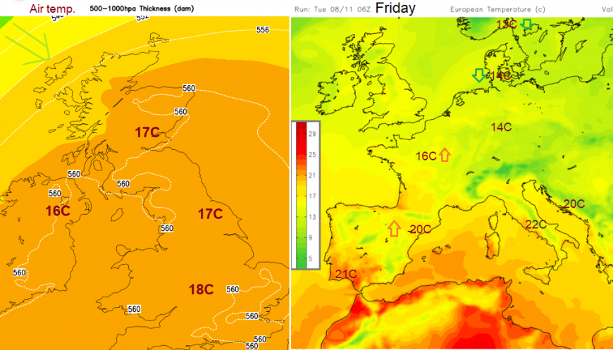
Another pulse of very warm air is forecast to move towards the UK on Friday and across Denmark and other parts of southern Scandinavia. This will lift the temperatures as high pressure builds over central and southern Europe. The flow of warm air continues from the southwest with a slight lull in the wet and windy weather over more northern parts of Europe to start the weekend. Barcelona and Paris will see their temperatures creeping upwards during the weekend in this warm flow.
Greenland had its warmest September on record, bizarrely warm but is now daily sub-zero at about -7C in Nuuk this week. Canada is also getting colder and finally beginning to see snowfall. There are warnings for Vancouver Island and Manitoba near the Great Lakes.
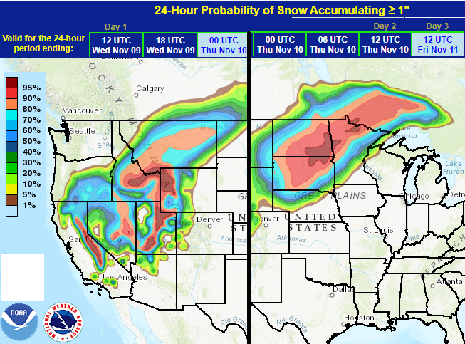
From NWS - In the US, a powerful storm is forecast to slam California on Tuesday with rain, flooding and mountain snow. Heavy rain and flash flooding is likely across parts of southwestern California on Tuesday with heavy mountain snow to continue through Wednesday for the Sierra Nevada, Intermountain West, and northern Rockies. Heavy snow and blizzard conditions are possible for the Plains, Wednesday through Thursday. Winter Storm Warnings are in effect.
We have the beginnings of colder air in the north moving across the north Atlantic and coming up against this warmer SW flow. The amplified Jetstream then aids low pressures which deepen and run towards NW Europe bringing more wind and rain. Denmark has not seen much frost yet so far this season in the mild air. The Alps have seen some snow, as have the Pyrenees.
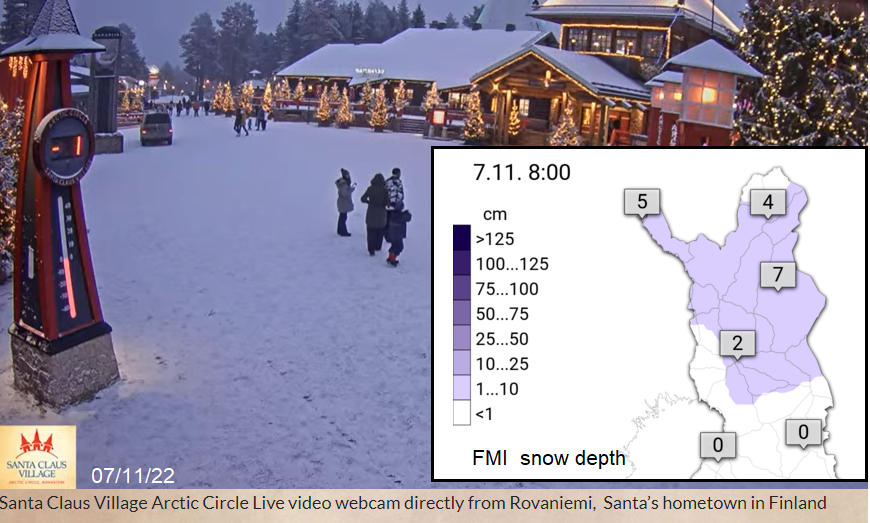
There is also a covering of snow in Lapland now, so good news for Santa’s preparations. The UK monthly forecast is just out which includes the start of December with "signs that we may see generally cold weather developing into early December."
Top image NASA WorldView 7th Nov 2022
Loading recent activity...