Low pressure close to the west over next few days will bring windy and unsettled conditions through to mid-week, with spells of rain or showers. Turning drier and warmer for England & Wales from Thursday, as high pressure builds, still some rain in the far northwest.
It’s been a very wet start to November for some parts of the UK, with some locations in SE England already recording double the monthly average rainfall in the first 6 days. More rain is on the way over the next few days, and it will become rather windy too, as low pressure remains close to the west and northwest, bringing bands of rain or blustery showers northeast across many parts, though the showers tending to be most frequent across southern and western parts, eastern areas escaping many of the showers.
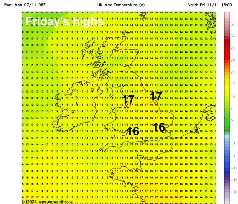
However, from late Wednesday through into the weekend, further rain trying to move in from the Atlantic will be thwarted by high pressure expanding over the near continent and in across the UK, confining rain to Scotland and the island of Ireland, England and Wales turning drier, sunnier but also warmer too – as we draw air from near the Azores. Temperatures reaching as high as 17C across parts of England and Wales on Thursday and Friday.
Watch how warm air dragged northwest from near the Azores to the UK on Thursday and Friday, bringing unseasonably warm temperatures
For today, a wet morning commute or school run for some. A warm front is pushing northeast and bringing a swathe of rain across Scotland and far north of England, while showery rain trails back southwest along a cold front across the island of Ireland. Further south, showery rain along a trough, locally heavy, will spread northeast across southern areas of England and Wales for a time this morning.
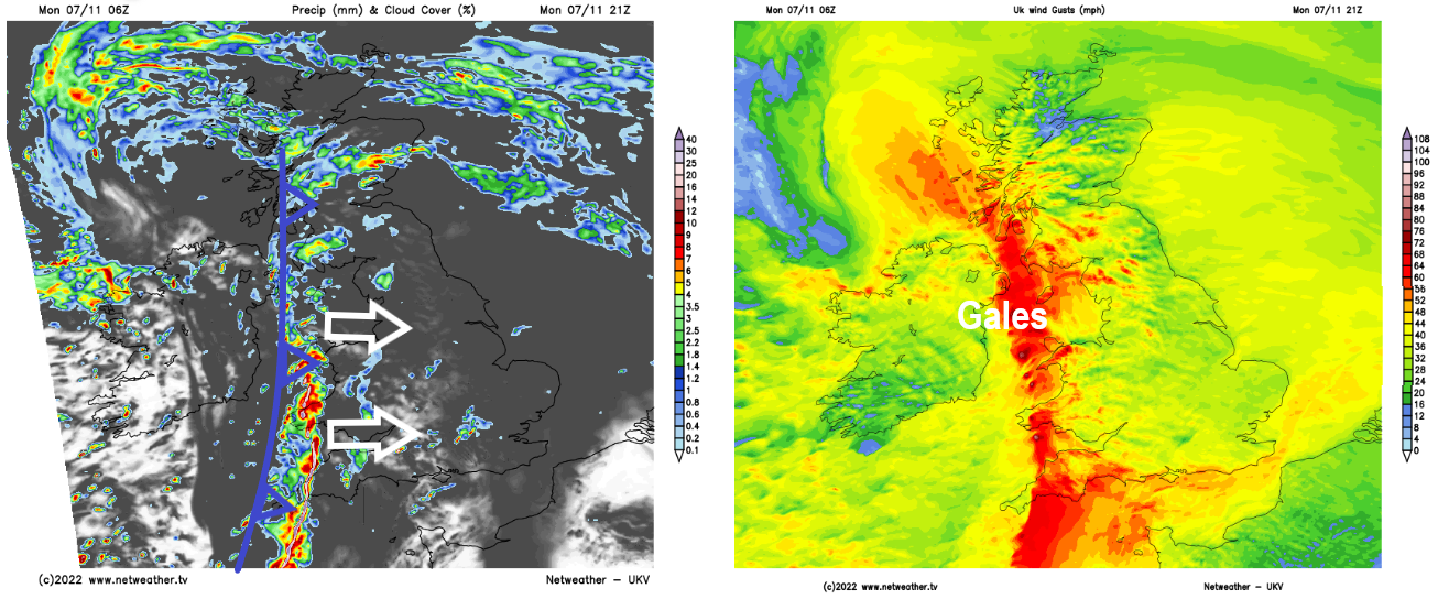
The morning rain across Scotland and NW England, locally heavy, will slowly clear northeast, followed by drier and perhaps drier conditions for a time, before cloud and showery rain across Ireland spreads in from the southwest through the afternoon – while also pushing in across western areas further south by early evening. Showery rain this morning across southern areas should ease to drier and brighter conditions this afternoon. Parts of eastern and northeastern England staying mostly dry today, just the odd shower. The southwesterly wind will strengthen through the day, with gales developing through the Irish Sea and around southwestern coasts. But it will be mild, temperatures a few degrees above average, reaching 13C in the north to 15C in the south.
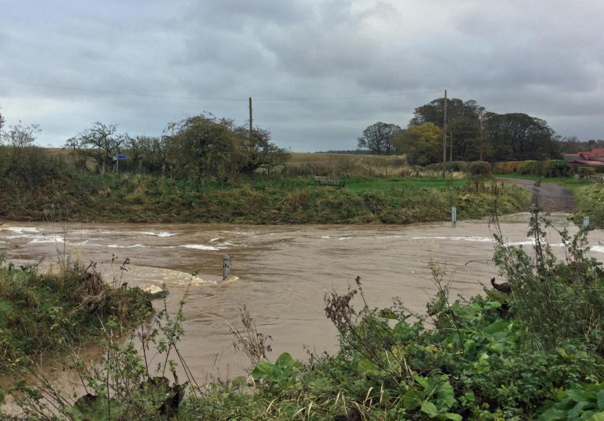
Becoming very windy with gales by evening across the west, particularly along Irish Sea coasts and coasts of south Wales and SW England, as an active cold front arrives in the west this evening bringing a band of squally and heavy rain. The band of heavy rain and strong winds, bringing gales around southern and western coasts, will push east across all parts overnight, clearing the east coast by 6am. Squally showers following around western coasts, drier conditions inland. There is a risk of flooding along southern and southwestern coasts, as a large swell moving in from the Atlantic and large waves driven by the wind coincide with higher-than-normal tides.
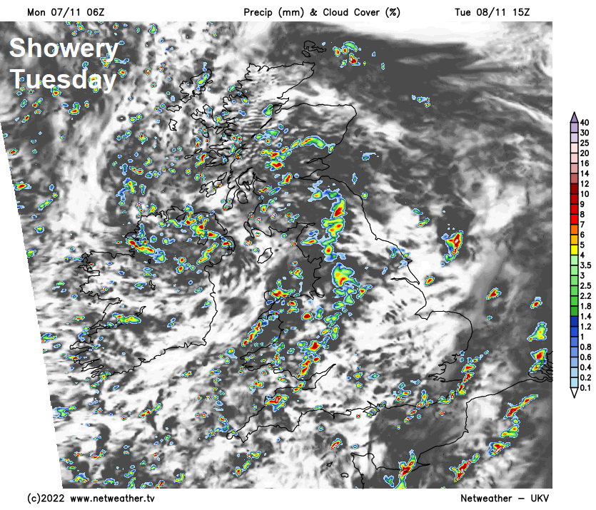
Tuesday will be a windy day, with a mixture of sunshine and blustery showers, showers most frequent and heaviest towards southern and western coastal areas – where hail and thunder is possible too. The northeast of Scotland may stay mostly dry and sunny. Temperatures reaching 12-15C.
Wednesday will see further heavy and perhaps thundery showers continuing around southern and western coastal areas, otherwise, elsewhere will be mostly dry and bright or sunny. Winds should ease too. Temperatures reaching 12-14C.
High pressure over the near continent will start to expand northwest across southern Britain on Thursday and Friday, bringing drier and more settled conditions to much of England and Wales. A large low pressure system near Iceland and the high to the southeast will combine to drag warm and moist air up from near the Azores, so it will be unseasonably warm in the sunshine across England and Wales both days, perhaps reaching 17C. However, the moist southwesterly flow will bring cloud and light rain or drizzle to hills and coasts of west Wales, Cumbria, N. Ireland and western Scotland. The rain perhaps turning heavier and more persistent across larger parts of Scotland and N. Ireland on Friday for a time, before easing. Elsewhere, dry, bright and very mild for much of England and Wales, cloudier towards western coasts of Wales and England, with some drizzle.
The weekend is looking mostly dry, bright and rather mild in the southerly or southeasterly breeze, however, we may see some thicker cloud with some showery rain move in across western and perhaps southern areas on Sunday afternoon and evening.