The weather looks to remain changeable over the weekend and through next week across the UK and Ireland, thanks to an upper trough covering much of the far north Atlantic and fairly strong jet stream underneath this trough across the south this weekend into early next week - before shifting north and west across the UK through next week.
Jet stream across the south and low pressure close to the NW will keep most of the UK unsettled from Sunday through until Thursday, before turning drier towards the south and east as the jet lifts north and west later in the week:
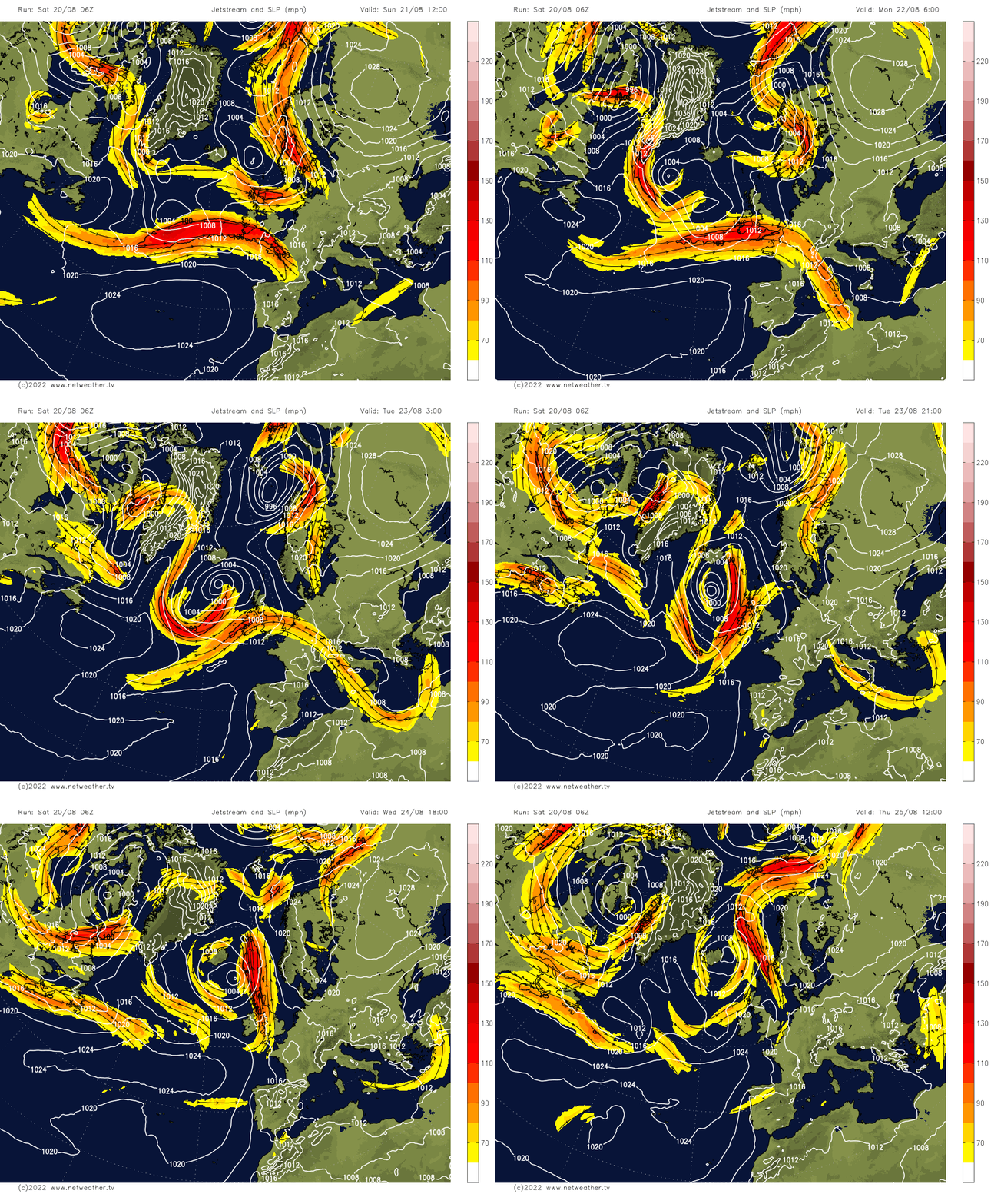
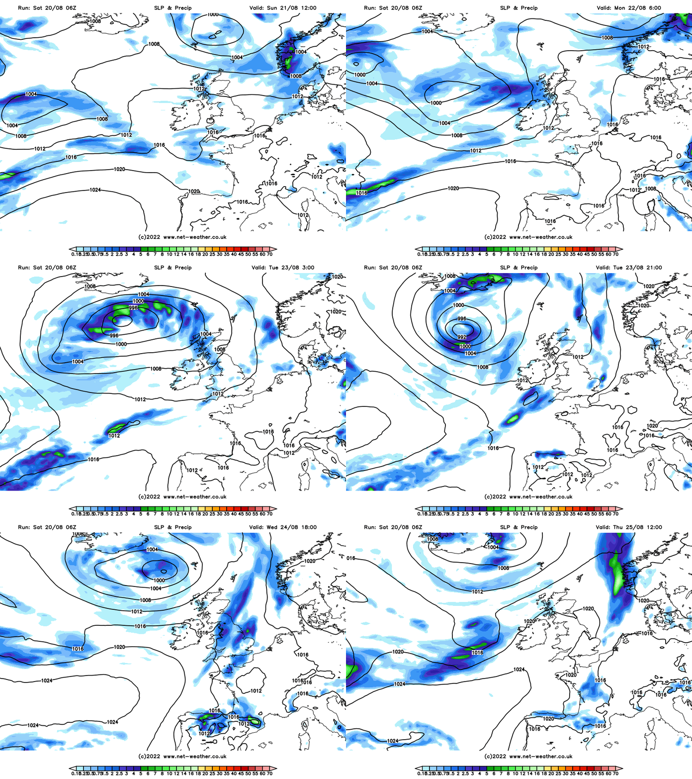
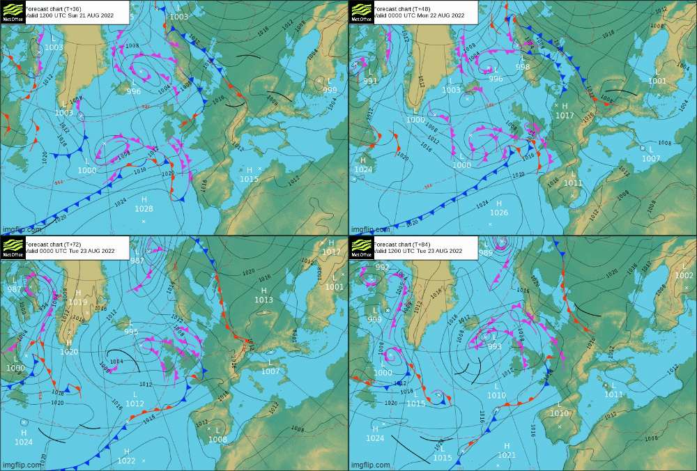
A cold front will sink southeastward across northern Britain on Saturday, bringing a band of squally and perhaps thundery rain with it, before the front weakens as it arrives across central areas tonight. Then frontal waves will run eastwards across England and Wales from Sunday, following the westerly jet stream that will run across southern Britain, feeding in cloudier skies and bringing outbreaks of rain eastwards at times Sunday and early next week. It will turn more humid too.
Frontal wave running east Sunday through to mid-week, bringing some rain
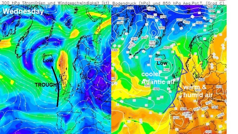
During Wednesday and into Thursday, weather models are indicating an area of more persistent heavy and perhaps thundery rain could develop from the southwest and move northeast across parts of England and Wales. This looks to occur as a sharpening upper trough moving in from the west causes a strengthening and backing of the upper flow ahead of the trough, which in turn induces an active wave / shallow low to develop along a frontal boundary, creating lift warm and humid airmass ahead of the front, before the boundary clears east on Thursday.
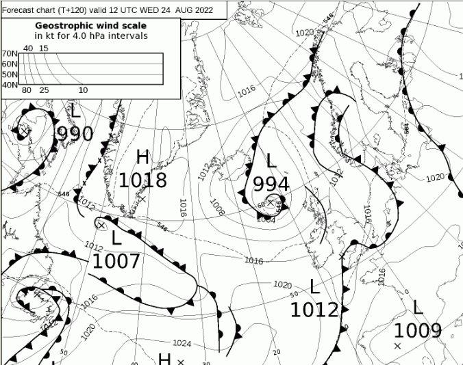
So, we could see some beneficial rains for areas of England and Wales enduring drought in the coming 7 days, particularly on Monday and again Wednesday into Thursday. But because the rain may be heavy in places too, it may not soak into the ground given how dry it’s been and how hard the ground is. If the rain is particularly heavy, i.e. possibly from thunderstorms mid-week, there may be a risk of flash-flooding – like we saw on Wednesday.
Low pressure will often be close to the northwest of Scotland through next week too, which will bring spells of showery rain at times here and across Ireland/N. Ireland through the week.
So all-in-all, changeable in the next seven days, with a chance of rain for everyone, but there will also be some drier and sunnier periods between the fronts bringing rain and feeling warm in the sun, very warm in the south early to mid-week. Highs are around average for the time of year this weekend, low to mid-20s in the south, high teens to low 20s in the north. But it looks to warm up a few degrees through next week, so by mid-week we may see 26-28C towards the southeast mid-week, as the upper trough over the Atlantic amplifies and winds back more southerly off the near continent. Temperatures falling back again from Thursday, as the flow returns from the Atlantic following a cold front clearing east.
Heights and pressure rising over the Bank Holiday weekend - promising more settled weather to end August:
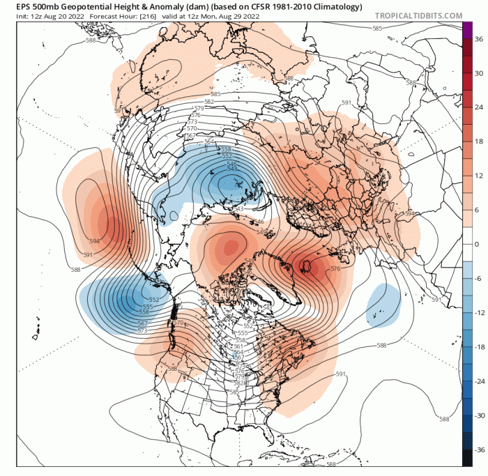
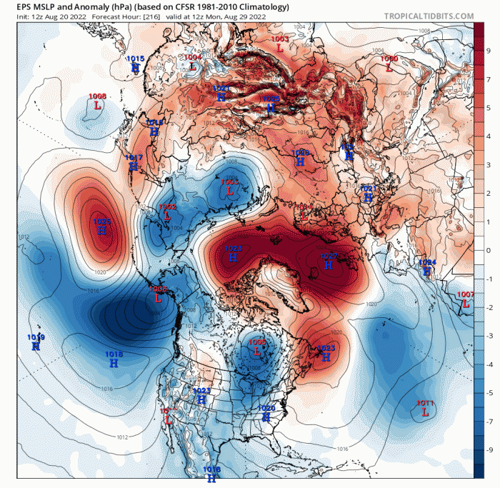
Further ahead though, there are signs from weather model ensemble guidance that high pressure may re-establish from next weekend, as an upper-level ridge extends northeast in the vicinity of NW Europe. Though there is some uncertainty this far out where the upper ridge will build and where the surface high will locate. But increasing confidence that we could be looking at fine, sunny, mostly dry and warm Bank Holiday and end to August. But where the high locates will determine how warm it may get. Though for now it looks like the high will centre over or west of the UK, temperatures on both GFS and ECWMF reaching the low to mid-20s tops, so not heatwave showing at the moment.
Loading recent activity...